Van Sant Airport
| Van Sant Airport (Vansant Airport) | |||||||||||||||
|---|---|---|---|---|---|---|---|---|---|---|---|---|---|---|---|
 | |||||||||||||||
| IATA: none – ICAO: none – FAA LID: 9N1 | |||||||||||||||
| Summary | |||||||||||||||
| Airport type | Public | ||||||||||||||
| Owner/Operator | Bucks County Airport Authority | ||||||||||||||
| Location | Erwinna, Pennsylvania | ||||||||||||||
| Elevation AMSL | 390 ft / 119 m | ||||||||||||||
| Coordinates | 40°29′03″N 075°05′59″W / 40.48417°N 75.09972°W | ||||||||||||||
| Website | www.bcaanet.org/... www.VanSantAirport.com | ||||||||||||||
| Map | |||||||||||||||
 9N1 Location of airport in Pennsylvania | |||||||||||||||
| Runways | |||||||||||||||
| |||||||||||||||
| Statistics (2008) | |||||||||||||||
| |||||||||||||||
Vansant Airport[1][2] or Van Sant Airport[3] (FAA LID: 9N1) is a public use airport located in Bucks County, Pennsylvania, United States and owned by the Bucks County Airport Authority.[1] It is two nautical miles (3.7 km) southwest of the central business district of Erwinna, Pennsylvania.[1]
History
In 1944, John Van Sant (born 1912) bought the Silver Star Airport, renamed it to The Old Star Airport, and started his own business, Van Sant Flying Service. The business offered crop dusting and flight training. Since then the airport was sold then resold to the Bucks County park system. Now the airport is a landmark for Classic Biplane rides and vintage airplanes.
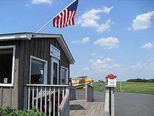
After World War II, John Van Sant founded and owned Van Sant Airport. His family sold it to Bucks County in 2003, and it was designated as a National Historic Landmark.[4] The 198.5 acre (0.8 km²) piece of property was sold to the county for almost US$3 million.[5] The Bucks County Airport Authority currently maintains the airport, and facilities on the field are leased to Bird Of Paradise http://866mustfly.com/about.html , a fixed-base operator (FBO).
Facilities and aircraft
The airport covers an area of 167 acres (68 ha) at an elevation of 390 feet (119 m) above mean sea level. It has two runways with turf surfaces:: 7/25 is 3,058 by 120 feet (932 x 37 m) and 5G/23G is 1,340 by 200 feet (408 x 61 m).[1]
For the 12-month period ending June 17, 2008, the airport had 25,695 aircraft operations, an average of 70 per day: 100% general aviation and <1% military. At that time there were 53 aircraft based at this airport: 75% single-engine, 23% glider and 2% ultralight.[1]
References
- 1 2 3 4 5 6 FAA Airport Master Record for 9N1 (Form 5010 PDF), effective 2009-07-02.
- ↑ Vansant Airport at Bucks County Airport Authority website
- ↑ Sport Aviation, Inc, the fixed-base operator (FBO)
- ↑ Dorfman, Marjorie (2005-08-24). "Van Sant Airport: Tribute to Aviation". HappyNews.com. Archived from the original on 2007-09-27. Retrieved 2007-07-17.
- ↑ Heuckroth, Sandy (2003-08-21). "County preserves historic Tinicum airport". Doylestown Patriot. Retrieved 2007-07-17.
External links
- Resources for this airport:
- FAA airport information for 9N1
- AirNav airport information for 9N1
- FlightAware airport information and live flight tracker
- SkyVector aeronautical chart for 9N1
- Van Sant Airport – about Bar and Dannie