Vân Đồn District
| Vân Đồn District Huyện Vân Đồn | |
|---|---|
| Rural district | |
|
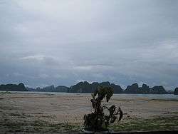
Quan Lạn Island | |
| Country |
|
| Region | Northeast |
| Province | Quảng Ninh |
| Capital | Cái Rồng |
| Area | |
| • Total | 213 sq mi (551 km2) |
| Population (2003) | |
| • Total | 39,157 |
| Time zone | Indochina Time (UTC+07:00) |
Vân Đồn (![]() listen) is a rural district of Quảng Ninh Province in the Northeast region of Vietnam. As of 2003 the district had a population of 39,157.[1] The district covers an area of 551 km². The district capital lies at Cái Rồng.[1]
listen) is a rural district of Quảng Ninh Province in the Northeast region of Vietnam. As of 2003 the district had a population of 39,157.[1] The district covers an area of 551 km². The district capital lies at Cái Rồng.[1]
History
Fujian was the origin of the ethnic Chinese Trần dynasty royal family who migrated to Vietnam along with a large amount of other Chinese during the Lý dynasty where they served as officials. Distinctly Chinese last names are found in the Tran and Ly dynasty Imperial exam records.[2] Ethnic Chinese are recorded in Tran and Ly dynasty records of officials.[3] Clothing, food, and language were all Chinese dominated in Van Don where the Tran had moved to after leaving their home province of Fujian. The Chinese language could still be spoken by the Tran in Vietnam.[4] The ocean side area of Vietnam was colonized by Chinese migrants from Fujian which included the Tran among them located to the capital's southeastern area.[5][6] The Red River Delta was subjected to migration from Fujian including the Tran and Van Don port arose as a result of this interaction.[7] Guangdong and Fujian Chinese moved to the Halong located Van Don coastal port during Ly Anh Tong's rule in order to engage in commerce.[8] The usurpation of the Ly occurred after they married with the fishing Fujianese Tran family.[9]
Administrative divisions
Cái Rồng, Đông Xá, Hạ Long, Bình Dân, Đoàn Kết, Đài Xuyên, Vạn Yên, Minh Châu, Quan Lạn, Ngọc Vừng, Bản Sen, Thắng Lợi.
References
- 1 2 "Districts of Vietnam". Statoids. Retrieved March 23, 2009.
- ↑ Alexander Woodside (1971). Vietnam and the Chinese Model: A Comparative Study of Vietnamese and Chinese Government in the First Half of the Nineteenth Century. Harvard Univ Asia Center. pp. 8–. ISBN 978-0-674-93721-5.
- ↑ Geoffrey C. Gunn (1 August 2011). History Without Borders: The Making of an Asian World Region, 1000-1800. Hong Kong University Press. pp. 112–. ISBN 978-988-8083-34-3.
- ↑ K. W. Taylor (9 May 2013). A History of the Vietnamese. Cambridge University Press. pp. 120–. ISBN 978-1-107-24435-1.
- ↑ Kenneth R. Hall (2008). Secondary Cities and Urban Networking in the Indian Ocean Realm, C. 1400-1800. Lexington Books. pp. 159–. ISBN 978-0-7391-2835-0.
- ↑ Hall (1 January 1955). Secondary Cities & Urban Networking in the Indian Ocean Realm, c. 1400-1800. Lexington Books. pp. 159–. ISBN 978-0-7391-3043-8.
- ↑ Jayne Werner; John K. Whitmore; George Dutton (21 August 2012). Sources of Vietnamese Tradition. Columbia University Press. pp. 29–. ISBN 978-0-231-51110-0.
- ↑ Philippe Truong (2007). The Elephant and the Lotus: Vietnamese Ceramics in the Museum of Fine Arts, Boston. MFA Pub. p. 18. ISBN 978-0-87846-717-4.
- ↑ Ainslie Thomas Embree; Robin Jeanne Lewis (1988). Encyclopedia of Asian history. Scribner. p. 190.

Coordinates: 21°04′19″N 107°25′28″E / 21.07194°N 107.42444°E