Uyts
| Uyts Ույծ | |
|---|---|
| community | |
 | |
 Uyts | |
| Coordinates: 39°31′N 46°03′E / 39.517°N 46.050°ECoordinates: 39°31′N 46°03′E / 39.517°N 46.050°E | |
| Country |
|
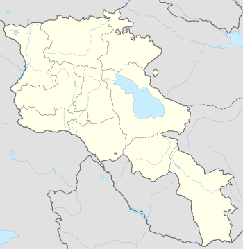
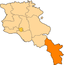
| Marz (Province) | Syunik |
| Area[1] | |
| • Total | 33.43 km2 (12.91 sq mi) |
| Population (2011) | |
| • Total | 396 |
| • Density | 12/km2 (31/sq mi) |
| Time zone | (UTC+4) |
| • Summer (DST) | (UTC+5) |
| Uyts at GEOnet Names Server | |
Uyts (Armenian: Ույծ, also Romanized as Uz and Uits) is a village and rural community (municipality) in the Syunik Province of Armenia. The National Statistical Service of the Republic of Armenia (ARMSTAT) reported its population was 586 in 2010,[2] compared to 453 at the 2001 census.[3] Uyts lies roughly 3.5 kilometers away from the nearby city of Sisian.
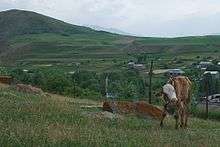
A cow grazes on a hillside overlooking Uyts.
Many Uyts residents are farmers or sheepherders, with agriculture playing an important role in village life.
Uyts has a small school, with roughly 70 students enrolled at any given time. Many teachers commute from neighboring Sisian to work in the village.
References
- ↑ Region.mtaes.am/ "Syunik regional e-Governance System" Check
|url=value (help) (in Armenian). Syunik Region Province provincial government. Click on link entitled "Համայնքներ" (community) and search for the place by Armenian name. - ↑ "Marzes of the Republic of Armenia and Yerevan City in Figures, 2010" (PDF). National Statistical Service of the Republic of Armenia (ARMSTAT).
- ↑ Report of the results of the 2001 Armenian Census, National Statistical Service of the Republic of Armenia
This article is issued from Wikipedia - version of the 6/7/2016. The text is available under the Creative Commons Attribution/Share Alike but additional terms may apply for the media files.