Ute Park, New Mexico
| Ute Park, New Mexico | |
|---|---|
|
Unincorporated community Census-designated place | |
 Ute Park Location within the state of New Mexico | |
| Coordinates: 36°33′29″N 105°06′54″W / 36.55806°N 105.11500°WCoordinates: 36°33′29″N 105°06′54″W / 36.55806°N 105.11500°W | |
| Country | United States |
| State | New Mexico |
| County | Colfax |
| Area | |
| • Total | 3.39 sq mi (8.79 km2) |
| • Land | 3.39 sq mi (8.79 km2) |
| • Water | 0 sq mi (0 km2) |
| Elevation | 7,413 ft (2,259 m) |
| Population (2010) | |
| • Total | 71 |
| • Density | 21/sq mi (8.1/km2) |
| Time zone | Mountain (MST) (UTC-7) |
| • Summer (DST) | MDT (UTC-6) |
| ZIP code | 87749 |
| FIPS code | 35-81450 |
| GNIS feature ID | 0902380 |
Ute Park is an unincorporated community and census-designated place in Colfax County, New Mexico, United States. As of the 2010 census it had a population of 71.[1] It was formerly part of the Maxwell Land Grant.[2][3]
Ute Park lies on U.S. Route 64 between Cimarron and Eagle Nest, just east of Cimarron Canyon State Park.
In 1921, the Guide to New Mexico[4] described it as:
Ute Park was named for the Ute Indians, who lived on the east slope of near-by Mt. Baldy. The rebellious Ute resisted their white oppressors, and an Indian Agency and military force were maintained at Cimarron to keep them subdued, until they were finally moved to a reservation in southern Colorado and Utah. The village of Ute Park, opposite the mouth of Ute Creek, is the terminus of an A.T.&S.F. railway branch and is a distributing point for freight for Moreno Valley, Red River and Taos.[5]
The St. Louis, Rocky Mountain, and Pacific Railway abandoned the Ute Park branch circa 1942. Portions of the right of way are still visible, but most railroad structures have been removed.
Notes
- ↑ "Geographic Identifiers: 2010 Demographic Profile Data (G001): Ute Park CDP, New Mexico". U.S. Census Bureau, American Factfinder. Retrieved October 23, 2014.
- ↑ Chilton, Lance (1984) New Mexico: a new guide to the colorful state. University of New Mexico Press, Albuquerque, New Mexico, page 301, ISBN 0-8263-0732-9
- ↑ Fugate, Francis L. and Roberta B. (1989) Roadside History of New Mexico Mountain Press, Missoula, Montana, p. 162, ISBN 0-87842-242-0
- ↑ New Mexico State Land Office (1921) A guide to New Mexico for the homeseeker, investor, tourist, sportsman, healthseeker: its resources and opportunities in government lands, state lands, farming, stock raising, mining, manufacturing, climate, scenery, fish and game; a hand-book of facts New Mexico State Land Office, Santa Fe, New Mexico, OCLC 1621160
- ↑ The New Mexico State Guide, cited by Stanley, F. (1952) The Grant that Maxwell Bought. World Press, Denver, Colorado, page 224 OCLC 5868328
Municipalities and communities of Colfax County, New Mexico, United States | ||
|---|---|---|
| City | 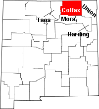 | |
| Town | ||
| Villages | ||
| CDP | ||
| Other unincorporated communities | ||
| Ghost towns | ||
This article is issued from Wikipedia - version of the 11/7/2016. The text is available under the Creative Commons Attribution/Share Alike but additional terms may apply for the media files.