Usiacurí
| Usiacurí | |||
|---|---|---|---|
| |||
 Location of the municipality and town of Usiacurí in the Department of Atlántico. | |||
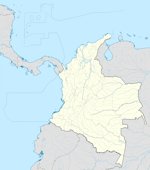 Usiacurí Location of the municipality and town of Usiacurí in the Department of Atlántico. | |||
| Coordinates: 10°45′N 74°59′W / 10.750°N 74.983°W | |||
| Country |
| ||
| Region | Caribbean | ||
| Department | Atlántico | ||
| Demonym | Usiacureno,-a | ||
| Government | |||
| • Mayor | Monica Urueta Torrealba (Radical Change)[1] | ||
| Area | |||
| • Total | 103 km2 (40 sq mi) | ||
| Elevation | 95 m (312 ft) | ||
| Population (2005) | |||
| • Total | 8,561 | ||
| • Density | 83/km2 (220/sq mi) | ||
| [2] | |||
| Time zone | Colombia Standard Time (UTC-5) | ||
| Website |
www.usiacuri-atlantico.gov.co/sitio.shtml | ||
.svg.png)
Usiacurí is a municipality and town in the Colombian department of Atlántico.
References
External links
- (Spanish) Gobernacion del Atlantico - Usiacurí
- (Spanish) Usiacurí official website
Municipalities in the Atlántico Department | ||
|---|---|---|
Coordinates: 10°45′N 74°59′W / 10.750°N 74.983°W
This article is issued from Wikipedia - version of the 9/1/2016. The text is available under the Creative Commons Attribution/Share Alike but additional terms may apply for the media files.