Uri, Jammu and Kashmir
| Uri | |
|---|---|
| Town | |
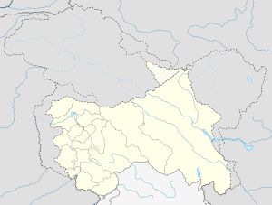 Uri  Uri Location in Jammu and Kashmir, India | |
| Coordinates: 34°5′10″N 74°2′0″E / 34.08611°N 74.03333°ECoordinates: 34°5′10″N 74°2′0″E / 34.08611°N 74.03333°E | |
| Country |
|
| State | Jammu and Kashmir |
| District | Baramulla |
| Government | |
| • Type | Tehsil |
| Population (2011) | |
| • Total | 9,366 |
| Sex ratio 6,674/2,692 ♂/♀ | |
| Languages | |
| • Official | Urdu |
| Time zone | IST (UTC+5:30) |
| PIN | 193123 |
| Telephone code | 01956 |
| Vehicle registration | JK 05 |
| Sex ratio | 1.13 |
| Literacy | 83% |
| Website |
www |

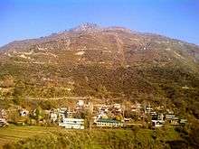
Uri (Urdu: اوڑی) is a town and a tehsil in the Baramulla district, in the Indian-administered state of Jammu and Kashmir.[1] Uri is located on the left bank of the Jhelum River, about 10 kilometres (6.2 mi) east of the Line of Control with Pakistan.
History
Hari Singh Nalwa (r. 1820–1823), the Sikh commander-cum-administrator of Maharaja Ranjit Singh, built the fort of Uri.[2][3]
Following the First Anglo-Sikh War (1845–1846) and the Treaty of Amritsar (1846), Raja Gulab Singh was proclaimed the Maharaja of Jammu and Kashmir, acquiring all the lands between the Ravi River and the Indus.[4]:51-52 Uri became a tehsil in the Muzaffarabad district of the Kashmir province.[5]
On 22 October 1947, the tribal invasion led to the fall of Muzaffarabad and Uri to the Pashtun tribes from Pakistan. The raiders then halted at Baramulla.[6] Following the accession of the Maharaja to India on 26 October, India air lifted troops to the Kashmir Valley, who retook Baramulla and Uri by mid-November.[7] The Indian government attached utmost importance to the defence of Uri.[8] Muzaffarabad, on the other hand, came under Pakistani control and became the capital of Azad Kashmir. The tehsil of Uri was subsequently merged into the Baramulla district.
2016 Uri Terrorist Attacks
At around 5:30 a.m. on 18 September, four terrorists attacked an Indian Army Brigade headquarters at Uri near the Line of Control. They are said to have lobbed 17 grenades in 3 minutes. A rear administrative base camp with tents caught fire and 13-14 army personnel were killed. A six-hour gun battle ensued, during which all four terrorists were killed. An additional 19-30 soldiers were reported to have been injured in the attack.[9][10][11][12][13]
Demographics
As of 2011, the town of Uri has a population of 9,366 of which 6,674 (71%) are males and 2,692 (29%) are females according to the report published by Census India in 2011.[14] Uri has an average literacy rate of 88.46%, higher than the national average of 76%. Male literacy is 95.27%, and female literacy is 70.02%. Child sex ratio is approximately 851 as compared to state average of 862 and the population of children under 6 years of age is 879 which is 9.39% of the total population.
References
- ↑ "Administrative Setup in District Baramulla". Baramulla District. Retrieved 21 September 2016.
- ↑ Bansal, Bobby Singh (2015), Remnants of the Sikh Empire: Historical Sikh Monuments in India & Pakistan, Hay House, Inc, p. 174, ISBN 978-93-84544-93-5
- ↑ Lone, F. A. (2005), The Exploration Of Uri Sector: Kashmir Valley, Shipra Publications, p. 42, ISBN 978-81-7541-222-4
- ↑ Singh, Bawa Satinder (1971), "Raja Gulab Singh's Role in the First Anglo-Sikh War", Modern Asian Studies, 5 (1): 35–59, JSTOR 311654
- ↑ Snedden, Kashmir: The Unwritten History 2013.
- ↑ Raghavan, War and Peace in Modern India 2010, p. 58.
- ↑ Raghavan, War and Peace in Modern India 2010, p. 114.
- ↑ Raghavan, War and Peace in Modern India 2010, p. 123.
- ↑ Uri terror attack: 17 soldiers killed, 19 injured in strike on Army camp, Times of India, 18 September 2016.
- ↑ "Tents set on fire, troops shot while coming out". The Hindu. 18 September 2016. Retrieved 18 September 2016.
- ↑ Uri attack: An inside story of how it happened, India Today, 18 September 2016.
- ↑ Sequence of the Uri attack & the plan of the terrorists, The Economic Times, 19 September 2016.
- ↑ Uri Attack: Most of the 17 Soldiers Died in a Tent Fire, The Quint, 19 September 2016.
- ↑ "Census of India 2011: Data from the 2011 Census, including cities, villages and towns (Provisional)". Census of India.
Bibliography
- Raghavan, Srinath (2010), War and Peace in Modern India: A Strategic History of the Nehru Years, Palgrave Macmillan, ISBN 978-1-137-00737-7
- Snedden, Christopher (2013) [first published as The Untold Story of the People of Azad Kashmir, 2012], Kashmir: The Unwritten History, HarperCollins India, ISBN 9350298988
Further reading
- A town called Uri — How the September 18 attack may now change it, The Indian Express, 25 September 2016.