Urakawa, Hokkaido
| Urakawa 浦河町 | ||
|---|---|---|
| Town | ||
| ||
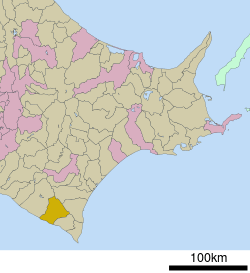 Location of Urakawa in Hokkaido (Hidaka Subprefecture) | ||
 Urakawa Location in Japan | ||
| Coordinates: 42°10′N 142°46′E / 42.167°N 142.767°ECoordinates: 42°10′N 142°46′E / 42.167°N 142.767°E | ||
| Country | Japan | |
| Region | Hokkaido | |
| Prefecture | Hokkaido (Hidaka Subprefecture) | |
| District | Urakawa | |
| Government | ||
| • Mayor | Kōichirō Tanikawa | |
| Area | ||
| • Total | 694.24 km2 (268.05 sq mi) | |
| Population (March 2008) | ||
| • Total | 14,814 | |
| • Density | 21/km2 (55/sq mi) | |
| Symbols | ||
| • Tree | Hidaka Japanese White Pine | |
| • Flower | Hidaka Yamatsutsuji (Rhododendron kaempferi var. kaempferi) | |
| Time zone | Japan Standard Time (UTC+9) | |
| City hall address |
1-3-1, Tsukiji, Urakawa-chō, Urakawa-gun, Hokkaidō 057-8511 | |
| Website |
www | |

Urakawa (浦河町 Urakawa-chō) is a town located in Urakawa District, Hidaka Subprefecture, Hokkaido, Japan.
As of 2008, the town has an estimated population of 14,814 and a density of 21.3 persons per km². The total area is 694.24 km².
Climate
Urakawa has depending on the method used a humid continental (Köppen Dfb) or a borderline oceanic climate (Cfb) with warm summers and cold winters. Owing to its slightly more southerly latitude, easterly aspect and location on the sea, snowfall is much lighter than in the major cities of western Hokkaido like Sapporo, Hakodate, Asahikawa and Wakkanai, with the most in one month being 0.98 metres (38.6 in) in January 1969.[1] Precipitation in heaviest in the summer months when remnant typhoons may approach; the heaviest daily rainfall being 190.0 millimetres (7.48 in) on 5 August 1981 and the wettest month August 1995 with 429.5 millimetres (16.91 in). The driest month has been February 2003 with 2.5 millimetres (0.10 in). Year-round sunshine, although less than in the Tokachi Plain, is also higher than western Hokkaido, with the dullest month being August 1941 with 48.0 hours and the sunniest April 2014 with 288.0 hours beating the previous record of 271.6 hours from May 1957.
| Climate data for Urakawa (1981-2010) | |||||||||||||
|---|---|---|---|---|---|---|---|---|---|---|---|---|---|
| Month | Jan | Feb | Mar | Apr | May | Jun | Jul | Aug | Sep | Oct | Nov | Dec | Year |
| Record high °C (°F) | 10.9 (51.6) |
10.9 (51.6) |
16.5 (61.7) |
21.0 (69.8) |
23.5 (74.3) |
27.2 (81) |
28.9 (84) |
31.2 (88.2) |
29.9 (85.8) |
23.7 (74.7) |
19.1 (66.4) |
14.3 (57.7) |
31.2 (88.2) |
| Average high °C (°F) | 0.7 (33.3) |
0.9 (33.6) |
3.9 (39) |
8.8 (47.8) |
13.0 (55.4) |
16.4 (61.5) |
20.2 (68.4) |
23.0 (73.4) |
20.9 (69.6) |
15.9 (60.6) |
9.5 (49.1) |
3.6 (38.5) |
11.4 (52.52) |
| Daily mean °C (°F) | −2.5 (27.5) |
−2.4 (27.7) |
0.5 (32.9) |
5.0 (41) |
9.3 (48.7) |
13.1 (55.6) |
17.2 (63) |
19.9 (67.8) |
17.3 (63.1) |
12.0 (53.6) |
5.9 (42.6) |
0.2 (32.4) |
7.96 (46.33) |
| Average low °C (°F) | −5.9 (21.4) |
−5.9 (21.4) |
−2.8 (27) |
1.6 (34.9) |
5.9 (42.6) |
10.3 (50.5) |
14.8 (58.6) |
17.4 (63.3) |
13.9 (57) |
8.0 (46.4) |
2.2 (36) |
−3 (27) |
4.71 (40.51) |
| Record low °C (°F) | −15.5 (4.1) |
−14.8 (5.4) |
−13.1 (8.4) |
−8.1 (17.4) |
−2.5 (27.5) |
2.3 (36.1) |
6.5 (43.7) |
8.9 (48) |
1.9 (35.4) |
−1.3 (29.7) |
−7.9 (17.8) |
−13.1 (8.4) |
−15.5 (4.1) |
| Average precipitation mm (inches) | 36.9 (1.453) |
24.4 (0.961) |
49.1 (1.933) |
75.6 (2.976) |
121.2 (4.772) |
88.3 (3.476) |
145.5 (5.728) |
159.9 (6.295) |
140.9 (5.547) |
99.3 (3.909) |
80.7 (3.177) |
50.5 (1.988) |
1,072.3 (42.215) |
| Average snowfall cm (inches) | 48 (18.9) |
37 (14.6) |
22 (8.7) |
2 (0.8) |
0 (0) |
0 (0) |
0 (0) |
0 (0) |
0 (0) |
0 (0) |
6 (2.4) |
32 (12.6) |
147 (58) |
| Average precipitation days (≥ 0.5 mm) | 12.2 | 8.8 | 11.0 | 11.1 | 11.6 | 9.5 | 12.0 | 11.0 | 11.8 | 11.6 | 15.1 | 14.0 | 139.7 |
| Average relative humidity (%) | 65 | 67 | 71 | 77 | 83 | 89 | 91 | 89 | 83 | 74 | 68 | 64 | 76.8 |
| Mean monthly sunshine hours | 139.5 | 162.3 | 194.2 | 185.7 | 189.3 | 145.6 | 109.5 | 137.5 | 159.5 | 174.9 | 122.1 | 114.1 | 1,834.2 |
| Source #1: Japan Meteorological Agency (precipitation)[2] | |||||||||||||
| Source #2: Japan Meteorological Agency[3] | |||||||||||||
References
- ↑ Japan Meteorological Agency; 観測史上1~10位の値(年間を通じての値)
- ↑ "浦河 平年値(年・月ごとの値) 詳細(気圧・降水量)". Japan Meteorological Agency. Retrieved January 28, 2016.
- ↑ "浦河 平年値(年・月ごとの値) 主な要素". Japan Meteorological Agency. Retrieved January 28, 2016.
External links
 Media related to Urakawa, Hokkaidō at Wikimedia Commons
- Official website (Japanese) (some English content)