Upper Walthamstow

Coordinates: 51°35′14″N 0°00′08″E / 51.58734°N 0.00223°E
Upper Walthamstow is the easterly part of Walthamstow, London, England.[1] It occupies an area of about 0.5 square kilometers, bounded by the A406 (in the north), Wood Street and the railway track (in the west), Woodford New Road and an Epping Forest vestige (in the east), and Lea Bridge Road (in the south).
Overall it has the appearance of the general architecture of medium-small houses normal to greater London suburbs. There is some regional variation: simple modern maisonette blocks in the north, Victorian houses in the middle and 1930s terraced and semi-detached houses in the south. Dotted around throughout there are a few small mid-20th century maisonette blocks; and one tower block in the extreme south west corner, refurbished externally in the late 20th century to moderate the original 1960s tower style.
It is tree-lined, tidy, and quiet. There is a cricket pitch, church, doctors surgery, and three public houses on the edges.
From the path to the footbridge over Forest Road, near Waterworks Corner roundabout, it is possible to see three of London's tallest buildings -- 30 St Mary Axe, Tower 42, BT Tower.
Transport
Nearest tube stations
- Walthamstow Central tube station (Victoria line)
- Snaresbrook tube station (Central line)
- South Woodford tube station (Central line)
Nearest rail station
Bus routes
The area has 4 bus routes: 212, W12 and W16 serve nearby and route 230 terminates on Fyfield road
References
| Districts | 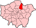 | |
|---|---|---|
| Attractions |
| |
| Street markets | ||
| Parks and open spaces |
| |
| Constituencies |
| |
| Tube and rail stations | ||
| Other topics | ||