Upper Macungie Township, Lehigh County, Pennsylvania
| Upper Macungie Township | |
| Township | |
.JPG) Township sign in Breinigsville | |
| Country | United States |
|---|---|
| State | Pennsylvania |
| County | Lehigh |
| Elevation | 463 ft (141.1 m) |
| Coordinates | 40°34′46″N 75°37′00″W / 40.57944°N 75.61667°WCoordinates: 40°34′46″N 75°37′00″W / 40.57944°N 75.61667°W |
| Area | 26.3 sq mi (68.1 km2) |
| - land | 26.2 sq mi (68 km2) |
| - water | 0.1 sq mi (0 km2), 0.38% |
| Population | 20,063 (2010) |
| Density | 529.5/sq mi (204.4/km2) |
| Timezone | EST (UTC-5) |
| - summer (DST) | EDT (UTC-4) |
| Area code | 610 |
 Location of Upper Macungie Township in Lehigh County | |
 Location of Upper Macungie Township in Pennsylvania | |
 Location of Pennsylvania in the United States | |
| Website: http://www.uppermac.org | |
Upper Macungie Township is a township in Lehigh County, Pennsylvania, in the United States. It is a suburb of Allentown, Pennsylvania, in the Lehigh Valley region of the state.
The population of Upper Macungie Township was 20,063 as of the 2010 U.S. census thus making it one of the fastest growing areas in the state of Pennsylvania in terms of total population.[1]
Upper Macungie also has among the highest median family and household income rates in the state of Pennsylvania with an average nearly double that of the state overall.
Geography
.jpg)
According to the United States Census Bureau, the township has a total area of 26.3 square miles (68.2 km2), of which, 26.2 square miles (68.0 km2) of it is land and 0.1 square miles (0.3 km2) of it (0.38%) is water. It is drained by the Little Lehigh Creek and the Jordan Creek into the Lehigh River.
Interstate 78 and U.S. Route 22 meet in Kuhnsville and they and U.S. Route 222 are the primary east-to-west roads, while Route 100, Interstate 476, and Route 863 are the primary north-to-south roads. Upper Macungie's villages include Breinigsville, Fogelsville, Haafsville (also in Weisenberg Township,) Krocksville, Kuhnsville, Newtown, Ruppsville, and Trexlertown.
Adjacent municipalities
- Lower Macungie Township (southeast)
- South Whitehall Township (northeast)
- North Whitehall Township (tangent to the north)
- Lowhill Township (north)
- Weisenberg Township (northwest)
- Maxatawny Township, Berks County (west)
- Longswamp Township, Berks County (southwest)
Demographics
As of 2014, the population of the township was estimated to be 21,461. The population was 77.6% Non-Hispanic White, 2.9% Black or African American, 0.1% Native American and Alaskan Native, 10.8% Asian, 3.2% from two or more race, and 1.8% from some other race. 5.6% of the population were Hispanic or Latino.
As of the census[2] of 2010, there were 20,063 people and 7,843 households residing in the township. The population density was 529.5 people per square mile (204.5/km2). There were 7,843 housing units at an average density of 203.3/sq mi (78.5/km2). The racial makeup of the township was 84.96% White, 2.68% African American, 0.14% Native American, 8.96% Asian, 1.03% from other races, and 1.70% from two or more races. Hispanic or Latino of any race were 4.92% of the population.
There were 7,843 households, out of which 35.8% had children under the age of 18 living with them, 66.0% were married couples living together, 6.5% had a female householder with no husband present, and 25.2% were non-families. 20.2% of all households were made up of individuals, and 8.8% had someone living alone who was 65 years of age or older. The average household size was 2.65 and the average family size was 3.08.
In the township the population was spread out, with 27.2% under the age of 18, 3.71% from 19 to 24, 36.08% from 25 to 49 and 31.1% age 50 or older. The median age was 39 years. For every 100 females there were 92.9 males. For every 100 females age 18 and over, there were 92.9 males.
The median income for a household in the township was $85,600, and the median income for a family was $97,180. Upper Macungie has one of the highest median family incomes in the state of Pennsylvania with an amount nearly double the state average. Males had a median income of $57,971 versus $38,490 for females. The per capita income for the township was $35,506. About 0.8% of families and 2.6% of the population were below the poverty line, including 1.8% of those under age 18 and 9.0% of those age 65 or over.
Government and politics
Legislators
- State Representative Gary Day, Republican, 187th district, 1st, 2nd, 3rd, and 5th wards
- State Representative Ryan Mackenzie, Republican, 134th district, 4th ward
- State Senator Pat Browne, Republican, 16th district
- US Representative Charlie Dent, Republican, 15th district
Board of Supervisors
- James Brunell, Chairman
- Sean Gill, Vice-chairman
- Kathy Rader, Secretary
Police & Fire
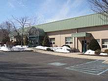
.JPG)
As of December 31, 2012, Upper Macungie Township is served by the Upper Macungie Township Police Department. Prior to that, it was served by the now defunct Berks-Lehigh Regional Police.
-Fogelsville Volunteer Fire Company, Lehigh County Station 8 - www.fogelsvillefire.org
-Good Will Fire Co. No. 1 of Trexlertown, Lehigh County Station 25 - www.goodwillfirecompany.com
-Upper Macungie Township Emergency Services Bldg., Lehigh County Station 56 - www.umtfire56.org
Public education
The Township is served by the Parkland School District. Students in grades 9-12 attend Parkland High School in the district. While Fogelsville and Fred J. Jaindl Elementary Schools are located in Upper Macungie, some of the township's students attend Cetronia, Kernsville, or Parkway Manor Elementary School. Most of its middle school students attend Springhouse Middle School, except in the far north which is served by Orefield Middle School.
References
- ↑ http://2010.census.gov/2010census/popmap/
- ↑ "American FactFinder". United States Census Bureau. Retrieved 2008-01-31.
External links
| Wikimedia Commons has media related to Upper Macungie Township, Lehigh County, Pennsylvania. |
Municipalities and communities of Lehigh County, Pennsylvania, United States | ||
|---|---|---|
| Cities | 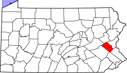 | |
| Boroughs | ||
| Townships | ||
| CDPs | ||
| Unincorporated communities |
| |
| Footnotes | ‡This populated place also has portions in an adjacent county or counties | |