Upper Kalskag, Alaska
| Upper Kalskag, Alaska | |
|---|---|
| City | |
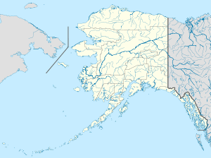 Upper Kalskag, Alaska Location in Alaska | |
| Coordinates: 61°32′15″N 160°18′58″W / 61.53750°N 160.31611°W | |
| Country | United States |
| State | Alaska |
| Census Area | Bethel |
| Incorporated | February 13, 1975[1] |
| Government | |
| • Mayor | Denise Reed[2] |
| • State senator | Lyman Hoffman (D) |
| • State rep. | Bob Herron (D) |
| Area | |
| • Total | 4.1 sq mi (10.7 km2) |
| • Land | 3.8 sq mi (9.8 km2) |
| • Water | 0.4 sq mi (0.9 km2) |
| Elevation | 39 ft (12 m) |
| Population (2010) | |
| • Total | 210 |
| • Density | 51/sq mi (20/km2) |
| Time zone | Alaska (AKST) (UTC-9) |
| • Summer (DST) | AKDT (UTC-8) |
| ZIP code | 99607 |
| Area code | 907 |
| FIPS code | 02-81320 |
Upper Kalskag is a city in Bethel Census Area, Alaska, United States. At the 2010 census the population was 210.
Culture and history
Upper Kalskag is a traditional Yup'ik village, with a culture centered on subsistence activities. The founding residents were from the native village of Kaltkhagamute, four miles down river. The Russian explorer Lavrenty Zagoskin reported a population of 120 in 1843 for Kaltkhagamute (Khalkagmute). Over the years, residents of Crow Village, Ohagamiut, Russian Mission, and Paimute also moved to the village. Russian and American explorers brought both Roman Catholic and Russian Orthodox religious influences, but the village's Russian Orthodox practitioners left to establish Lower Kalskag 2 miles downriver in 1940. George Morgan, a German immigrant who founded Georgetown, established a general store and post office in 1932. Paul N. Kameroff, Sr. also established a general store, a pool hall, and a coffee shop around 1930. The government school was built in that timeframe as well. The community once owned a herd of about 2000 reindeer.
Geography
Upper Kalskag is located at 61°32′15″N 160°18′58″W / 61.53750°N 160.31611°W (61.537440, -160.316070).[3]
According to the United States Census Bureau, the city has a total area of 4.1 square miles (11 km2), of which, 3.8 square miles (9.8 km2) of it is land and 0.3 square miles (0.78 km2) of it (8.47%) is water.
Upper Kalskag, referred to by the locals as just "Upper", is linked to Lower Kalskag (Lower) by a single two mile maintained gravel/dirt road.
Upper Kalskag is accessible only by small plane, boat, and automobile via the river "ice road" (Winter only). The ice road is constructed each winter from Aniak to Bethel by drilling and marking holes in the ice every 100 yards and subsequently marking and plowing a route on the river where the ice depth is sufficient.
Demographics
| Historical population | |||
|---|---|---|---|
| Census | Pop. | %± | |
| 1980 | 129 | — | |
| 1990 | 172 | 33.3% | |
| 2000 | 230 | 33.7% | |
| 2010 | 210 | −8.7% | |
| Est. 2015 | 222 | [4] | 5.7% |
As of the census[6] of 2000, there were 230 people, 62 households, and 44 families residing in the city. The population density was 60.8 people per square mile (23.5/km²). There were 66 housing units at an average density of 17.5 per square mile (6.7/km²). The racial makeup of the city was 8.70% White, 0.43% Black or African American, 85.65% Native American, and 5.22% from two or more races.
There were 62 households out of which 56.5% had children under the age of 18 living with them, 37.1% were married couples living together, 16.1% had a female householder with no husband present, and 29.0% were non-families. 24.2% of all households were made up of individuals and 6.5% had someone living alone who was 65 years of age or older. The average household size was 3.71 and the average family size was 4.55.
In the city the population was spread out with 43.9% under the age of 18, 10.4% from 18 to 24, 27.0% from 25 to 44, 12.6% from 45 to 64, and 6.1% who were 65 years of age or older. The median age was 22 years. For every 100 females there were 103.5 males. For every 100 females age 18 and over, there were 111.5 males.
The median income for a household in the city was $28,333, and the median income for a family was $32,708. Males had a median income of $16,667 versus $20,938 for females. The per capita income for the city was $7,859. About 24.5% of families and 24.2% of the population were below the poverty line, including 28.4% of those under the age of eighteen and 5.3% of those sixty five or over.
References
- ↑ 1996 Alaska Municipal Officials Directory. Juneau: Alaska Municipal League/Alaska Department of Community and Regional Affairs. January 1996. p. 155.
- ↑ 2015 Alaska Municipal Officials Directory. Juneau: Alaska Municipal League. 2015. p. 159.
- ↑ "US Gazetteer files: 2010, 2000, and 1990". United States Census Bureau. 2011-02-12. Retrieved 2011-04-23.
- ↑ "Annual Estimates of the Resident Population for Incorporated Places: April 1, 2010 to July 1, 2015". Retrieved July 2, 2016.
- ↑ "Census of Population and Housing". Census.gov. Retrieved June 4, 2015.
- ↑ "American FactFinder". United States Census Bureau. Retrieved 2008-01-31.
Further reading
- Petroff, Ivan, (1884). "Report on the Population, Industries, and Resources of Alaska" Reprinted from U.S. 10th Census, Reports [1880] Washington, U.S. Census Office
Coordinates: 61°32′15″N 160°18′58″W / 61.53744°N 160.31607°W
Municipalities and communities of Bethel Census Area, Alaska, United States | ||
|---|---|---|
| Cities | 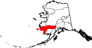 | |
| CDPs | ||
| Unincorporated communities | ||
| Ghost towns | ||
| Neighborhoods | ||