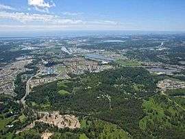
Upper Coomera, Queensland
| Upper Coomera City of Gold Coast, Queensland | |||||||||||||
|---|---|---|---|---|---|---|---|---|---|---|---|---|---|
 | |||||||||||||
| Coordinates | 27°52′48″S 153°17′10″E / 27.8800°S 153.2861°ECoordinates: 27°52′48″S 153°17′10″E / 27.8800°S 153.2861°E | ||||||||||||
| Population | 21,136 (2011 census)[1] | ||||||||||||
| • Density | 5,030/km2 (13,030/sq mi) | ||||||||||||
| Established | 1900s | ||||||||||||
| Postcode(s) |
4209 4210 | ||||||||||||
| Area | 4.2 km2 (1.6 sq mi) | ||||||||||||
| Location |
| ||||||||||||
| LGA(s) |
City of Gold Coast Division of Coomera and Helensvale | ||||||||||||
| State electorate(s) | Albert | ||||||||||||
| Federal Division(s) | Forde | ||||||||||||
| |||||||||||||
Upper Coomera is a suburb on the Gold Coast in Queensland, Australia. Upper Coomera and Coomera have long been the main centre of urban development on the Gold Coast and are considered to be, along with Southport and Robina, one of the Gold Coast's three urban centres. Upper Coomera is a heavily suburbanised suburb consisting of many large residential developments and commercial centres. Despite already being heavily developed and having an extraordinarily large population, Upper Coomera is predicted by both the Queensland Government and Gold Coast City Council to grow and develop at an exponential rate well into the next decade. Upper Coomera is a popular place of residence for dual-city commuters as it is placed roughly halfway between the central commercial districts of Southport and Beenleigh and within reasonable travelling distance to Brisbane CBD.
Location
Upper Coomera is located on the northern side of the Gold Coast on the western side of the M1 Pacific Motorway. It borders Willow Vale in the north, the Coomera River on the south which separates it from Oxenford and the Pacific Highway on the east which separates it from Coomera.
Education
State primary schools
- Upper Coomera State College - Chrisholm Junior School (P-6)
- Coomera Springs State School (P-6)
- Highland Reserve State School (P-6)
State secondary schools
- Upper Coomera State College - Jakaara Middle School (7-9)
- Upper Coomera State College - Fensham Senior School (10-12)
Private schools
- Assisi Catholic College (P-12)
- Saint Stephen's College (P-12)
- Coomera Anglican College (P-12)
In addition to local schools, the southern parts of the suburb lie within the catchment area of Gaven State School (P-6) and Pacific Pines State High School (7-12) in the neighbouring suburb of Pacific Pines.
Community

The Upper Coomera Community Centre is located on Reserve Road and contains the office of Councillor Donna Gates, Customer Service Office, Aquatic Centre, and Upper Coomera Branch Library. The Upper Coomera Branch Library opened in April 2013 and is the newest branch of the Gold Coast libraries.
The Upper Coomera School of Arts was established in 1896. It is used for public meetings and other community purposes.[2]
Shopping
Upper Coomera has several shopping venues, the main ones being Coomera City Centre, Coomera Grand Shopping Centre and The Hub at the junction of Days Road and Old Coach Road. Together they consist of Woolworths and Aldi supermarkets, a Masters Home Improvement store and various other stores. Also located throughout the suburb in smaller shopping villages are Bi-Lo and Coles supermarkets. Various fast food outlets exist in Upper Coomera including two McDonalds restaurants, Hungry Jacks, Pizza Hut, Subway, Nandos, KFC, Pizza Capers and Krispy Kreme Doughnuts.
In the neighbouring suburb of Coomera is the soon to be constructed Westfield Coomera Town Centre. Nearby major shopping centres include Westfield Helensvale, Robina Town Centre, Pacific Fair Shopping Centre, Harbour Town Shopping Centre and Australia Fair Shopping Centre.
Entertainment
Upper Coomera has a number of hotels, cafes and restaurants, catering to families.
Public transport
Upper Coomera is well serviced by a variety of bus routes provided by Surfside Bus Lines and operated by Translink. There is also a train station on Foxwell Road in the neighbouring suburb of Coomera.
References
- ↑ Australian Bureau of Statistics (31 October 2012). "Upper Coomera (State Suburb)". 2011 Census QuickStats. Retrieved 16 February 2014.
- ↑ "Upper Coomera". Queensland Places. Centre for the Government of Queensland, University of Queensland. Retrieved 26 January 2015.