Upper Burrell Township, Westmoreland County, Pennsylvania
| Upper Burrell Township, Pennsylvania | |
|---|---|
| Township | |
|
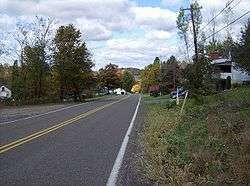
A typical road in Upper Burrell Township | |
 Map of Westmoreland County, Pennsylvania Highlighting Upper Burrell Township | |
 Map of Pennsylvania highlighting Westmoreland County | |
| Country | United States |
| State | Pennsylvania |
| County | Westmoreland |
| Settled | 1791 |
| Incorporated | 1879 |
| Area | |
| • Total | 15.2 sq mi (39 km2) |
| Population (2000) | |
| • Total | 2,240 |
| • Density | 147.6/sq mi (57.0/km2) |
| Time zone | Eastern (EST) (UTC-5) |
| • Summer (DST) | EDT (UTC-4) |
| Website | http://www.upperburrelltwp.com |
Upper Burrell Township is a township in Westmoreland County, Pennsylvania, United States, within the Pittsburgh metropolitan area. The population was 2,240 at the 2000 census.
History
The Byerly House was added to the National Register of Historic Places in 1985.[1]
Geography
According to the United States Census Bureau, the township has a total area of 15.2 square miles (39.3 km²), all of it land.
Upper Burrell is the site of Penn State New Kensington, and a large research facility of Alcoa.
Demographics
As of the census[2] of 2000, there were 2,240 people, 856 households, and 647 families residing in the township. The population density was 147.6 people per square mile (57.0/km²). There were 914 housing units at an average density of 60.2/sq mi (23.2/km²). The racial makeup of the township was 96.34% White, 2.81% African American, 0.04% Native American, 0.31% Asian, and 0.49% from two or more races. Hispanic or Latino of any race were 0.45% of the population.
There were 856 households out of which 31.3% had children under the age of 18 living with them, 65.1% were married couples living together, 7.4% had a female householder with no husband present, and 24.4% were non-families. 19.3% of all households were made up of individuals and 8.5% had someone living alone who was 65 years of age or older. The average household size was 2.62 and the average family size was 3.01.
In the township the population was spread out with 22.9% under the age of 18, 9.0% from 18 to 24, 27.5% from 25 to 44, 27.0% from 45 to 64, and 13.7% who were 65 years of age or older. The median age was 40 years. For every 100 females there were 102.2 males. For every 100 females age 18 and over, there were 103.4 males.
The median income for a household in the township was $39,880, and the median income for a family was $46,855. Males had a median income of $37,083 versus $24,583 for females. The per capita income for the township was $18,344. About 4.5% of families and 6.4% of the population were below the poverty line, including 6.3% of those under age 18 and 5.2% of those age 65 or over.
References
- ↑ National Park Service (2010-07-09). "National Register Information System". National Register of Historic Places. National Park Service.
- ↑ "American FactFinder". United States Census Bureau. Retrieved 2008-01-31.
| Counties |  Map of the Pittsburgh Tri-State with green counties in the metropolitan area and yellow counties in the combined area. | |
|---|---|---|
| Major cities | ||
| Cities and towns 15k-50k (in 2010) | ||
| Airports | ||
| Topics | ||
| ||
Coordinates: 40°33′19″N 79°40′30″W / 40.55528°N 79.67500°W