University of Dayton Ghetto

The South Student Neighborhood is a neighborhood in Dayton, Ohio, that is home to upperclassmen at the University of Dayton (UD). Houses in the neighborhood are leased to students, an arrangement that resembles both traditional university housing and a landlord/tenant relationship. Some students and alumni insist on calling the neighborhood "the ghetto" despite objections from students, faculty, and administrators.
Tracing its history back to the 1870s, the South Student Neighborhood now includes more than 200 university-owned houses as well as landlord-owned houses, high-density housing and gathering spaces. With the inclusion of Holy Angels and The Darkside, two smaller neighborhoods the university owns property in, there are more than 400 houses currently used as student residential space. Because of the area's age, the university has been engaged in a program to renovate and update the South Student Neighborhood, and several additional changes to the neighborhood are expected in the coming years as part of the university's Master Plan.
History and geography
The South Student Neighborhood is south of downtown Dayton but north of the city of Oakwood. The Great Miami River is just more than half a mile to the west, and Interstate 75 is just more than a mile to the west. In its current form, it is bounded by Brown Street to the west, Irving Avenue to the south, Trinity Avenue and Evanston Avenue to the east, and Caldwell Street and Stonemill Road to the north. This gives the area a roughly triangular shape.[1]
The land on which the South Student Neighborhood now sits was owned by John Henry Patterson until the mid-1870s. The land was then divided between suburban housing lots to the east and the NCR factory to the west.[2] The original proprietors of the neighborhood were Thomas S. Babbitt, Dr. Joseph E. Lowes, R. D. Hughes and Harry Kiefaber. The area was known as the town of Babbitt, and in its original form included only four streets: Lowes Street, Kiefaber Street, Hughes (now Stonemill Road) and Wead (now Lawnview Avenue). This core area was measured at 47 acres (190,000 m2).[3]
The NCR Corporation used Babbitt as housing for its workers. In 1906, the area was annexed by the city of Dayton and continued on as a middle-class neighborhood. The University of Dayton, Babbitt's neighbor to the northeast, began to buy available houses in the neighborhood in the 1950s as an experiment in off-campus housing. By the 1970s, the student population of the area was growing rapidly.[3]
While it is unknown when the area began its life as the South Student Neighborhood, there have been several efforts to rename it. In the 1960s, Rev. Norbert Burns, who taught at the university for 62 years before retiring in 2007 at the age of 82,[4] was part of one such effort. His committee attempted to change the name to the "Village," an effort which ultimately failed.[2] University administrators now refer to the area as the "South Student Neighborhood,"[5] though the phrase sees little use by the student population.[6]
Recent changes

As the houses in the South Student Neighborhood age, and as the number of students wishing to live in the South Student Neighborhood expands, the university has begun a renovation and replacement program with the goal of keeping the current feel of the area intact. In 2000, construction began on several new duplexes to fill land that was unused, resulting in housing for several dozen additional students. The duplexes housed six students per side, for a total of 12 students each.[7] In 2003, the university continued the project by tearing down several houses on Stonemill Road and replacing them with a new five-person design.[8] Several more of these houses have now been built throughout the South Student Neighborhood.
In 2006, the university began a new phase of replacement and renovation in the neighborhood, in which $2.5 million was spent to renovate four existing structures, including a duplex, as well as to build a five-unit set of attached townhouses. The houses, located on Frericks Way and Stonemill Road, house 55 students and include the famous "Castle" which has been given a new faux-stone facade in homage to its traditional name. The houses became available to students for the 2007 – 2008 academic year.[9]
The new wave of construction brings the university's stock of houses to 328, including several duplexes.[9] Not including these new additions, as of 2005, the university owned 225 houses in the South Student Neighborhood, with the rest on the Darkside, the other half of the University of Dayton campus. Additionally, 73 houses in the neighborhood were owned by private landlords and rented to UD students.[10]
Holy Angels and the Darkside
In addition to the properties the university owns in the South Student Neighborhood, there are also student houses located in two other neighborhoods: the Darkside—or North Student Neighborhood, as it is referred to by the university—and Holy Angels. Once considered a single neighborhood and connected by the north-south Alberta Street, the areas were separated when the Thomas J. Frericks Center and a new formal entrance were added. Alberta Street now acts as the main thoroughfare for the Darkside, while the street has been rerouted and renamed College Park Avenue in the Holy Angels neighborhood. It is cut off from the portion in the South Student Neighborhood, renamed Frericks Way.[11]
The Darkside, which derives its name from a lack of street lights when students first began to move to the area, is bounded by Stewart Street to the south, Brown Street to the west, Woodland Cemetery to the east and Wyoming Street to the north.[2] Traditionally, the Darkside has served as housing for juniors. This is not due to any university policy, but rather the preference of seniors, who select houses first in the student housing lottery due to their larger number of credit hours.[12][13]
The third and smallest neighborhood, Holy Angels, derives its name from the Holy Angels Church and School that occupies the center of the area. It lies between the Darkside and the South Student Neighborhood, but is physically separated from them by Stewart Street and the Frericks Center parking lot.[14]
Features

Not all of the houses in the student neighborhoods are occupied by students. Four houses in both the South Student Neighborhood and the Darkside — on Trinity Avenue, Kiefaber Street, Stonemill Road and Chambers Street — are home to groups of Marianists, the Catholic religious institute behind UD. Between six and 10 Marianists live in each house. They serve the university as ministers, groundskeepers, administrators and professors, among other professions.[15]
The South Student Neighborhood also contains several high-density living areas, including the Garden Apartments, the Lawnview Apartments and the Campus South, a high-rise living complex for sophomores. In 2004, the ArtStreet complex opened, intended as a combined living-learning space. It includes housing for 56 students, as well as a cafe, an amphitheater, rehearsal rooms, several activity rooms and gallery spaces, and a new studio for the campus radio station, WUDR.[16] The South Student Neighborhood is also home to the McGinnis school house, which was acquired in 1982 and renamed the McGinnis Center; it is used as a central point of contact for South Student Neighborhood residents.[3] The McGinnis Center houses several meeting rooms, administrative offices and laundry facilities for houses that are not equipped with washers and dryers.
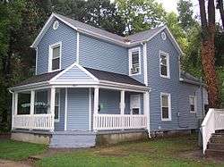
Some houses in the neighborhood have been given informal nicknames by which they are commonly known, such as "The Deli House" at 237 Lowes St.,[17] the "The F Shaq" at 418 Lowes St.[17] and "The Crack House" at 1488 Frericks Way.[17] For the majority of houses, nicknames are arbitrary and vary year to year. In addition, many houses in the South Student Neighborhood are those occupied by various fraternities, sororities and other special interest groups.[17]
Future

In 2002, the University of Dayton released a Master Plan which called for the renovation and construction of several houses, an extension to Stonemill Road to connect directly to Evanston Avenue, and the enlargement and clean-up of the parking areas in the alleys behind the houses.[18] Despite ongoing rumors, there were no plans to raze the South Student Neighborhood and replace it with more high-density housing and other university buildings, despite the landlocked nature of the campus.[19]
In June 2005, before the plan could be realized, the university made a $25 million purchase of an additional 49 acres (200,000 m2)—much of the land which was once home to the NCR Corporation—as well as a new 100,000-square-foot (9,300 m2) building on Brown Street.[20] The area, renamed Mid Campus, prompted the development of a new Campus Master Plan.[21]
While several new buildings have been planned, many of the changes that had been proposed to the South Student Neighborhood in the previous master plan are no longer included in the new plan. The largest feature affecting the student neighborhoods is a new building to the east of Alberta Street, between Chambers Street and Obell Court, on the Darkside. According to the draft of the master plan, the building is intended to be a sustainable residence hall, a 75- to 90-bed facility that would also include an educational wing. The proposed building would use technologies such as solar energy, geothermal heating and cooling, compost piles and low-flow showers. The plan also calls for a walk/bike greenway to link the neighborhood to the core of campus and the athletic complex.[22]
References
- ↑ "The South Student Neighborhood". University of Dayton. Retrieved 2007-06-14.
- 1 2 3 Szink, Jennie and Peter Blazunas. "What's in a name?" Flyer News. Volume 54, Issue 35. March 27, 2007.
- 1 2 3 Pham, HaQuyen. "Deep roots lead to long, storied past." Flyer News. Volume 52, Issue 33. March 8, 2005.
- ↑ Tiedge, Amy. "Well-known professor to retire after 62 years." Flyer News. Volume 54, Issue 35. March 27, 2007.
- ↑ Davis, Robert; Anthony DeBarros (30 August 2006). "Alcohol and fire a deadly mix". USA Today. Retrieved 19 February 2009.
- ↑ "UD Lingo". University of Dayton. Retrieved 2007-10-01.
- ↑ Gruenke, Jessica. "New duplexes planned to alleviate housing shortage." Flyer News. Volume 48, Issue 20. December 8, 2000.
- ↑ Dowell, Matt. "Houses to be built on Stonemill." Flyer News. Volume 50, Issue 34. March 7, 2003.
- 1 2 Rizvi, Teri (2007-06-08). "Citirama with a twist: student housing will be showcased in August event". University of Dayton. Retrieved 2007-06-08.
- ↑ Martin, Jerry. "Neighborhood gives spice to UD life." Flyer News. Volume 52, Issue 34. March 11, 2005.
- ↑ "University of Dayton Campus Land Use Plan" (PDF). University of Dayton. Retrieved 2007-10-01.
- ↑ "Junior/Senior Lottery Position". University of Dayton. Retrieved 2007-10-01.
- ↑ "The North Student Neighborhood". University of Dayton. Retrieved 2007-06-14.
- ↑ "The Holy Angels Neighborhood". University of Dayton. Retrieved 2007-06-14.
- ↑ Ross, Hilary. "Marianists talk about life in the Ghetto." Flyer News. Volume 53, Issue 8. September 30, 2005.
- ↑ Martin, Jerry. "New facilities welcome UD students." Flyer News. Volume 52, Issue 1. August 31, 2004.
- 1 2 3 4 "Student Housing: View Residential Properties". University of Dayton. Retrieved 2007-06-14.
- ↑ "University of Dayton old plan map (direct link)". University of Dayton. Retrieved 2007-10-01.
- ↑ Griesenbrock, Tyler. "More neighborhood changes planned" Flyer News. Volume 52, Issue 35. March 15, 2005.
- ↑ Pham, HaQuyen. "UD buys NCR property for $25M" Flyer News. Volume 53, Issue 1. August 30, 2005.
- ↑ "University of Dayton Campus Master Planning". University of Dayton. Retrieved 2009-01-05.
- ↑ "University of Dayton Campus Master Plan Preliminary Draft" (PDF). University of Dayton. Retrieved 2007-09-29.
External links
| Athletics |  | |
|---|---|---|
| Facilities | ||
| Organizations | ||
| Programs | ||
| Products and services | |
|---|---|
| Divisions | |
| People | |
| Other | |
| |
Coordinates: 39°44′8.16″N 84°10′44.76″W / 39.7356000°N 84.1791000°W