Union Township, Bollinger County, Missouri
| Union Township | |
|---|---|
| Township | |
 | |
| Coordinates: 37°32′50″N 090°03′50″W / 37.54722°N 90.06389°WCoordinates: 37°32′50″N 090°03′50″W / 37.54722°N 90.06389°W | |
| Country | United States |
| State | Missouri |
| County | Bollinger |
| Area | |
| • Total | 56.99 sq mi (147.61 km2) |
| • Land | 56.96 sq mi (147.53 km2) |
| • Water | 0.03 sq mi (0.08 km2) 0.05% |
| Elevation[1] | 712 ft (217 m) |
| Population (2010) | |
| • Total | 1,058 |
| • Density | 24.28/sq mi (39.07/km2) |
| FIPS code | 29-74518[2] |
| GNIS feature ID | 0766326 |
Union Township is one of eight townships in Bollinger County, Missouri, USA. As of the 2000 U.S. Census, its population was 1,035. As of the 2010 U.S. Census, the population had increased to 1,058. Union Township covers an area of 56.99 square miles (147.6 km2).
Union Township was established in 1848.[3]
Demographics
As of the 2010 U.S. Census, there were 1,058 people residing in the township. The population density was 24.28 people per square mile (39.07/km²). There were 497 housing units in the township. The racial makeup of the township was 96.03% White, 1.70% Black or African American, 0.57% Native American, 0.19% Asian, 0.19% from other races, and 1.32% from two or more races. Approximately 0.28% of the population were Hispanic or Latino of any race.
Geography
Incorporated Areas
The township contains no incorporated settlements.
Unincorporated Areas
The township contains the unincorporated areas and historical communities of Alliance, Hurricane, North Patton, Patton, and Patton Junction.
Cemeteries
The township contains two cemeteries: Johnson and Pleasant Hill.
Streams
The streams of Baltimore Creek, Blue Creek, Buck Creek, Cape Creek, Conrad Creek, Goose Creek, Grounds Creek, Little Whitewater Creek, and Stannett Creek flow through Union Township. Other bodies of water located in the township include the Whitewater River, Destitute Acres Lake, Fulton Lake, and Grindstaff Lake.
Landmarks
- Amidon Memorial Conservation Area
- Little Whitewater Conservation Area
Administrative Districts
School Districts
- Meadow Heights R-II School District
Political Districts
- Missouri's 8th Congressional District
- State House District 145
- State Senate District 27
References
- ↑ "US Board on Geographic Names". United States Geological Survey. 2007-10-25. Retrieved 2008-01-31.
- ↑ "American FactFinder". United States Census Bureau. Archived from the original on September 11, 2013. Retrieved 2008-01-31.
- ↑ "Bollinger County Place Names, 1928-1945 (archived)". The State Historical Society of Missouri. Retrieved 3 September 2016.
External links
Municipalities and communities of Bollinger County, Missouri, United States | ||
|---|---|---|
| City | 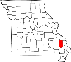 | |
| Villages | ||
| Townships | ||
| Unincorporated communities | ||
| Abandoned villages | ||