U.S. Route 89
| |
|---|---|
 | |
| Route information | |
| Length: | 1,252 mi[1] (2,015 km) |
| Existed: | 1926 (WY, ID, UT, AZ), 1934 (MT)[1] – present |
| Major junctions | |
| South end: |
|
|
| |
| North end: |
|
| Location | |
| States: | Arizona, Utah, Idaho, Wyoming, Montana |
| Highway system | |

U.S. Route 89 (US 89) is a north–south United States Highway with two sections, and one former section. The southern section runs for 848 miles (1,365 kilometers) from Flagstaff, Arizona, to the southern entrance of Yellowstone National Park. The northern section runs for 404 miles (650 kilometers) from the northern entrance of Yellowstone National Park in Montana, ending at the Canada–US border. Unnumbered roads through Yellowstone connect the two sections. Before 1992, U.S. Highway 89 was a Canada to Mexico, border-to-border, highway that ended at Nogales, Arizona, on its southern end.[2]
Sometimes called the National Park Highway, U.S. 89 links seven national parks across the Mountain West. In addition, fourteen other national park areas, mostly national monuments are also reachable from this backbone of the Rockies.
Route description
Arizona

U.S. 89 begins at Flagstaff, Arizona. The highway proceeds north passing near Grand Canyon National Park and through the Navajo Nation. Near the Utah state line, the highway splits into U.S. 89 and U.S. 89A. The Alternate is the original highway; what is now the main highway was constructed in the 1960s to serve the Glen Canyon Dam. The two highways rejoin in Kanab, Utah.
The main branch passes over the Colorado River just south of the Glen Canyon Dam and Lake Powell near Page, Arizona, and then it enters Utah. The 89A branch crosses the Colorado River at Navajo Bridge and then skirts the North Rim of the Grand Canyon before entering Utah.
National Park Highway - Starting just north of the Mexican border in Arizona is the Tumacacori National Monument. Saguaro National Park is the first national park by title, in Tucson. Short links from Highway 89 take motorists to the Casa Grande National Monument and the Hohokam Pima National Monument, before reaching Phoenix. Approaching Flastaff there is a quartet of parks, including Tuzigoot National Monument, Walnut Canyon National Monument, Sunset Crater National Monument, and Wupatki National Monument. North of Flagstaff is the Grand Canyon National Park, the second of the seven national parks along this highway.[3] Continuing northward, U.S. 89 divides into U.S. 89 and U.S. 89A. The northern mainline route passes by Page, Arizona, and through the Glen Canyon National Recreation Area before leaving the state and Lake Powell.
U.S. 89A turns westward, and it serves Lees Ferry, and then it goes over the Kaibab Plateau, connecting with Arizona State Route 67 at Jacob Lake, Arizona, then with Arizona State Route 389 in Fredonia, Arizona, before turning north into the state of Utah. State Route 67 will take travelers to the North Rim of the Grand Canyon, while State Route 389 serves the Pipe Spring National Monument, which is the last National Park Service area in Arizona.[4]
Utah

The first city in Utah along either U.S. 89 or U.S. 89A is Kanab where the two routes re-unite. From Kanab U.S. 89 proceeds north passing by the Zion National Park and the Bryce Canyon National Park. It eventually enters the Sevier County, Utah, and the Sanpete Valleys. The highway then passes by Thistle, Utah, a ghost town that was destroyed by a lake resulting from a landslide in 1983. The highway then enters the Wasatch Front where U.S. 89 becomes the main street for many of the largest cities in Utah. The highway is also often in the shadows of Interstate 15 during its route along the Wasatch Front. U.S. 89 runs concurrent with I-15 from Bountiful to Farmington, where it departs and runs at the base of the Wasatch Mountains until it reaches Ogden. In Ogden, the highway is Washington Blvd. From Ogden the highway runs north until it meets U.S. 91 at Brigham City, Utah, where it turns east and goes to serve the Cache Valley and Logan, Utah. In Logan, U.S. 89 is Main Street and it passes by the campus of the Utah State University. The highway next proceeds up Logan Canyon to Bear Lake where the highway exits Utah.
Two sections of U.S. 89 in Utah have been designated Scenic Byways. The Kanab to Mt. Carmel and Long Valley Scenic Byway is a designated Utah Scenic Byway. From Logan to Bear Lake is designated as the Logan Canyon Scenic Byway by the National Scenic Byways project.
The section of U.S. 89 in Utah, other than concurrencies with Interstate 70, Interstate 15, U.S. Highway 6, and U.S. Highway 91, is defined in the Utah Code Annotated § 72-4-114(8).[5]
Utah is dominated by the Colorado Plateau. Along U.S. 89 are the Zion National Park, the Bryce Canyon National Park, and the Cedar Breaks National Monument. Although not readily adjacent to U.S. 89, the Capitol Reef National Park is accessible from U.S. 89. U.S. 89 leaves northern Utah well-north of Salt Lake City and the Timpanogos Cave National Monument and the Golden Spike National Historic Site.[4]
Idaho

In Idaho, the highway partially circumnavigates the Bear Lake which straddles the Utah / Idaho state line.
Wyoming
In Wyoming, U.S. 89 passes through many scenic sites including Grand Teton National Park, the Jackson Hole valley, the Snake River Canyon, and the Star Valley.
Passing northward along the western border of Wyoming with Idaho, U.S. 89 enters the Grand Teton National Park. Here, U.S. 89 is the backbone visitor highway for two U.S. National Parks. Leaving the Tetons, the road enters a lesser known park, John D. Rockefeller, Jr. Memorial Parkway, before ending at the South Entrance of Yellowstone National Park. An unnumbered park road connects the two sections of U.S. 89 through Yellowstone.
Montana
U.S. 89 enters Montana at the North Entrance of Yellowstone National Park. It traverses the width of the state before approaching Glacier National Park. At St. Mary, Montana, U.S. 89 is the access highway to Glacier Route One, also known as the Going-to-the-Sun Road.[4]
The Kings Hill Scenic Byway passes through the Little Belt Mountains in the Lewis and Clark National Forest in Montana.[6] The route is home to a wide variety of wildlife and provides many recreational opportunities for travelers on the route. The Byway is a 71-mile route that begins on US Highway 89 at its junction with US Highway 12. From the junction of the Byway it travels north through the Lewis and Clark National Forest through the communities of Neihart and Monarch, Montana and on to its junction with US Highway 87. The route offers access to the Showdown Ski Area and Sluice Boxes State Park. The route travels over the Kings Hill Pass which snow removal crews work to keep open throughout the winter season.[7]
The northern terminus of U.S. 89 is at the Canada–US border. There, the highway continues into Canada as Alberta Highway 2.
History
Prior to 1992, the southern terminus of US 89 was at Nogales, Arizona, and the highway proceeded to Flagstaff, Arizona, along what is now I-19, State Route 79, US 60, US 93, and State Route 89. In addition, there was another US 89A in Arizona between Prescott and Flagstaff on which is now State Route 89A.
In central Arizona, the need for a north–south U.S. Highway was largely superseded by the completion of I-17, which now carries the bulk of the traffic and all of the heavy trucks along this north–south corridor. I-17 connects I-40 in Flagstaff with I-10 in Phoenix, Arizona, along a very hilly route that also passes through the Verde Valley.
US 89 was discontinuous for most of 1983 due to a landslide that destroyed the town of Thistle, Utah and closed the highway for about 8 months in central Utah.
From early 2013 to mid 2015, US 89 was closed approximately 25 miles south of Page, Arizona, due to a geological event that caused the roadway to buckle and subside. Traffic was being re-routed via 45 miles of secondary and tertiary roads on the Navajo Nation.[8] U.S. Route 89T opened on August 29, 2013, a 28-mile (45 km) paved portion of a Navajo route to serve as a long-term bypass of the closed section.
Major intersections
- Southern segment
- Arizona
- Utah
-
 I‑70 north-northeast of Sevier. The highways travel concurrently to Salina.
 -
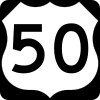 I‑70 / US 50 in Salina. US 50/US 89 travels concurrently through Salina.
 -
 US 6 east-northeast of Thistle. The highways travel concurrently to Spanish Fork.
 -
 US 189 in Provo
 -
 I‑15 in Lehi. The highways travel concurrently to Draper.
 -
 I‑215 in Murray
 -
 I‑80 in South Salt Lake
 - I‑15 in Salt Lake City
- I‑15 in North Salt Lake
- I‑15 on the West Bountiful–Bountiful city line. The highways travel concurrently to Farmington.
-
 I‑84 south-southeast of Uintah
 -
 US 91 in Brigham City. The highways travel concurrently to Logan.
-
- Idaho
-
 US 30 in Montpelier. The highways travel concurrently through Montpelier.
-
- Wyoming
-
 US 26 on the Alpine Northwest–Alpine Northeast line. The highways travel concurrently to Moran.
 -
 US 189 / US 191 in Hoback Junction. US 89/US 189 travels concurrently to Jackson. US 89/US 191 travels concurrently to the southern entrance to Yellowstone National Park north-northwest of Colter Bay Village.
 -
 US 26 / US 287 in Moran. US 89/US 287 travels concurrently to the southern entrance to Yellowstone National Park north-northwest of Colter Bay Village.
-
- Northern segment
- Montana
- The northern entrance to Yellowstone National Park south of Gardiner
-
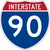 I‑90 / US 191 in Livingston. The highways travel concurrently to northeast of Livingston.
 -
 US 12 south of White Sulphur Springs. The highways travel concurrently to northeast of White Sulphur Springs.
 -
 US 87 south-southeast of Armington. The highways travel concurrently to Great Falls.
 -
 I‑315 in Great Falls. The highways travel concurrently through Great Falls.
 - I‑15 / I‑315 in Great Falls. I-15/US 89 travels concurrently to northeast of Vaughn.
- US 287 in Choteau
-
 US 2 southeast of South Browning. The highways travel concurrently to South Browning.
 -
 Hwy 2 at the Canada–United States border north-northeast of Babb
See also
- U.S. Route 189
- U.S. Route 89A
- Arizona State Route 89
- Arizona State Route 89A
- Interstate 10
- Interstate 15
- Interstate 17
- Interstate 40
- Interstate 70
- Interstate 80
References
- 1 2 Droz, Robert V. U.S. Highways : From US 1 to (US 830). Retrieved 02:55, July 4, 2006 (UTC).
- ↑ "End of US highway 89". USEnds.com. Retrieved July 7, 2007.
- ↑ "US 89 Society". Retrieved October 9, 2014.
- 1 2 3 National Park System, US Department of the Interior, Washington, D.C.
- ↑ Archived February 9, 2007, at the Wayback Machine.
- ↑ "Kings Hill Scenic Byway". Retrieved November 22, 2010.
- ↑ "Kings Hill Scenic Byway". Retrieved November 21, 2010.
- ↑ Stocks, Deborah (February 20, 2013). "US 89 south of Page buckles, collapses". Phoenix, AZ: KNXV-TV. Retrieved February 25, 2013.
External links
| Wikimedia Commons has media related to U.S. Route 89. |
- US Route 89: The West's Most Western Highway
- U.S. Highway 89: The Scenic Route to Seven National Parks; Ann Torrence
- Highway 89 Digital Collection: Utah State University - Includes documents and photos.
| Browse numbered routes | ||||
|---|---|---|---|---|
| ← | ID | US-91 | ||
| ← | WY | WYO 89 | ||
| ← | MT | MT 89 | ||
Routes in italics are no longer a part of the system. Highlighted routes are considered main routes of the system. |