U.S. Route 70 Bypass (Goldsboro, North Carolina)
| |
|---|---|
| Goldsboro Bypass | |
|
Route of US 70 Bypass in red | |
| Route information | |
| Maintained by NCDOT | |
| Length: | 21.7 mi[1] (34.9 km) |
| Existed: | 2016[2] – present |
| Major junctions | |
| West end: |
|
| East end: |
|
| Location | |
| Counties: | Wayne, Lenoir |
| Highway system | |

_map.svg.png)
U.S. Route 70 Bypass (US 70 Byp.) is an bypass route of US 70 in North Carolina that runs west of Goldsboro to La Grange. Formally known as North Carolina Highway 44 (NC 44), from 2011 to 2016, its current designation is also only temporary as it will become part of Interstate 42 (I-42).
Route description
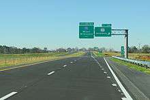
US 70 Byp. is a four-lane freeway that is 21.7 miles (34.9 km) in length north of Goldsboro, connecting with US 70 at both ends. Starting west of Goldsboro, it splits as the through traffic from US 70, which continues on towards Goldsboro. In a northeasterly direction, it connects with NC 581, I-795 and US 117, where it turns southeasterly. After connecting with Wayne Memorial Drive, US 13 and Parkstown Road, it merges back as the through traffic with US 70 near La Grange. Mile markers along the route are based off US 70 and the speed limit is 70 miles per hour (110 km/h) throughout.
The bypass serves both as a strategic transportation corridor for North Carolina and part of the Strategic Highway Network (STRAHNET).[3]
History
Construction started on the 3.9-mile (6.3 km) central section of the Goldsboro Bypass on October 9, 2008; its contract awarded to Barnhill Contracting Co. of Tarboro.[4] At a cost of $65.5 million (equivalent to $73.5 million in 2015[5]), it features three interchanges connecting I-795, US 117 and Wayne Memorial Drive (SR 1556).[6] On December 16, 2011, the central section became the first segment of the Goldsboro Bypass to open; signed as NC 44.[7]
In 2012, both eastern and western sections of the bypass began construction. The 12.5-mile (20.1 km) eastern section's contract was awarded to Barnhill Contracting Co. in February, at a cost of $104.4 million (equivalent to $113 million in 2015[5]). The 5.9-mile (9.5 km) western section's contract was awarded to S.T. Wooten in July, at a cost of $62.4 million (equivalent to $67.8 million in 2015[5]).[1] On September 25, 2015, the American Association of State Highway and Transportation Officials (AASHTO) approved the establishment of US 70 Byp., dependent on the completion of the Goldsboro Bypass.[3][8] On October 17, 2015, the western section became the second segment to open; connecting US 70 and I-795, with an interchange at NC 581.[9][10][11]
The eastern or last section of the Goldsboro Bypass was opened on May 27, 2016; from Wayne Memorial Drive (SR 1556) to US 70, with interchanges at US 13 and Parkstown Road (SR 1714).[1] The section opened with a ribbon cutting ceremony and all signage that formally delineate NC 44 would be changed to US 70 Byp. after the event.[2]
North Carolina Highway 44
| |
|---|---|
| Location: | Goldsboro, North Carolina |
| Length: | 9.8 mi[1] (15.8 km) |
| Existed: | 2011[7]–2016 |
The first NC 44 appeared in 1930 as a new primary routing between US 17-1/NC 40, in Whitakers, and NC 90, in Tarboro.[12] In 1935, NC 44 was extended east through Tarboro, along US 64, to Princeville, then on new primary routing to NC 125, in Oak City. In 1941, NC 44 was extended west, along new primary routing, to NC 48.[13] In 1967, NC 44 was removed from a 0.6-mile (0.97 km) concurrency with NC 11 to NC 125, in Oak City.[14] By 1968, NC 44 was rerouted onto new western bypass of Tarboro, in currency with US 64; its former routing became US 64 Business.[15] In 1994, NC 44 was decommissioned in favor of NC 33, between NC 48 and Tarboro, and NC 111, between Princeville and Oak City.[16][17]
The second NC 44 was signed as a place holder along the Goldsboro Bypass during its construction until it was completed. Established on December 17, 2011 along the 3.9-mile (6.3 km) central section, it was extended 5.9 miles (9.5 km) west on October 17, 2015. On May 27, 2016, the 21.7 miles (34.9 km) Goldsboro Bypass was completed and NC 44 decommissioned in favor of US 70 Byp.[1]
Future
The Goldsboro Bypass is planned to become part of future I-42.
Exit list
| County | Location | mi | km | Exit | Destinations | Notes |
|---|---|---|---|---|---|---|
| Wayne | Goldsboro | 0.0 | 0.0 | — | Continuation as US 70 | |
| 2.0 | 3.2 | 351 | ||||
| 5.9 | 9.5 | 355A | Signed as exit 355A (south) and 355B (north) | |||
| 355B | ||||||
| 7.3 | 11.7 | 356 | ||||
| | 9.8 | 15.8 | 358 | Wayne Memorial Drive | ||
| | 361 | |||||
| | 364 | Parkstown Road | ||||
| Lenoir | La Grange | 369 | ||||
| — | Continuation as US 70 | |||||
| 1.000 mi = 1.609 km; 1.000 km = 0.621 mi | ||||||
See also
-
 North Carolina portal
 -
 U.S. Roads portal
References
- 1 2 3 4 5 North Carolina Department of Transportation. "NCDOT: US 70 Goldsboro Bypass". North Carolina Department of Transportation. Retrieved October 17, 2015.
- 1 2 North Carolina Department of Transportation (May 27, 2016). "Governor McCrory Celebrates Opening of Completed Goldsboro Bypass" (Press release). North Carolina Department of Transportation. Retrieved May 29, 2016.
- 1 2 North Carolina Department of Transportation (August 24, 2015). "US 70 Bypass Application" (PDF). Raleigh: North Carolina Department of Transportation. Retrieved October 5, 2015 – via American Association of State Highway and Transportation Officials.
- ↑ "Construction Begins on Goldsboro Bypass". Raleigh, NC: WRAL-TV. October 9, 2008. Retrieved December 17, 2011.
- 1 2 3 United States nominal Gross Domestic Product per capita figures follow the Measuring Worth series supplied in Johnston, Louis; Williamson, Samuel H. (2016). "What Was the U.S. GDP Then?". MeasuringWorth. Retrieved April 10, 2016. These figures follow the figures as of 2015.
- ↑ "First Section of Goldsboro Bypass Opens". Raleigh, NC: WRAL-TV. December 16, 2011. Retrieved December 17, 2011.
- 1 2 "NCDOT Opens First Section of Goldsboro Bypass to Traffic" (Press release). North Carolina Department of Transportation. December 16, 2011. Retrieved December 17, 2011.
- ↑ Vitale, Marty (September 25, 2015). "Special Committee on U.S. Route Numbering Report to the Standing Committee on Highways" (PDF) (Report). Chicago, IL: American Association of State Highway and Transportation Officials. Retrieved October 4, 2015.
- ↑ Staff Reports (October 16, 2015). "Second Leg of Goldsboro Bypass to Open Saturday". The News & Observer. Raleigh, NC. Retrieved October 17, 2015.
- ↑ North Carolina Department of Transportation (October 16, 2015). "Western Section of US 70 Goldsboro Bypass to Open Saturday" (Press release). North Carolina Department of Transportation. Retrieved October 17, 2015.
- ↑ North Carolina Department of Transportation (January 12, 2016). "Route Changes" (PDF). Highway Traffic Ordinance. Raleigh: North Carolina Department of Transportation. p. 5. Retrieved February 15, 2016.
- ↑ North Carolina State Highway Commission (1930). State Highway System of North Carolina (PDF) (Map). North Carolina State Highway Commission. Retrieved October 17, 2015.
- ↑ North Carolina State Highway and Public Works Commission (1951). North Carolina Primary Highway System (PDF) (Map). Raleigh: North Carolina State Highway and Public Works Commission. Retrieved October 17, 2015.
- ↑ North Carolina State Highway Commission (September 1, 1967). "NC Route Changes" (PDF). Raleigh: North Carolina State Highway Commission. pp. 11–3 to 11–5A. Retrieved October 17, 2015.
- ↑ North Carolina State Highway Commission Planning and Research Department; Federal Highway Administration (1968). North Carolina County Road Survey 1968 (PDF) (Map). Raleigh: North Carolina State Highway Commission. Retrieved October 17, 2015.
- ↑ North Carolina Department of Transportation (May 9, 1994). "Route Changes" (PDF). Highway Traffic Ordinance 94-38. Raleigh: North Carolina Department of Transportation. pp. 1, 3. Retrieved October 17, 2015.
- ↑ North Carolina Department of Transportation (October 10, 1994). "Route Change Amendment" (PDF). Highway Traffic Ordinance 91-117. Raleigh: North Carolina Department of Transportation. p. 1. Retrieved October 17, 2015.
External links
-
 Media related to U.S. Route 70 in North Carolina at Wikimedia Commons
 - Media related to North Carolina Highway 44 at Wikimedia Commons
- NCRoads.com: N.C. 44