U.S. Route 3
| ||||||||||
|---|---|---|---|---|---|---|---|---|---|---|
|
US 3 highlighted in red | ||||||||||
| Route information | ||||||||||
| Maintained by MassDOT | ||||||||||
| Length: | 277.90 mi[1] (447.24 km) | |||||||||
| Existed: | 1926[1] – present | |||||||||
| Major junctions | ||||||||||
| South end: |
| |||||||||
| ||||||||||
| North end: |
| |||||||||
| Location | ||||||||||
| States: | Massachusetts, New Hampshire | |||||||||
| Highway system | ||||||||||
| ||||||||||


U.S. Route 3 (US 3) is a United States highway running 277.9 miles (447.2 km) from Cambridge, Massachusetts,[2] through New Hampshire, to the Canada–US border near Third Connecticut Lake, where it connects to Quebec Route 257.
In New Hampshire, parts of US 3 are known as the Daniel Webster Highway. From Burlington, Massachusetts, to Nashua, New Hampshire, US 3 is a freeway. The segment in New Hampshire is a free portion of the Everett Turnpike, while the portion in Massachusetts is known as the Northwest Expressway. A second freeway portion exists in northern New Hampshire, where US 3 utilizes the Franconia Notch Parkway, overlapping Interstate 93.
Massachusetts Route 3 connects to the southern terminus of US 3 in Cambridge and continues south to Cape Cod. Though it shares a number, it has never been part of US 3. Both routes, which connect end-to-end, are treated as a single 91.3-mile (146.9 km) state highway by MassDOT, with mileposts increasing continuously from Cape Cod all the way to the New Hampshire state border.
Route description
| mi[3] | km | |
|---|---|---|
| MA | 35.70 | 57.45 |
| NH | 241.953 | 389.386 |
| Total | 277.653 | 446.839 |
Massachusetts
Cambridge to Burlington
US 3 begins in the south along Memorial Drive in Cambridge, along the Charles River, at an interchange with Massachusetts Avenue (Route 2A). The road continues "south" (actually east) as Route 3 towards downtown Boston, while US 3 heads west, then north along the river towards downtown Cambridge, joining with Route 2 along the way. It runs opposite Soldiers Field Road in Allston along this stretch. Passing south of the downtown area, US 3 and Route 2 transition onto the Fresh Pond Parkway and join Route 16 in a wrong-way concurrency (heading north on US 3, one is also heading west on Route 2 and east on Route 16). Near the Alewife MBTA station, Route 2 splits off as a freeway to the west (Concord Turnpike), while US 3 / Route 16 turn onto the Alewife Brook Parkway. Shortly thereafter, US 3 splits from the Parkway (which continues as Route 16) and joins Route 2A (Massachusetts Avenue) westbound, crossing into Arlington. In the center of town, US 3 and Route 2A split from Massachusetts Avenue and overlap briefly with Route 60 (in another wrong-way concurrency) before continuing along Mystic Street. Route 2A splits from US 3 just to the north. US 3 continues through parts of Winchester and Woburn without any major intersections before entering Burlington and interchanging with Interstate 95 / Route 128 (Yankee Division Highway) at exit 33. US 3 joins the freeway to connect with the Northwest Expressway, while its historic surface alignment continues as Route 3A.
Burlington to Tyngsborough (Northwest Expressway)
US 3 runs along 1.6 miles (2.6 km) of I-95 (Route 128) in a wrong-way concurrency before exiting at exit 32A onto its own freeway, the Northwest Expressway.
Originally built in the 1950s, before the cancellation of the Inner Belt, the US 3 freeway was to have extended into metro Boston before being truncated to I-95. Consequently, a partially completed cloverleaf interchange connects US 3 to I-95, and exit numbers on the US 3 freeway start at 25 and increase sequentially to 36.
The freeway closely parallels Route 3A, the historic alignment of US 3, along its entire 19-mile (31 km) length from Burlington to the New Hampshire state border. It passes through Billerica and into Chelmsford, where it connects with I-495 and the Lowell Connector, a freeway spur into downtown Lowell widely regarded as one of the most dangerous roads in the state. Continuing north, the freeway briefly enters Lowell, then passes through North Chelmsford and Tyngsborough before crossing the state line into Nashua, New Hampshire. The freeway continues north as the Frederick E. Everett Turnpike.
New Hampshire
US 3 is one of New Hampshire's most well-known roads, as it passes through most of the state's major cities and towns and is the only highway to extend from the Massachusetts state border in the south to the Canada–US border in the north. Running for 242 miles (389 km) in New Hampshire, US 3 is by far the longest signed highway in the state.
US 3 crosses the state border into Nashua and immediately becomes concurrent with the Everett Turnpike, running on the freeway for 6.7 miles (10.8 km) along the western side of the city. US 3 leaves the Everett Turnpike at exit 7E, crosses NH 101A and turns northeast for approximately 1.5 miles (2.4 km) along a segment known as the Henri Burque Highway, before turning north onto Concord Street, which soon becomes known as the Daniel Webster Highway. (Some locals erroneously refer to the Everett Turnpike from exit 7 through the I-293 interchange as Route 3 and refer to the actual US 3 only as the Daniel Webster Highway or "Old Route 3".)
US 3 continues north through the town of Merrimack and into Bedford, where it becomes South River Road. The highway parallels I-293 until it turns east in Manchester and then crosses the Merrimack River on Queen City Avenue, just after its intersection with I-293 / NH 3A and NH 114A. US 3 and NH 3A are signed in a wrong-way concurrency for approximately 0.6 miles (0.97 km) before US 3 turns north onto Elm Street towards downtown Manchester. After approximately 2.2 miles (3.5 km), US 3 turns east onto Webster Street, then joins NH 28 to proceed in a northeasterly direction towards Hooksett, interchanging with I-93. The two routes continue as Hooksett Road, then the Daniel Webster Highway.
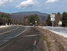
In Suncook, NH 28 leaves to the northeast, and US 3 proceeds northwest towards Concord on Pembroke Street, becoming Manchester Street when it enters the Concord city limits. After crossing the Merrimack River and interchanging with I-93, US 3 intersects NH 3A (South Main Street), which terminates at its parent route. US 3 traverses downtown Concord as North and South Main streets (briefly overlapping with US 202 and NH 9), then follows North State Street to Fisherville Road to Village Street in Penacook before crossing the Contoocook River into Boscawen. US 3 travels north through Boscawen, briefly overlapping with US 4. The highway parallels the Merrimack River north into Franklin, where the highway meets NH 11. US 3 joins NH 11 and turns east; NH 3A also resumes at this intersection, continuing north. US 3 and NH 11 briefly form a three-route concurrency with NH 127 in Franklin, then pass through Tilton, crossing NH 132 and passing the western end of NH 140. Continuing northeast past Winnisquam Lake, US 3 and NH 11 reach Laconia and turn onto the Laconia-Gilford Bypass, intersecting with NH 106, NH 107, and NH 11A. At the northern end of the bypass, US 3 and NH 11 split after a 17.3-mile (27.8 km) overlap, with the U.S. highway continuing north on Lake Street to Weirs Beach and an intersection with NH 11B. US 3 continues north as the Daniel Webster Highway to Meredith at the northern end of Meredith Bay on Lake Winnipesaukee. In Meredith, US 3 intersects the northern terminus of NH 106, then joins NH 25 and continues north past Squam Lake into Holderness, passing the western termini of NH 25B and NH 113. Through Holderness, US 3 and NH 25 gradually turn west, then southwest, passing the southern end of NH 175, and then reaching the northern end of NH 132 in Ashland.
From Ashland to North Woodstock, US 3 proceeds north, roughly paralleling I-93 in the Pemigewasset River valley. Along this stretch it passes through the towns of Plymouth (NH 25 splits from US 3 near I-93 in Plymouth, which also marks the true northern terminus of NH 3A), West Campton (where it meets the western end of NH 49, the principal access road to Waterville Valley), Thornton, and Woodstock. In North Woodstock, US 3 crosses NH 112 (known to the east as the Kancamagus Highway).
Continuing north, US 3 joins with I-93 as it passes through Franconia Notch State Park, one of the more scenic drives in the White Mountains. This stretch of freeway is known as the Franconia Notch Parkway and is the only section of Interstate highway in the country with only one lane in each direction.
US 3 separates from I-93 at exit 35, shortly north of the northern park boundary in Franconia. From there, NH 141 branches northwest and US 3 heads north and east toward Twin Mountain and a junction with US 302. This portion of the road is noted for fairly frequent moose sightings, especially during sunrise and sunset when moose are particularly active.
Heading north from Twin Mountain, US 3 passes through the village of Carroll, where NH 115 branches to the northeast and US 3 bears to the northwest and the town of Whitefield. In the center of Whitefield, NH 142 branches to the northwest and NH 116 crosses, running roughly southwest to northeast. US 3 continues north to Lancaster, where it joins US 2 in the town center, and where NH 135 branches off to the west. After US 2 leaves to the west, US 3 continues north, roughly paralleling the course of the Connecticut River (which also forms the border with Vermont), through Northumberland and Groveton, where NH 110 ends. North of Groveton, US 3 continues to follow the river, through Stratford, North Stratford, and Columbia, until it reaches Colebrook, where it crosses NH 26 and meets the southern terminus of NH 145. Still following the Connecticut River north, US 3 passes through portions of Stewartstown and Clarksville. In Stewartstown, the road turns more directly east (still following the Connecticut River, which is no longer a boundary), before resuming a northeasterly direction through Pittsburg. Its last major intersection is at the northern terminus of NH 145. US 3 continues north for another 22 miles (35 km), eventually reaching the Pittsburg-Chartierville Border Crossing, where the road crosses into Chartierville, Quebec and becomes Quebec Route 257.
In total, US 3 runs along the Connecticut River and its source lakes for approximately 70 miles (110 km).
History
New England Interstate

Before the establishment of the U.S. Highway system, the section of US 3 / Massachusetts Route 3 from Orleans, Massachusetts, to Colebrook, New Hampshire, was part of the New England road marking system as New England Interstate Route 6 (NEI 6 or NE-6). It was replaced in its entirety with the establishment of US 3 and Massachusetts Route 3 in 1926.
Massachusetts
US 3 in Massachusetts closely follows the route of the early 19th-century Middlesex Canal and Middlesex Turnpike.
The modern Northwest Expressway was begun near Route 110 in Lowell before World War II. In the 1950s, it was extended south to Route 128 (later overlapped by I-95), and by the 1960s, it was completed north from Chelmsford to New Hampshire. By 2005, the chronically congested four-lane road, largely with antiquated ramps around Lowell, was later widened to six lanes (as it had been in Nashua, New Hampshire, a few years prior) with a breakdown lane on both the left and right sides of the road, and many interchanges were modernized in what was comically known as "The Big Wide", in reference to Massachusetts' other "Big" construction project (the Big Dig). The roadbed and bridges were built to support a fourth lane in each travel direction for future expansion.
The $365 million, 21-mile (34 km) widening project was completed in 2005 from Burlington to the New Hampshire border.
Termini
According to the AASHTO route log, the southern terminus of US 3 is at the junction of Route 2A and Route 3 in Cambridge, which is where Route 2A crosses the Charles along the Harvard Bridge (also known as the Massachusetts Avenue Bridge).[4] This is a change from AASHTO's 1989 Route Log which placed the terminus at US 20 in Boston, where Route 2 currently meets US 20 after crossing the Charles River at the Boston University Bridge.[5] This was where US 3 met US 1 until that highway was re-routed in 1971.
The original northern terminus of US 3 (in 1926) was at Colebrook, New Hampshire, but the highway was extended to West Stewartstown in 1928, and to Pittsburg in 1937. Colebrook was the northern terminus again from 1939 to 1940. Since 1940, the highway has run through Pittsburg to the Pittsburg-Chartierville Border Crossing.
Major intersections
| State | County | Location[3][6] | mi[lower-alpha 1][3][6] | km | Exit | Destinations | Notes |
|---|---|---|---|---|---|---|---|
| Massachusetts | Middlesex | Cambridge | 55.7 | 89.6 | Southern terminus of US 3; northern terminus of Route 3; Southern terminus of silent concurrency with Route 3A | ||
| 56.8 | 91.4 | Southern terminus of concurrency with Route 2 | |||||
| 59.7 | 96.1 | Southern terminus of concurrency with Route 16 | |||||
| 61.2 | 98.5 | Northern terminus of concurrency with Route 2 | |||||
| 61.5 | 99.0 | Northern terminus of concurrency with Route 16 Southern terminus of concurrency with Route 2A | |||||
| Arlington | 62.9 | 101.2 | Southern terminus of concurrency with Route 60 | ||||
| Northern terminus of concurrency with Route 60 | |||||||
| 63.2 | 101.7 | Northern terminus of concurrency with Route 2A | |||||
| Burlington | 33 | Southern terminus of concurrency with I-95 / Route 128; northern terminus of silent concurrency with Route 3A | |||||
| 72.0 | 115.9 | 25 | Northern terminus of concurrency with I-95/Route 128 concurrency Exit signed as 25A (north) and 25B (south) | ||||
| Bedford | 72.9 | 117.3 | 26 | ||||
| Billerica | 76.1 | 122.5 | 27 | Concord Road – Billerica, Bedford | |||
| 77.5 | 124.7 | 28 | Treble Cove Road – North Billerica, Carlisle | ||||
| Chelmsford | 79.7 | 128.3 | 29 | ||||
| 81.2 | 130.7 | 30 A-B | Signed as exits 30A (Lowell Connector) and 30B (I-495 north) northbound Signed as exits 30A (I-495 north) and 30B (I-495 south) southbound | ||||
| 30C | Northbound exit and southbound entrance | ||||||
| 81.5 | 131.2 | 31 | Shared collector ramps with exit 30C (northbound) and 30B (southbound) | ||||
| 83.7 | 134.7 | 32 | |||||
| 85.8 | 138.1 | 33 | |||||
| Tyngsborough | 88.0 | 141.6 | 34 | Westford Road – Tyngsborough, Westford | |||
| 89.6 | 144.2 | 35 | |||||
| 91.0 | 146.5 | 36 | Middlesex Road – South Nashua NH | No southbound exit; northbound entrance crosses the state line | |||
| MA–NH border | 91.3 0.000 | 146.9 0.000 | Massachusetts–New Hampshire state line South end of the Everett Turnpike | ||||
| New Hampshire | Hillsborough | Nashua | 0.834 | 1.342 | 1 | Spit Brook Road – South Nashua | |
| 1.553 | 2.499 | 2 | Access via the Circumferential Highway Signed as Exit 1A northbound | ||||
| 2.819 | 4.537 | 3 | Daniel Webster Highway – South Nashua | Southbound exit and northbound entrance | |||
| 3.055 | 4.917 | 4 | East Dunstable Road | FAA Center signage was removed at the request of the FAA shortly after 9/11 | |||
| 4.724 | 7.603 | 5 | Signed as Exits 5E (east) and 5W (west) | ||||
| 5.059 | 8.142 | 5A | Simon Street | Northbound exit only, formerly Exit 5-EA | |||
| 6.285 | 10.115 | 6 | |||||
| 6.781 | 10.913 | Exit 7 on Everett Turnpike; northern end of concurrency with the Everett Turnpike | |||||
| Merrimack | 10.832 | 17.432 | Exit 10 on Everett Tpke. | ||||
| 12.109 | 19.488 | Exit 11 on Everett Tpke. | |||||
| 15.745 | 25.339 | Exit 12 on Everett Tpke. | |||||
| Bedford | 17.874– 18.148 | 28.765– 29.206 | Interchange opened in 2011; Exit 13 on Everett Tpke. | ||||
| 20.900 | 33.635 | Southbound exit to and entrance from NH 101 east via Meetinghouse Road | |||||
| 21.331 | 34.329 | ||||||
| Manchester | 22.690 | 36.516 | Exit 4 on I-293; eastern terminus of NH 114A; southern terminus of wrong-way concurrency with NH 3A | ||||
| 23.333 | 37.551 | Northern end of wrong-way concurrency with NH 3A | |||||
| 25.974 | 41.801 | Southern end of concurrency with NH 28 | |||||
| Merrimack | Hooksett | 26.998– 27.591 | 43.449– 44.403 | Exit 9 on I-93 | |||
| 28.586 | 46.005 | Northern terminus of NH 28A | |||||
| 29.082 | 46.803 | Western terminus of NH 27 | |||||
| 29.578 | 47.601 | Northern terminus of NH 28 Bypass | |||||
| Allenstown | 35.237 | 56.708 | Northern end of concurrency with NH 28 | ||||
| Pembroke | 39.506 | 63.579 | Southern terminus of NH 106 | ||||
| Concord | 41.704 | 67.116 | Korean Veterans Memorial Bridge over the Merrimack River | ||||
| 41.775– 41.933 | 67.230– 67.485 | Exit 13 on I-93 | |||||
| 42.173 | 67.871 | Southern end of silent concurrency with NH 3A | |||||
| 42.729 | 68.766 | Southern end of concurrency with US 202 / NH 9 | |||||
| 43.024 | 69.240 | Northern end of concurrency with NH 9 | |||||
| 43.411 | 69.863 | Northern end of concurrency with US 202 | |||||
| Boscawen | 50.812 | 81.774 | Southern end of concurrency with US 4 | ||||
| 52.168 | 83.956 | Northern end of concurrency with US 4 | |||||
| Franklin | 60.645 | 97.599 | Southern end of concurrency with NH 127 | ||||
| 61.307 | 98.664 | Northern end of concurrency with NH 3A; southern end of concurrency with NH 11 | |||||
| 61.755 | 99.385 | Northern end of concurrency with NH 127 | |||||
| Belknap | Tilton | 64.925 | 104.487 | Southern end of concurrency with NH 132 | |||
| 66.203– 66.586 | 106.543– 107.160 | Exit 20 on I-93; western terminus of NH 140 | |||||
| 66.678 | 107.308 | Northern end of concurrency with NH 132 | |||||
| Belmont | 72.845 | 117.233 | Western terminus of NH 11A | ||||
| Laconia | 74.355 | 119.663 | Partial interchange; no southbound exit to NH 106 north; no northbound entrance from NH 106 south | ||||
| 74.999 | 120.699 | Partial interchange; southbound exit and northbound entrance | |||||
| Gilford | 76.040 | 122.375 | Interchange | ||||
| 78.649 | 126.573 | Northern end of concurrency with NH 11 | |||||
| Gilford–Laconia line | 79.442 | 127.850 | Northern terminus of NH 107 | ||||
| Laconia | 82.684 | 133.067 | Western terminus of NH 11B in village of Weirs Beach | ||||
| Meredith | 86.334 | 138.941 | Northern terminus of NH 106 | ||||
| 86.847 | 139.767 | Eastern terminus of NH 104 | |||||
| 87.693 | 141.128 | Southern end of concurrency with NH 25 | |||||
| Center Harbor | 90.778 | 146.093 | Western terminus of NH 25B | ||||
| Grafton | Holderness | 95.526 | 153.734 | Southern terminus of NH 113 | |||
| 96.661 | 155.561 | Southern terminus of NH 175 | |||||
| Ashland | 99.271 | 159.761 | Northern terminus of NH 132 | ||||
| 99.958– 100.339 | 160.867– 161.480 | Exit 24 on I-93 | |||||
| Plymouth | 105.397 | 169.620 | Western terminus of NH 175A | ||||
| 106.202 | 170.916 | Interchange; northern end of concurrency with NH 25; northern terminus of NH 3A | |||||
| Campton | 109.525 | 176.263 | Exit 27 on I-93 via Blair Road | ||||
| 112.375 | 180.850 | Western terminus of NH 49 | |||||
| Thornton | 113.804– 114.101 | 183.150– 183.628 | Exit 29 on I-93 | ||||
| Woodstock | 120.410– 120.910 | 193.781– 194.586 | Exit 30 on I-93 | ||||
| 125.420 | 201.844 | Northern terminus of NH 175 | |||||
| 126.031 | 202.827 | ||||||
| Lincoln | 128.210– 128.394 | 206.334– 206.630 | Exit 33 on I-93 | ||||
| 131.562 | 211.729 | Exit 34A on I-93; southern end of concurrency with I-93 and the Franconia Notch Parkway | |||||
| Franconia | 135.923 | 218.747 | 34B | Cannon Mountain Tramway – Old Man Historic Site | |||
| 136.623 | 219.873 | 34C | Southern terminus of NH 18 | ||||
| 138.080 | 222.218 | Exit 35 on I-93; northern end of concurrency with I-93 and the Franconia Notch Parkway | |||||
| 139.044 | 223.770 | Eastern terminus of NH 141 | |||||
| Coos | Carroll | 148.497 | 238.983 | In village of Twin Mountain | |||
| 150.510 | 242.222 | Southern terminus of NH 115 | |||||
| Whitefield | 156.871 | 252.459 | Southern end of concurrency with NH 116 / NH 142 | ||||
| 156.918 | 252.535 | Northern end of concurrency with NH 142 | |||||
| 156.959 | 252.601 | Northern end of concurrency with NH 116 | |||||
| Lancaster | 165.330 | 266.073 | Southern end of concurrency with US 2 | ||||
| 165.372 | 266.140 | Northern terminus of NH 135 | |||||
| 166.126 | 267.354 | Northern end of concurrency with US 2 | |||||
| Northumberland | 175.152 | 281.880 | Western terminus of NH 110 in village of Groveton | ||||
| North Stratford | 188.576 | 303.484 | |||||
| Colebrook | 201.458 | 324.215 | Southern end of concurrency with NH 26 | ||||
| 201.565 | 324.387 | Northern end of concurrency with NH 26 | |||||
| 201.647 | 324.519 | Southern terminus of NH 145 | |||||
| Pittsburg | 219.573 | 353.368 | Northern terminus of NH 145 | ||||
| 241.953 | 389.386 | Continuation into Quebec | |||||
1.000 mi = 1.609 km; 1.000 km = 0.621 mi
| |||||||
Bannered routes
A total of at least 4 bannered routes of U.S. Route 3 have existed. The only remaining route still designated is an unsigned business loop in Laconia, New Hampshire, internally designated U.S. Route 3 Business. The route runs along NH 11A and NH 107, and is 4.2 miles (6.8 km) long.
See also
-
 Massachusetts portal
 -
 New Hampshire portal
 -
 U.S. Roads portal
Notes
- ↑ Milepost readings for Massachusetts reflect the combined mileage with Massachusetts Route 3; US 3 and Route 3 are treated as one continuous route by the state, mileposts continuously increase and do not reset when the designation changes in Cambridge.[7] Exit numbers along the Northwest Expressway section in Massachusetts will be changed to mileage based numbers under a project to start in 2016.[8]
References
- 1 2 US Highways From US 1 to US 830 Robert V. Droz
- ↑ The official end according to AASHTO is at US 20 across the Charles River in Boston, though current signs indicate a terminus in Cambridge at Massachusetts Routes 2A/3.
- 1 2 3 Bureau of Planning & Community Assistance (February 20, 2015). "NH Public Roads". Concord, New Hampshire: New Hampshire Department of Transportation. Retrieved April 7, 2015.
- ↑ "Route Number Database". AASHTO. 2009. Retrieved October 14, 2015.
- ↑ p.10 "U.S. Numbered Highways, 1989 Edition" Check
|url=value (help) (PDF). AASHTO. 1989. Retrieved October 14, 2015. - 1 2 Bureau of Planning & Community Assistance (April 3, 2015). "Nodal Reference 2015, State of New Hampshire". New Hampshire Department of Transportation. Retrieved April 7, 2015.
- City of Nashua, Hillsborough County
- Town of Merrimack, Hillsborough County
- Town of Bedford, Hillsborough County
- City of Manchester, Hillsborough County
- Town of Hooksett, Merrimack County
- Town of Allenstown, Merrimack County
- Town of Pembroke, Merrimack County
- City of Concord, Merrimack County
- Town of Boscawen, Merrimack County
- City of Franklin, Merrimack County
- Town of Tilton, Belknap County
- Town of Belmont, Belknap County
- City of Laconia, Belknap County
- Town of Gilford, Belknap County
- Town of Meredith, Belknap County
- Town of Center Harbor, Belknap County
- Town of Holderness, Grafton County
- Town of Ashland, Grafton County
- Town of Plymouth, Grafton County
- Town of Campton, Grafton County
- Town of Thornton, Grafton County
- Town of Woodstock, Grafton County
- Town of Lincoln, Grafton County
- Town of Franconia, Grafton County
- Town of Carroll, Coos County
- Town of Whitefield, Coos County
- Town of Northumberland, Coos County
- Town of Stratford, Coos County
- Town of Colebrook, Coos County
- Town of Pittsburg, Coos County
- ↑ Staff (2007). "Interchange Lists (US 3)". Massachusetts Executive Office of Transportation. Retrieved August 7, 2011.
- ↑ "COMMBUYS Solicitation:FAP# HSIP-002S(874) Exit Signage Conversion to Milepost-Based Numbering System along Various Interstates, Routes and the Lowell Connector". Commonwealth of Massachusetts.
External links
| Wikimedia Commons has media related to U.S. Route 3. |
- US 3/Northwest Expressway on Bostonroads.com
- Photos of US 3 in New Hampshire
- Speculative Future US 3 in Mass. Exit List
Routes in italics are no longer a part of the system. Highlighted routes are considered main routes of the system. |
| Browse numbered routes | ||||
|---|---|---|---|---|
| ← | MA | Route 3 | ||
| ← | NH | NH 3A | ||
| ← | N.E. | Route 6A | ||