Washington State Route 285
| ||||
|---|---|---|---|---|
|
SR 285 is highlighted in red. | ||||
| Route information | ||||
| Auxiliary route of SR 28 | ||||
| Defined by RCW 47.17.517 | ||||
| Maintained by WSDOT | ||||
| Length: | 5.04 mi[1] (8.11 km) | |||
| Existed: | 1977[2] – present | |||
| Major junctions | ||||
| South end: |
| |||
| North end: |
| |||
| Location | ||||
| Counties: | Douglas, Chelan | |||
| Highway system | ||||
| ||||

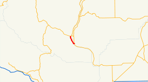
State Route 285 (SR 285) is a 5.04-mile (8.11 km) state highway serving Douglas and Chelan counties, located in the U.S. state of Washington. The highway serves Wenatchee and begins at an interchange with State Route 28 (SR 28) in East Wenatchee, crosses the Columbia River on the Senator George Sellar Bridge into Downtown Wenatchee and continues north to end at an interchange with U.S. Route 2 (US 2) and US 97 north of the Wenatchee River in Sunnyslope.
The highway originally crossed the Columbia River on an earlier bridge built in 1908. The bridge was signed as part of State Road 7 in 1909 and later State Road 2 (the Sunset Highway) in 1923. The roadway was used by US 10 from 1926 until 1940, when it was re-routed and replaced by an alternate route. US 2 was extended from Idaho into Washington in 1946 and used the bridge until the newer Senator George Sellar Bridge was built to the south in 1950. SR 285 was designated in 1977 after US 2 was routed onto the Richard Odabashian Bridge north of Wenatchee and East Wenatchee. The area around the Senator George Sellar Bridge is being improved by the Washington State Department of Transportation to handle increased traffic.
Route description
SR 285 begins its 5.04-mile-long (8.11 km) long route at a partial cloverleaf interchange with SR 28 west of the Wenatchee Valley Mall in East Wenatchee.[1][3] The freeway crosses the Columbia River from Douglas County into Wenatchee and Chelan County on the Senator George Sellar Bridge, listed as a part of the National Register of Historic Places.[4][5] The highway becomes Stevens Street and has a small interchange with Wenatchee Avenue before turning north onto Mission Street.[6]
SR 285 serves Downtown Wenatchee and splits into a one-way pair with southbound lanes on Chelan Avenue and northbound lanes staying on Mission Street,[7] passing the Wenatchee branch of the North Central Regional Library at Memorial Park and the Wenatchee Valley Hospital.[8][9] The one-way pair rejoins the main route,[7] turning north as Miller Street and then northwest as Wenatchee Avenue into West Wenatchee near Wenatchee Confluence State Park.[10] Wenatchee Avenue crosses the Wenatchee River into Sunnyslope and becomes a freeway, intersecting Penny Road and Easy Street in an incomplete diamond interchange before ending at an interchange with US 2 and US 97.[11][12]
The Senator George Sellar Bridge is the busiest section of SR 285, being used by a daily average of 52,000 vehicles in 2011. The southern end of the one-way pair, at the intersection of Chelan Avenue and Mission Street, had a daily average of 22,000 vehicles in 2011.[13]
History
The cantilever truss Columbia River Bridge was built in 1908 by the Washington Bridge Company and purchased by the Washington State Highway Commission the following year to serve Wenatchee and East Wenatchee, divided by the Columbia River.[14][15][16] The bridge and the streets were signed as State Road 7 in 1909 as part of the highway from Renton to Idaho,[17][18] later named the Sunset Highway in 1913.[19] The Sunset Highway became State Road 2 in a 1923 renumbering before the creation of US 10 in 1926.[20][21]
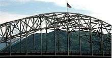
State Road 2 became Primary State Highway 2 (PSH 2) in 1937 during the creation of the primary and secondary state highway system.[22] US 10 was re-routed south to cross the Columbia River at Vantage in the 1940s and was designated as US 10 Alternate,[23] until US 2 was extended from Bonners Ferry, Idaho to Everett in 1946.[24][25][26] The Columbia River Bridge was replaced by the newly built Senator George Sellar Bridge in 1950 and US 2 was re-routed south onto the bridge.[5][27][28] PSH 2 was decommissioned during the 1964 renumbering and US 2 remained.[29][30] US 2 was re-routed, along with US 97, onto the Richard Odabashian Bridge in Sunnyslope, bypassing Wenatchee in 1975.[31] SR 285 was established in 1977 to maintain the Senator George Sellar Bridge and only included the short route until 1991,[32] when it was extended to Sunnyslope.[2][33]
Since 1991, no major revisions to the highway have occurred,[34] however the Washington State Department of Transportation (WSDOT) has been improving the roadway around the Senator George Sellar Bridge.[35] Between May 2009 and July 2011, WSDOT added an additional eastbound lane by moving the sidewalks to a new structure on the outside of the bridge,[36] opening on July 29, 2011.[37] A southbound bypass lane for SR 28 is currently being constructed under the east end of the bridge, expected to be completed in spring 2013.[38][39] At the west end of the bridge, in Downtown Wenatchee, a new off-ramp to Crescent Street and signal improvements at Mission Street are being constructed and are scheduled to be finished by fall 2013.[40][41][42]
Major intersections
| County | Location | mi[1] | km | Destinations | Notes |
|---|---|---|---|---|---|
| Douglas | East Wenatchee | 0.00 | 0.00 | Southern terminus | |
| Columbia River | 0.16– 0.39 | 0.26– 0.63 | Senator George Sellar Bridge | ||
| Chelan | Wenatchee | 0.39– 0.47 | 0.63– 0.76 | Wenatchee Avenue – Business Center, Convention Center | Interchange, northbound exit and southbound entrance |
| 1.11 | 1.79 | Chelan Avenue | Southern terminus of one-way pair | ||
| 2.86 | 4.60 | Miller Street | Northern terminus of one-way pair | ||
| Sunnyslope | South end of freeway | ||||
| 4.48– 4.58 | 7.21– 7.37 | Easy Street, Penny Road | Northbound exit and southbound entrance | ||
| 4.93– 5.04 | 7.93– 8.11 | Northern terminus | |||
| 1.000 mi = 1.609 km; 1.000 km = 0.621 mi | |||||
References
- 1 2 3 Staff (2012), State Highway Log: Planning Report 2011, SR 2 to SR 971 (PDF), Washington State Department of Transportation, pp. 1321–1326, retrieved January 10, 2013
- 1 2 "47.17.517: State route No. 285", Revised Code of Washington, Washington State Legislature, 1977, retrieved January 10, 2013
- ↑ SR 28 - Junction SR 285/SR 28 CO WENTCH (PDF), Washington State Department of Transportation, January 12, 2011, retrieved January 11, 2013
- ↑ National Register of Historic Places: Weekly List of Actions - June 16, 1995 (PDF), United States Department of the Interior, National Park Service, June 16, 1995, p. 36, retrieved January 11, 2013
- 1 2 Krier, Robert H.; Barber, J. Byron; Bruce, Robin; Holstine, Craig (December 12, 1991), National Register of Historic Places - Registration Form: Columbia River Bridge at Wenatchee (PDF), United States Department of the Interior, National Park Service, retrieved January 11, 2013
- ↑ SR 285 - Junction Wenatchee Avenue (PDF), Washington State Department of Transportation, February 11, 2003, retrieved January 11, 2013
- 1 2 SR 285 - Junction SR 285 CO WENTCH (PDF), Washington State Department of Transportation, October 1, 2004, retrieved January 11, 2013
- ↑ Wenatchee Public Library, North Central Regional Library, 2008, retrieved January 11, 2013
- ↑ Wenatchee Valley Hospital, Wenatchee Valley Medical Center, 2008, retrieved January 11, 2013
- ↑ Complete Information for Wenatchee Confluence, Washington State Parks and Recreation Commission, 2013, retrieved January 11, 2013
- ↑ US 2/97 - Junction SR 285 (PDF), Washington State Department of Transportation, April 3, 2013, retrieved January 11, 2013
- ↑ Google (January 11, 2013). "State Route 285" (Map). Google Maps. Google. Retrieved January 11, 2013.
- ↑ Staff (2011), 2011 Annual Traffic Report (PDF), Washington State Department of Transportation, pp. 167, 230, retrieved January 11, 2013
- ↑ Soderberg, Lisa (June 1980), HAER Inventory: Bridges, Trestles, and Aqueducts - Columbia River Bridge (PDF), Historic American Engineering Record, retrieved January 11, 2013
- ↑ National Register of Historic Places; Annual Listing of Historic Properties (PDF), United States Department of the Interior, National Park Service, March 1, 1983, p. 44, retrieved January 11, 2013
- ↑ Topography of the State of Washington: Wenatchee Quadrangle (JPG) (Map). 1:62,500. United States Geological Survey. October 1915. Retrieved January 11, 2013.
- ↑ Washington State Legislature (March 13, 1909), "Chapter 51: Providing for the Survey of Certain State Roads", Session Laws of the State of Washington, Session Laws of the State of Washington (1909 ed.), Olympia, Washington: Washington State Legislature, p. 95, retrieved January 11, 2013,
1st. Extension over the most feasible route of State Road No. 7 westerly through the town of Renton and along the shore of Lake Washington to the city of Seattle and easterly to the city of Spokane.
- ↑ State of Washington Highway Map (DJVU) (Map). Department of Highways. April 1, 1933. Retrieved January 11, 2013.
- ↑ Washington State Legislature (March 17, 1913), "Chapter 65: Classifying Public Highways", Session Laws of the State of Washington, Session Laws of the State of Washington (1913 ed.), Olympia, Washington: Washington State Legislature, p. 221, retrieved January 11, 2013,
b. A highway starting from the Pacific Highway at Renton, Washington; thence over the most feasible route by the way of Snoqualmie Pass into the Yakima River Valley; thence by way of Wenatchee, over the most feasible route, through Waterville and Spokane, to the state boundary, which shall be known as the Sunset Highway.
- ↑ Washington State Legislature (March 19, 1923), "Chapter 185: Primary and Secondary State Highways", Session Laws of the State of Washington, Session Laws of the State of Washington (1923 ed.), Olympia, Washington: Washington State Legislature, p. 628, retrieved January 11, 2013,
SEC. 2. A primary state highway, to be known as State Road No. 2 or the Sunset Highway, is established as follows: Beginning at the City of Seattle; thence by the most feasible route in a easterly direction through the cities of Renton, North Bend, Cle Elum, Wenatchee, Waterville, Davenport and Spokane to the Washington-Idaho state line.
- ↑ Bureau of Public Roads & American Association of State Highway Officials (November 11, 1926). United States System of Highways Adopted for Uniform Marking by the American Association of State Highway Officials (Map). 1:7,000,000. Washington, DC: U.S. Geological Survey. OCLC 32889555. Retrieved November 7, 2013 – via University of North Texas Libraries.
- ↑ Washington State Legislature (March 17, 1937), "Chapter 190: Establishment of Primary State Highways", Session Laws of the State of Washington, Session Laws of the State of Washington (1937 ed.), Olympia, Washington: Washington State Legislature, p. 934, retrieved January 11, 2013,
SEC. 2. A primary state highway to be known as Primary State Highway No. 2, or the Sunset Highway, is hereby established according to description as follows: Beginning at Seattle in King county, thence in an easterly direction by the most feasible route by way of Renton, Snoqualmie Pass, Cle Elum, Blewett Pass, Wenatchee, Waterville, Wilbur, Davenport and Spokane to the Washington-Idaho boundary line; also beginning at Seattle in King county, thence in an easterly direction by the most feasible route to the north of Lake Washington to a junction with Primary State Highway No. 2, as herein described, in the vicinity west of Snoqualmie Pass; also beginning at Almira, on Primary State Highway No. 2, as herein described, thence in a northerly direction by the most feasible route to the Grand Coulee Dam.
- ↑ Northwest, 1946 (Map). Rand McNally. 1946. Retrieved January 11, 2013.
- ↑ Weingroff, Richard (April 7, 2011), U.S. 2: Houlton, Maine, to Everett, Washington, Federal Highway Administration, retrieved January 11, 2013
- ↑ Rand McNally Road Map of the United States (Map). 1:7,500,000. Rand McNally. 1947. Retrieved January 11, 2013.
- ↑ Wenatchee, 1948 (JPG) (Map). 1:250,000. United States Geological Survey. 1948. Retrieved January 11, 2013.
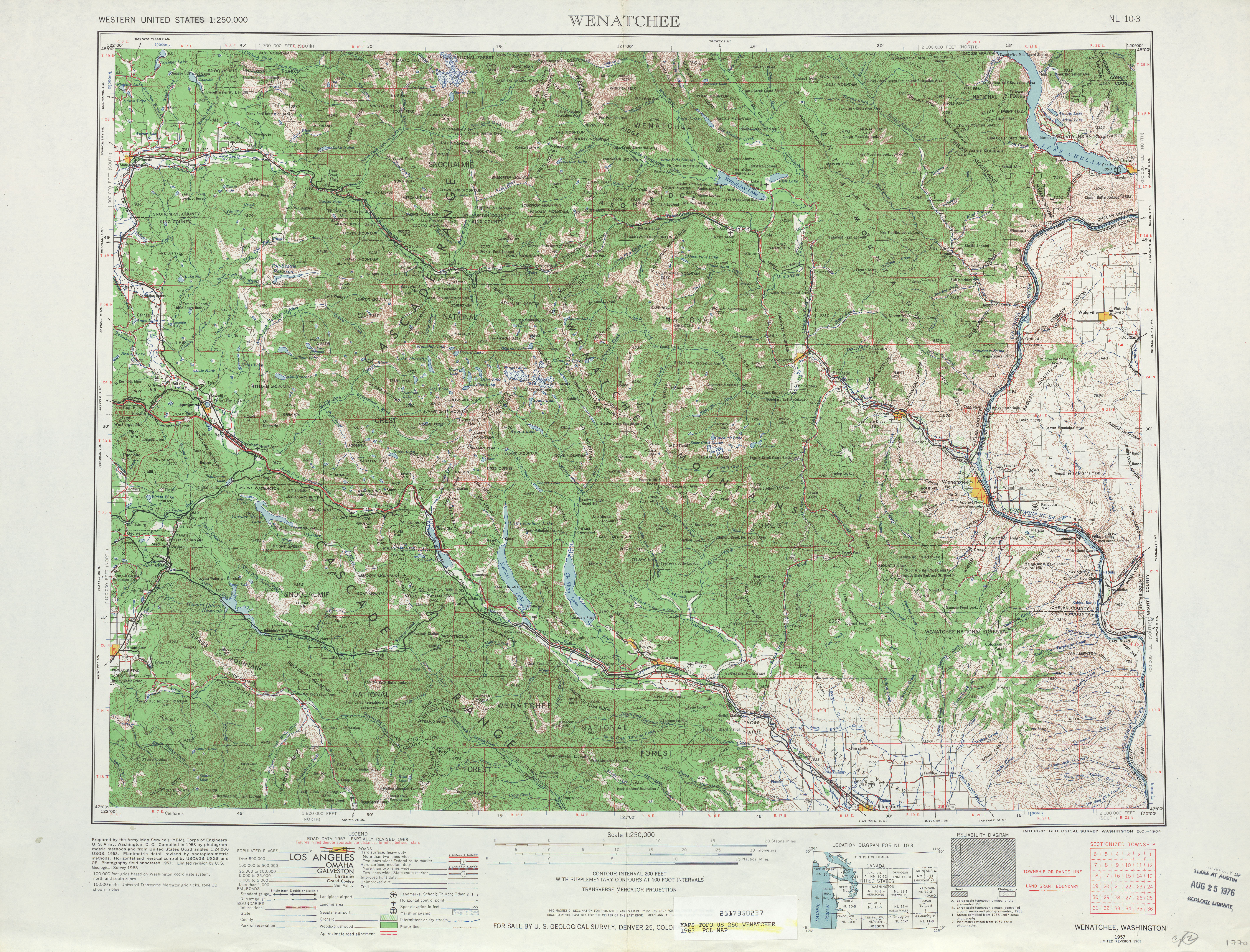
- ↑ Wenatchee, 1963 (JPG) (Map). 1:250,000. United States Geological Survey. 1963. Retrieved January 11, 2013.
- ↑ Northwest, 1967 (Map). Rand McNally. 1967. Retrieved January 11, 2013.
- ↑ Prahl, C. G. (December 1, 1965), Identification of State Highways (PDF), Washington State Highway Commission, Department of Highways, retrieved January 11, 2013
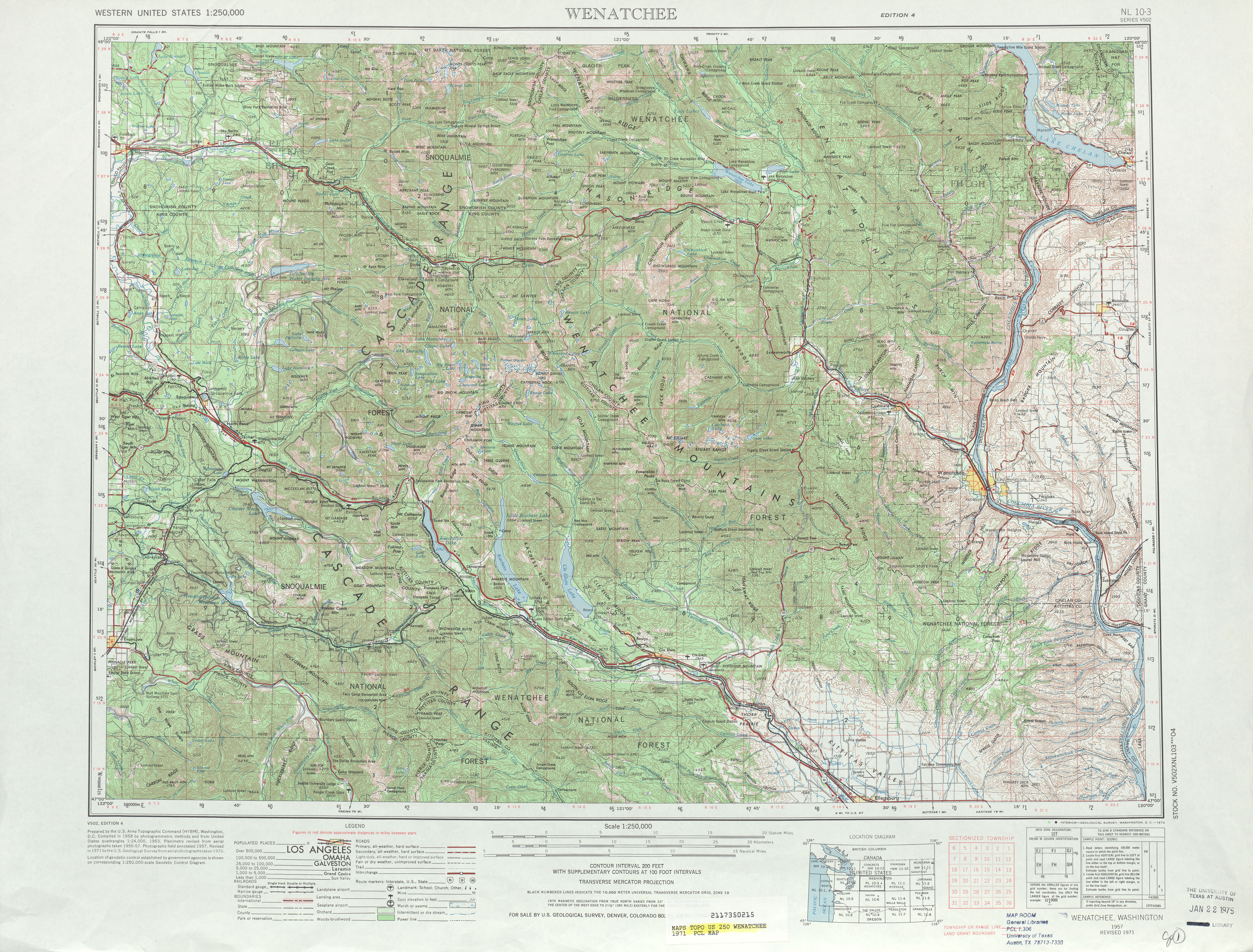
- ↑ Wenatchee, 1971 (JPG) (Map). 1:250,000. United States Geological Survey. 1971. Retrieved January 11, 2013.
- ↑ Staff (1970), 1970 Annual Traffic Report (PDF), Washington State Department of Transportation, pp. 31–32, retrieved January 11, 2013
- ↑ Staff (1990), 1990 Annual Traffic Report (PDF), Washington State Department of Transportation, p. 112, retrieved January 11, 2013
- ↑ Washington House of Representatives (1991), Chapter 342, Laws of 1991: State Highway Routes — Revisons To (House Bill 5801)", Session Laws of the State of Washington (1991 ed.), Olympia, Washington: Washington State Legislature
- ↑ Washington State Highways, 2011–2012 (PDF) (Map). 1:842,000. Washington State Department of Transportation. 2011. Retrieved January 11, 2013.
- ↑ Senator George Sellar Bridge Area Projects (PDF), Washington State Department of Transportation, August 2011, retrieved January 11, 2013
- ↑ SR 285 - George Sellar Bridge - Additional EB Lane - Complete July 2011, Washington State Department of Transportation, July 29, 2011, retrieved January 11, 2013
- ↑ Irwin, Mike (July 29, 2011), "New bridge walk puts pedestrians high above the flow", The Wenatchee World, retrieved January 11, 2013
- ↑ SR 28 - E End of the George Sellar Bridge, Washington State Department of Transportation, 2012, retrieved January 11, 2013
- ↑ Pratt, Christine (August 24, 2012), "Sellar Bridge work taking shape", The Wenatchee World, retrieved January 11, 2013
- ↑ SR 285 - W End George Sellar Bridge - Intersection Improvement, Washington State Department of Transportation, 2012, retrieved January 11, 2013
- ↑ Adamson, Jeff; Romine, Bob (July 20, 2012), The last of 3 projects to improve Wenatchee’s SR 285 Senator George Sellar Bridge begins next week., Washington State Department of Transportation, retrieved January 11, 2013
- ↑ Pratt, Christine (July 23, 2012), "Sellar Bridge work enters home stretch", The Wenatchee World, retrieved January 11, 2013