Bannered routes of U.S. Route 220
| |
|---|---|
| Highway system | |

Several bannered routes of U.S. Route 220 exist. In order from south to north they are as follows.
Existing
Candor–Seagrove alternate route
| |
|---|---|
| Location: | Candor–Seagrove, North Carolina |
| Length: | 27.5 mi[1] (44.3 km) |
| Existed: | 1979–present |
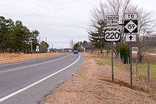
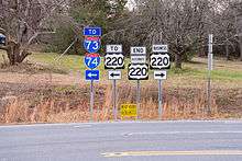
U.S. Route 220 Alternate (US 220 Alt), established in 1979, is an 27.5-mile (44.3 km) route that follows the old US 220 route through Candor, Biscoe and Star.[2] In 1997, it was extended further north through Seagrove to its current terminus near Ulah. In 2008, the US 220 Alt was temporary extended south 7.9-mile (12.7 km) to NC 73, while mainline US 220 was on new freeway filling in for Future I-73/I-74; In 2013, mainline US 220 was moved back on that section. Predominantly a two-lane rural highway, it begins at exit 41 interchange from I-73/I-74/US 220 and ends at US 220 Bus, just 200 feet (61 m) from exit 68.
| County | Location | mi[1] | km | Destinations | Notes |
|---|---|---|---|---|---|
| Montgomery | Emery | 0.0 | 0.0 | ||
| Candor | 1.8 | 2.9 | West end of NC 731 overlap | ||
| 23.1 | 37.2 | East end of NC 731 overlap | |||
| Biscoe | 8.2 | 13.2 | |||
| Star | 11.7 | 18.8 | Spies Road | ||
| Ether | 14.9 | 24.0 | |||
| | 17.5 | 28.2 | Black Ankle Road | ||
| Randolph | Seagrove | 21.2 | 34.1 | ||
| | 25.6 | 41.2 | New Hope Church Road | ||
| | 26.5 | 42.6 | |||
| | 27.5 | 44.3 | |||
1.000 mi = 1.609 km; 1.000 km = 0.621 mi
| |||||
Asheboro business loop
| |
|---|---|
| Location: | Ulah–Level Cross, North Carolina |
| Length: | 20.2 mi[3] (32.5 km) |
| Existed: | 1966–present |
U.S. Route 220 Business (US 220 Bus) was established in 1966 when mainline US 220 was rerouted onto new freeway bypass from south of Ulah to Vision Drive, in Asheboro. In 1972, US 220 Bus replaced some of the mainline along Vision Drive as new freeway was built further north towards US 311.[4] In 1974, US 220 Bus was removed from Vision Drive and continued north along the old mainline route, through Randleman, to Level Cross. In 1982, US 220 Bus was adjusted at Level Cross, replacing some of the mainline to its current terminus with US 220 interchange.[5] US 220 Bus is two-lane along its routing outside Asheboro and three to four-lane in Asheboro. The entire route is in Randolph County.
| Location | mi[3] | km | Destinations | Notes | |
|---|---|---|---|---|---|
| | 0.0 | 0.0 | US 220 Alt is 200 feet (61 m) north of interchange NC 134 is 600 feet (180 m) south of interchange | ||
| Asheboro | 3.5 | 5.6 | McDowell Road | ||
| 4.8 | 7.7 | East and westbound via connector roads | |||
| 6.2 | 10.0 | ||||
| 6.7 | 10.8 | Presnell Street | |||
| 8.2 | 13.2 | ||||
| 9.4 | 15.1 | Spero Road | |||
| 10.7 | 17.2 | Pineview Street | |||
| Randleman | 12.5 | 20.1 | |||
| 14.0 | 22.5 | Academy Street | |||
| Level Cross | 20.2 | 32.5 | |||
| 1.000 mi = 1.609 km; 1.000 km = 0.621 mi | |||||
Madison–Mayodan business loop
| |
|---|---|
| Location: | Madison–Mayodan, North Carolina |
| Length: | 7.1 mi[6] (11.4 km) |
| Existed: | 1963–present |
Ridgeway business loop
| |
|---|---|
| Location: | Ridgeway, Virginia |
| Length: | 1.7 mi[7] (2.7 km) |
Martinsville business loop
| |
|---|---|
| Location: | Martinsville, Virginia |
| Length: | 10.5 mi[8] (16.9 km) |
Rocky Mount business loop
| |
|---|---|
| Location: | Rocky Mount, Virginia |
| Length: | 5.4 mi[9] (8.7 km) |
U.S. Route 220 Business begins at an interchange two miles south of Rocky Mount as South Main Street. The street continues north through residential neighborhoods as it passes Franklin Memorial Hospital and the Franklin County Courthouse in downtown Rocky Mount. The route continues north as Main Street and intersects with Virginia State Route 40 (Franklin St and Pell Avenue). The street becomes North Main Street as it continues north through town. North Main St intersects with State Route 919 just before the final interchange with US 220.
Roanoke alternate route
| |
|---|---|
| Location: | Roanoke, Virginia |
| Length: | 11.0 mi[10] (17.7 km) |
U.S. Route 220 Alternate is a 11.0-mile (17.7 km) route that appeared in 1979 as a concurrency with US 460/US 221 from the junction of I-581/US 220 (Exit 7) in downtown Roanoke and then north on the route of former secondary State Route 604 from Bonsack in Roanoke County to just north of Cloverdale in Botetourt County.[10] There, its terminus is at an interchange of I-81, US 220 and US 11 (Exit 150).
In the 1930s and 40s, the Bonsack to Cloverdale route was part of VA 114 until it was downgraded to SR 604 in April 1944.[11] In the 1990s, the section from Bonsack to Cloverdale was widened to four lanes and it serves as a bypass for US 460 seeking to avoid Roanoke traffic congestion.
Previously, the Rocky Mount bypass was designated as US 220 Alternate from its construction in 1960-61 until it was changed to US 220 Bypass between 1968-70.[10]
Clifton Forge business loop
| |
|---|---|
| Location: | Clifton Forge, Virginia |
| Length: | 3.3 mi[12] (5.3 km) |
Maryland truck route
| |
|---|---|
| Location: | La Vale – Cresaptown, Maryland |
| Length: | 3.26 mi[13] (5.25 km) |
U.S. Route 220 Truck is a southbound-only truck route used to bypass the exit ramp from eastbound I-68 to southbound US 220 at Interchange 42, which carries a truck and bus prohibition due to the steep grade.[14] The restricted traffic exits eastbound I-68 at Interchange 40 and follows US 220 Truck, which follows MD 658 (Vocke Road) and then MD 53 south to US 220 in Cresaptown.
Bedford business route
| |
|---|---|
| Location: | Bedford, Pennsylvania |
| Existed: | 1973–present |
U.S. Route 220 Business is a 12-mile (19 km) route following the original alignment of its parent. In 1973, US 220 became a freeway between Bedford and Altoona, Pennsylvania, and the old tract of the route near Bedford became a business loop. Currently, US 220 has been partnered with Interstate 99; however, the freeway segment south of the Pennsylvania Turnpike is currently not yet part of the interstate system, which may or may not affect the future status of this road. South of the borough, the route winds over the hilly approach to the town at much steeper grades than does the freeway. It ten reaches several stoplights as it serves as a north-south main street. After exciting the municipality, it briefly becomes four lanes as it accommodates a variety of travel services at the interchanges with the Turnpike and I-99. Travelling north, the route flattens out, before meeting US 220 at I-99 Exit 3.
Blair County business route
| |
|---|---|
| Location: | Blair County, Pennsylvania |
| Existed: | 1996–present |
U.S. Route 220 Business is a 37-mile (60 km) route following the original alignment of its parent. The route begins at Exit 13 of Interstate 99, in the southernmost point of Blair County, Pennsylvania. After travelling over a largely rural two-lane segment, it briefly becomes four lanes as it enters metropolitan Altoona; the highway then spends nearly a mile co-signed with two-lane U.S. Route 22. Afterward, it becomes Plank Road between Hollidaysburg and Altoona, feature four-lanes, a center turning lane, and a copious commercial development. Eventually the route becomes the more suburban Pleasant Valley Boulevard, and it transitions to a two-laner before leaving the urban area. A cosign with Pennsylvania Route 764 occurs, as the route travels toward Tyrone, through which it serves as a narrow main street. After heading through several more small towns, the route rejoins I-99 at Exit 52.
Centre County alternate route
| |
|---|---|
| Location: | Centre County, Pennsylvania |
| Existed: | 2002–present |
U.S. Route 220 Alternate is a 19-mile (31 km) route following the original alignment of its parent. As part of the ongoing completion of Interstate 99, U.S. 220 was shifted on to the Mount Nittany Expressway around State College, Pennsylvania. This portion received an alternate instead of a business designation because it deviates from the route's current course. The route begins in Huston Township, and is multiplexed consecutively with Pennsylvania Route 504, Pennsylvania Route 144, Pennsylvania Route 150, and Interstate 80 in its final 6 miles (9.7 km).
Williamsport truck route
| |
|---|---|
| Location: | Williamsport, Pennsylvania |
| Existed: | 2013–present |
U.S. Route 220 Truck is a truck route established to help trucks from US 220 south access US 220 north and trucks from US 220 north access US 220 south. The route was signed in 2013 and is located in Williamsport, Pennsylvania.
Former
Ellerbe business loop
| |
|---|---|
| Location: | Ellerbe, North Carolina |
| Length: | 8.1 mi[15] (13.0 km) |
| Existed: | 2008–2013 |
U.S. Route 220 Business (US 220 Bus) was established in 2008 as a temporary route, while mainline US 220 was on new freeway filling in for Future I-73/I-74. At or near NC 73, it would continue north as US 220 Alt. In 2013, mainline US 220 was moved back onto its original route through Ellerbe, deleting the business loop.
Rocky Mount alternate route
| |
|---|---|
| Location: | Rocky Mount, Virginia |
| Existed: | 1959–1970 |
Established around 1959-1961 as new construction bypassing Rocky Mount. By 1970, it was converted into mainline US 220.[16][17]
References
- 1 2 Google (January 1, 2014). "US 220 Alternate - Candor-Seagrove" (Map). Google Maps. Google. Retrieved January 1, 2014.
- ↑ "US 220 Route Change (1976-11-01)" (PDF). North Carolina Department of Transportation. November 1, 1976. Retrieved January 2, 2014.
- 1 2 Google (August 29, 2012). "US 220 Bus - Asheboro" (Map). Google Maps. Google. Retrieved August 29, 2012.
- ↑ "US 220 Route Change (1972-11-02)" (PDF). North Carolina Department of Transportation. November 2, 1972. Retrieved January 3, 2014.
- ↑ "US 220 Route Change (1982-03-01)" (PDF). North Carolina Department of Transportation. March 1, 1982. Retrieved January 3, 2014.
- ↑ Google (August 29, 2012). "US 220 Bus - Madison-Mayodan" (Map). Google Maps. Google. Retrieved August 29, 2012.
- ↑ Google (February 24, 2013). "US 220 Business - Ridgeway, Virginia" (Map). Google Maps. Google. Retrieved February 24, 2013.
- ↑ Google (August 29, 2012). "US 220 Bus - Martinsville" (Map). Google Maps. Google. Retrieved August 29, 2012.
- ↑ Google (August 29, 2012). "US 220 Bus - Rocky Mount" (Map). Google Maps. Google. Retrieved August 29, 2012.
- 1 2 3 US 220 Alternate. Virginia Highway Index. Retrieved 25 October 2012.
- ↑ VA 114. Virginia Highway Index. Retrieved 25 October 2012.
- ↑ Google (February 24, 2013). "US 220 Business - Clifton Forge, Virginia" (Map). Google Maps. Google. Retrieved February 24, 2013.
- ↑ "Highway Location Reference: Allegany County" (PDF). Maryland State Highway Administration. 2009. Retrieved 2010-11-02.
- ↑ "Maryland Route Restrictions" (PDF). Maryland State Highway Administration. 2010-02-04. Retrieved 2010-03-09.
- ↑ Google (January 3, 2014). "US 220 Business - Ellerbe, North Carolina" (Map). Google Maps. Google. Retrieved January 3, 2014.
- ↑ "U.S. Highways: Alternate U.S. Routes - US 41 to US 611". Retrieved August 29, 2012.
- ↑ "Mapmikey's Virginia Highways Page: US 220". Retrieved August 29, 2012.
External links
 Media related to U.S. Route 220 at Wikimedia Commons