U.S. Route 12 in Michigan
| |||||||||||||
|---|---|---|---|---|---|---|---|---|---|---|---|---|---|
|
US 12 highlighted in red | |||||||||||||
| Route information | |||||||||||||
| Maintained by MDOT | |||||||||||||
| Length: | 210.077 mi[1] (338.086 km) | ||||||||||||
| Existed: | November 11, 1926[2] – present | ||||||||||||
| Tourist routes: |
| ||||||||||||
| Major junctions | |||||||||||||
| West end: |
| ||||||||||||
| East end: | Michigan Avenue and Cass Avenue in Detroit | ||||||||||||
| Location | |||||||||||||
| Counties: | Berrien, Cass, St. Joseph, Branch, Hillsdale, Lenawee, Washtenaw, Wayne | ||||||||||||
| Highway system | |||||||||||||
| |||||||||||||

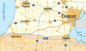
US Highway 12 (US 12) is an east–west US Highway that runs from Aberdeen, Washington, to Detroit, Michigan. In Michigan it runs for 210 miles (338 km) between New Buffalo and Detroit as a state trunkline highway and Pure Michigan Byway. On its western end, the highway is mostly a two-lane road that runs through the southern tier of counties roughly parallel to the Indiana state line. It forms part of the Niles Bypass, a four-lane expressway south of Niles in the southwestern part of the state, and it runs concurrently with the Interstate 94 (I-94) freeway around the south side of Ypsilanti in the southeastern. In between Coldwater and the Ann Arbor area, the highway angles northeasterly and passes the Michigan International Speedway. East of Ypsilanti, US 12 follows a divided highway routing on Michigan Avenue into Detroit, where it terminates at an intersection with Cass Avenue.
When US 12 was designated in Michigan on November 11, 1926, along with the other original US Highways, it ran along a more northerly course. It originally replaced sections of the original M-11 and M-17 along Michigan Avenue in the state, the route of the much older St. Joseph Trail, a footpath used by Native Americans before European settlement in the area. It entered from Indiana as it does now, but it followed the Lake Michigan shoreline farther north to Benton Harbor–St. Joseph before turning eastward to run through Kalamazoo, Battle Creek and Jackson. In the Ann Arbor area, it followed a more northerly path into Detroit before terminating downtown. In the 1940s and 1950s, sections of the highway were converted into expressways and freeways. Starting in 1959, these freeway segments were renumbered as part of I-94, and in January 1962, US 12 was shifted to replace US Highway 112 (US 112). That highway, when it was designated in 1926 replaced the original M-23 along the Chicago Road. Later, US 112 replaced the first M-151 when the former was extended to New Buffalo in the mid-1930s. Since 1962, the highway has remained relatively unchanged aside from minor truncations in the city of Detroit. US 112 previously had two business loops, both of which were renumbered Business US 12 (Bus. US 12) in 1962. In 2010, the Niles business loop was decommissioned, but the one in Ypsilanti remains. One section of the former US 112 was renumbered US 112S for a few years in the 1930s.
Route description
Between the state line near Michiana and the interchange with I-94 near New Buffalo, US 12 forms a portion of the Lake Michigan Circle Tour (LMCT). The full length of the highway in the state is also a Pure Michigan Historic Byway.[3] Outside of the various cities, most of US 12 is a rural, two-lane state highway. One section runs concurrently with I-94 south of Ypsilanti. From there eastward, the US 12 is a divided highway and then a boulevard into the Detroit area.[4] The entire length of the highway east of Coldwater is listed on the National Highway System,[5] a network of roads important to the US's economy, defense, and mobility.[6]
Southwest Michigan
US 12 enters the state of Michigan southwest of New Buffalo near the town of Michiana. The highway runs a bit inland and parallel to the Lake Michigan shore on Red Arrow Highway past the community of Grand Beach before turning eastward away from the lake on the north side of New Buffalo. US 12 intersects I-94 less than a mile east of this turn and continues due east along Pulaski Highway through rural farmland. The highway is the main east–west street as it crosses through Three Oaks in southern Berrien County. East of Galien, the highway dips southward around Dayton Lake before passing south of Buchanan. The highway continues eastward, intersecting US 31 (St. Joseph Valley Parkway) near Niles. East of that freeway, US 12 expands into an expressway as the Niles Bypass. This bypass intersects M-139, crosses the St. Joseph River and intersects M-51 on the south side of Niles. US 12 turns northeasterly along the bypass east of downtown and then departs to the southeast at an interchange with Main Street and M-60 just across the county line with Cass County.[3][4]
Continuing through southern Cass County, US 12 runs roughly parallel to the state line. It turns northeasterly to run into Edwardsburg, where it intersects M-62. The highway turns southeasterly and runs to the south of Eagle Lake before entering the community of Adamsville. The highway continues on this southeasterly course until it intersects the former M-205 and M-217 (Michiana Parkway) near Union and turns to the northeast. US 12 intersects the southern end of M-40 before crossing into St. Joseph County at the eastern crossing of the St. Joseph River.[3][4]
On the eastern side of the river, US 12 enters Mottville and intersects M-103. The highway continues as Chicago Road through farmland and intersects US 131 near White Pigeon. It runs along the south side of Klinger Lake and continues to a junction with M-66 in Sturgis; the two highways run concurrently for about eight blocks through town. East of Sturgis, US 12 turns northeasterly into Branch County. Still named Chicago Road, it passes through Bronson and Batavia. Northeast of Batavia, US 12 intersects the eastern end of M-86 near Branch County Memorial Airport. The airport is on the western edge of Coldwater, and after crossing the Coldwater River between Cemetery and South lakes, the highway runs through residential neighborhoods and into downtown. East of Division Street, Business Loop I-69 (BL I-69) follows US 12 through downtown and out to an interchange with I-69 on the east side of Coldwater. The highway continues past retail businesses and parallel to the Sauk River. US 12 passes through the town of Quincy before crossing into Hillsdale County.[3][4]
Southeast Michigan
East of Hillsdale County line, US 12 runs easterly into Allen, where it intersects M-49. The highway continues northeastward through farmland to Jonesville, where it runs concurrently with M-99 through downtown and across a different St. Joseph River. The trunkline continues northeasterly through northern Hillsdale County, crossing the South Branch of the Kalamazoo River in Moscow. US 12 runs along the south side of Lake LeAnn in Somerset Center in the northeastern corner of the county. East of Somerset, the highway crosses into northern Lenawee County.[3][4]
Immediately east of the Lenawee County line, US 12 intersects US 127 in the Irish Hills region. South of Brooklyn in Cambridge Junction, it passes the Michigan International Speedway and crosses the River Raisin next to a junction with M-50. East of the racetrack, the highway meanders through an area dotted by several smaller lakes until it intersects M-124 at Walter J. Hayes State Park. Continuing as Michigan Avenue, US 12 angles northeasterly from the park until it hits the Lenawee–Washtenaw county line. The highway follows the line for several miles before reentering Lenawee County. It continues through an intersection with M-52 and into Clinton before turning northeasterly and fully crossing into Washtenaw County.[3][4]
In Washtenaw County, US 12 passes through Benton in a rural southern section of the county.[3] At Saline, the highway enters the suburban edge of the Ann Arbor–Ypsilanti metro area. US 12 follows Michigan Avenue northeasterly through Saline and across an interchange with US 23 before intersecting I-94 in Pittsfield and Ypsilanti townships. US 12 leaves Michigan Avenue to follow I-94 at that freeway's exit 181; Michigan Avenue continues into downtown Ypsilanti as a city street. I-94/US 12 skirts around the south side of the city and intersects the western end of Business US 12 (Bus. US 12) at Huron Street south of downtown. The freeway continues around the south side of the city and rounds the north end of Ford Lake. It is bounded by residential neighborhoods, and it crosses the Huron River on the eastern side of Ypsilanti. Near the Willow Run industrial complex and airport, US 12 separates from I-94 and turns northeasterly along an expressway on the north side of the airport. There are three interchanges, including one for the eastern end of M-17 before US 12 crosses into Wayne County and intersects the eastern end of Bus. US 12.[4][7]
East into Detroit
Once US 12 intersects the eastern end of its business loop, it returns to Michigan Avenue for the remainder of its routing in the state. The roadway is a boulevard in this area, a street divided by a central median. It runs through Canton Township and parallel to the Lower River Rouge. US 12 intersects I-275 on the eastern side of the township before crossing into Wayne. The highway is bounded by a mix of industrial and commercial properties in suburban Metro Detroit. In downtown Wayne, the two sides of Michigan Avenue split apart, surrounding the central business district of the city and separated by two to three city blocks. East of this split, Michigan Avenue crosses a section of Westland before entering Inkster.[4][7]
In Dearborn, US 12 intersects US 24 (Telegraph Road) at an interchange on the western side of the city, and M-39 (Southfield Freeway) on the eastern side near the River Rouge crossing and Greenfield Village. On the Dearborn–Detroit city border, US 12 pass through a complex interchange with I-94 (Edsel Ford Freeway) and M-153 (Ford Road/Wyoming Avenue). Michigan Avenue continues northeasterly parallel to I-94 for a short distance before it turns due east.[4][7] Once it makes the direction change, it forms the 0 Mile of Detroit's Mile Road System.[8] US 12 continues through residential areas on Detroit's West Side, passing through the interchange that connects I-75 with I-96's eastern terminus near the Ambassador Bridge. The highway runs through Corktown, Detroit and beside the site of the former Tiger Stadium at the corner of Michigan and Trumbull. East of the former stadium, US 12 crosses M-10 (Lodge Freeway) near the MGM Grand Detroit casino. East of M-10, Michigan Avenue enters Downtown Detroit. At the corner of Michigan and Cass, US 12 ends while Michigan Avenue continues several blocks further to terminate at Campus Martius Park at Woodward Avenue.[4][7]
History
Before 1926
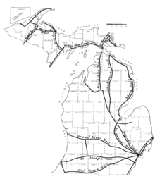
The first major overland transportation corridors in the future state of Michigan were the Indian trails.[9] Two of these trails are relevant to US 12. The St. Joseph Trail ran between the Benton Harbor–St. Joseph area and Detroit by way of what is now Kalamazoo, Battle Creek, Jackson and Ann Arbor. The second, the Sauk Trail, ran further south through what is now Niles, and Coldwater to the Ann Arbor area.[10]
The Town of Detroit[lower-alpha 1] created 120-foot-wide (37 m) rights-of-way for the principal streets of the city in 1805, including Michigan Avenue.[12] This street plan was devised by Augustus Woodward and others following a devastating fire in Detroit,[13] with a mandate from the territorial governor to improve on the previous plan.[14] The wide width of the avenues was an emulation of the street plan for Washington, DC, and intended to make Detroit the "Paris of the West".[15]
The southern of these two Indian trails later became the Chicago Road. Father Gabriel Richard, the first priest to serve in the U.S. House of Representatives, petitioned Congress to fund a highway between Detroit and Chicago in March 1824. A year later, the road was established in federal law, and it was surveyed by the end of 1825. Construction started in 1829, and the road was finished across Michigan in 1833.[16] The northern Indian trail was established as an unnamed territorial road in 1829.[17]
The State Trunkline Highway System was created on May 13, 1913, by an act of the Michigan Legislature; at the time, two of the system's divisions corresponded to the original US 12. Division 5 had a segment from New Buffalo to Benton Harbor and Watervliet while Division 6 connected Watervliet through Kalamazoo, Jackson and Ann Arbor to Detroit. No divisions corresponded to the future US 112.[18] In 1919, the Michigan State Highway Department (MSHD)[lower-alpha 2] signposted the highway system for the first time,[21] and the future US 12 corridor was assigned two numbers. From the state line north through Benton Harbor to Watervliet, it carried the original M-11 designation, and from Watervliet eastward it was the original M-17. From Dearborn into Detroit, the original M-10 ran concurrently along M-17.[22]
| |
|---|---|
| Location: | Union–Ypsilanti |
| Length: | 130.223 mi[1] (209.574 km) |
| Existed: | c. July 1, 1919[22]–November 11, 1926[23] |
The future US 112 along the Chicago Road had two different numbers in the original highway plan. Between New Buffalo and Niles, the highway was numbered M-60, and from Union to Ypsilanti, it was M-23. East of Ypsilanti, the corridor was part of M-17 and M-10. In November 1926, these two highway corridors were renumbered as part of the United States Numbered Highway System.[23]
Original US Highway: 1926–62
On November 11, 1926, the United States Numbered Highway System was approved by the American Association of State Highway Officials (AASHO),[2][lower-alpha 3] and US 12 was the designation assigned to a highway running northeasterly from Indiana near Lake Michigan to Benton Harbor–St. Joseph and turning east to Detroit through Kalamazoo, Jackson and Ann Arbor.[23] This designation replaced sections of the original M-11 and M-17 through the southern part of the state.[25][26] By the end of the next year, the MSHD rerouted the highway between Sawyer and Stevensville,[27] and Downtown Stevensville was bypassed in 1928.[28][29] Additional work to fully bypass Stevensville was finished in 1929.[30][31]
In 1931, the original routing of US 12 along a section of Michigan Avenue between Kalamazoo and Comstock was renumbered US 12A, and a new routing along King Highway south of the original opened.[32][33] By 1936, another US 12A debuted in Battle Creek, and by the end of the year, the main highway was rerouted between Augusta and Battle Creek. Another new segment of highway opened that same year east of Jackson, bypassing Leoni and Grass Lake to the north.[34][35] This new bypass was extended eastward from Sylvan to bypass Chelsea to the south the following year, filling a gap in "super highway"[lower-alpha 4] segments between Jackson and Ann Arbor.[36][37] The last routing change in the 1930s was the opening of Stadium Drive in Kalamazoo, after which US 12 was rerouted to follow it west of downtown.[38][39]
In 1940, a southern bypass of Battle Creek opened along Columbia Avenue, and the former routing through downtown on Michigan Avenue became a Business US 12 (Bus. US 12).[40][41] In late 1951 or early 1952, a northerly bypass of Jackson opened, and the former route through downtown on Michigan Avenue became another Bus. US 12.[42][43] By the next year, the western half of the Jackson bypass opened, including a bypass of Parma.[44][45] In 1954, a new bypass of Kalamazoo and Galesburg opened; US 12 was rerouted to follow the new highway while M-96 replaced part of the old route and the US 12A in the area.[46][47]
In 1956, several changes were made to US 12's routing. A southern bypass of Ann Arbor and Ypsilanti was converted to a freeway. US 12 was rerouted to follow the bypass, supplanting the M-17 and Bypass US 112 designations used previously on the bypass. US 112 was also rerouted, and it runs concurrently with US 12 along the bypass. The former route of US 12 along Plymouth Road from Ann Arbor east to Detroit was renumbered M-14, and the M-112 designation on the Willow Run and Detroit Industrial expressways was replaced by US 12. At the same time as these changes were made, the Jackson bypass was upgraded to a full freeway.[48][49] By the middle of 1958, the Kalamazoo bypass was converted to a full freeway.[50][51]
Previously delayed so that the designations could be finalized,[52] the MSHD started numbering its Interstate Highways in 1959, adding I-94 to the sections of US 12 freeway.[53] Later that year, additional segments of I-94/US 12 were opened, starting with a 10-mile (16 km) section from Hartford to Coloma, then another from Paw Paw to Kalamazoo which connected with a segment between Galesburg to Battle Creek. The overall 45-mile (72 km) section from Paw Paw to Battle Creek was dedicated on December 7, 1959.[54] By the middle of 1960, US 12 followed the I-94 freeway from Coloma to Watervliet and from Paw Paw to the east side of Jackson. It was also routed along the freeway from the west side of Ann Arbor into Detroit, where it followed the southern end of the Lodge Freeway.[55] By the middle of 1961, the Watervliet–Paw Paw and Jackson–Ann Arbor freeway gaps were completed, and the freeway was extended westward to Stevensville;[56] By the end of the year, I-94/US 12 extended all the way to New Buffalo.[57] In January 1962, the state made the biggest rerouting change of all to US 12: the designation was removed from the I-94 freeway from New Buffalo to Detroit and shifted to completely replace US 112.[58]
US Highway 112: 1926–62
| |
|---|---|
| Location: | New Buffalo–Detroit |
| Length: | 205.507 mi[1] (330.731 km) |
| Existed: | November 11, 1926[2]–January 1962[58] |
| |
|---|---|
| Location: | Niles–Union |
| Length: | 17.376 mi[1] (27.964 km) |
| Existed: | 1931[32][33]–1935[59][60] |
In 1925, US 112 was originally proposed to run from Oshkosh to Fremont, Wisconsin, on what later became U.S. Route 110.[61] When it was initially designated in November 1926, US 112 made a sharp turn to the southwest to connect to US 20 in Elkhart, Indiana. In 1931, a new trunkline highway was designated between M-60 at Niles and US 112 at Union. This highway was numbered M-151.[32][33] In 1933, the section of US 112 from Union to Elkhart was renumbered US 112S.[62][63] M-151 and US 112S each lasted until 1935 when US 112 was extended to replace M-151. US 112 was also extended to run concurrently with M-60 to New Buffalo, and US 112S was renumbered M-205.[59][60]
In 1936, the section of US 112 along Michigan Avenue east of Ypsilanti was expanded into a "super highway".[34][35] In 1955, a realignment of US 127 in southern Jackson County removed a short concurrency with US 112 from Somerset Center in Hillsdale County and the current intersection in northwestern Lenawee County.[64][65]
On December 1, 1956, the highway department opened the first 6.6 miles (10.6 km) of a new four-lane divided highway around the south side of Niles, with the final 1.6 miles (2.6 km) of the bypass opening early the next year.[66] Consequently, they converted the former route through town into a business loop numbered Bus. US 112 back to US 112/M-60.[67][68] At the end of the decade, another highway concurrency was removed when US 131 was realigned to run directly south of US 112 to the state line instead of running concurrently along US 112 between Mottville and White Pigeon.[51][55] In January 1962, the US 112 designation was decommissioned when US 12 was shifted off the I-94 freeway to replace US 112.[58]
After 1962
After US 12 replaced US 112, the Bus. US 12 routes were renumbered as Business Loop I-94, and the two Bus. US 112s were renumbered to Bus. US 12.[57] In 1966, the state truncated M-60 and removed it as a concurrent designation along US 12 between New Buffalo and Niles.[69][70]
In October 2000, the state proposed changing jurisdiction of several highways near Campus Martius Park in Detroit,[71] and US 12 was shortened by four city blocks the next year to end along Michigan Avenue at Griswold Street.[72][73] This would be shortened again in 2005 to Michigan Avenue and Cass Avenue.[74][75]
Memorial highway and byway names
The roads that have carried US 12 in Michigan have been given a number of memorial highway names. In 1922, after the publication of Main Street by Sinclair Lewis, that street name took on a pejorative connotation. The newspaper in Jackson advocated that the main road from Detroit to Chicago which formed the main street through many communities in southern Michigan should be given a new name. It was already labeled the Michigan–Detroit–Chicago Highway on travel maps of the time, so the paper suggested that the roadway should be renamed to create the longest street in the country. Both Chicago and Detroit had streets named Michigan Avenue, so that is what the paper suggested for a new name. Albion was the first community to change the name of its street after the paper followed by Jackson and Marshall in 1924, Battle Creek in 1928 and Kalamazoo in 1929.[17]
In 1952, US 12 was dedicated to the 32nd Infantry Division. The division used a red arrow as its insignia to symbolize how they pierced the German Hindenburg Line during World War I and Japanese defenses during World War II. The soldiers who composed the division were drawn from the Michigan and Wisconsin National Guards. After other proposals failed, US 12 was named the Red Arrow Highway on August 30, 1952, and dedicated on March 22, 1953. Jurisdiction of most of the roadways that composed US 12 at that time has passed to local governments as I-94 was built, but the highway still bears that name in Berrien County.[76]
Count Casimir Pulaski was a Polish-born noble and soldier who fought on the side of the Americans during the Revolutionary War. He was appointed a brigadier general on the recommendations of George Washington and later became known as the "Father of the American Cavalry". He was severely wounded during the Siege of Savannah and died while being treated on the brigantine Wasp. The route of US 112 was designated the Pulaski Memorial Highway by Public Act 11 of 1953 and formally dedicated in Detroit on October 4, 1953. The segment of what is now US 12 in Berrien County still bears this name.[77]
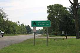
US 12 has also been designated as the Iron Brigade Memorial Highway, a designation which it also has in Indiana,[78] Illinois[79] and Wisconsin.[80] The name honors the 24th Michigan Infantry Regiment, part of the Iron Brigade from the American Civil War. The regiment lost more troops than any other on the Union side during the war and provided the military escort for Abraham Lincoln's funeral in Springfield, Illinois. The unit traveled along the Chicago Road to join the war effort. The highway was dedicated in twin ceremonies in New Buffalo on October 9, 1994, and in Detroit on November 11, 1995, to the Iron Brigade.[81]
In 1986, the Michigan Department of Transportation consulted with its counterparts in Wisconsin (WisDOT), Minnesota (Mn/DOT) and Ontario (Ministry of Transportation of Ontario, MTO) about the formation of a circle tour around Lake Superior.[82] The Lake Michigan Circle Tour was signed on maps by 1988.[83]
In May 2001, the section of US 12 through Saline was designated a Michigan Historic Heritage Route. The segment through Clinton was given the same status in October 2002.[16] On June 9, 2004, the full length of US 12 was dedicated as the US 12 Heritage Trail.[84] In December 2014, this became a Pure Michigan Byway when Governor Rick Snyder signed legislation renaming the Michigan Heritage Route System to the Pure Michigan Byway System.[85]
Major intersections
| County | Location | mi[1] | km | Exit | Destinations | Notes | ||
|---|---|---|---|---|---|---|---|---|
| Berrien | New Buffalo Township | 0.000 | 0.000 | Indiana state line | ||||
| 5.758– 5.868 | 9.267– 9.444 | Eastern end of LMCT concurrency; exit 4 on I-94 | ||||||
| Bertrand Township | 26.260– 26.304 | 42.261– 42.332 | Exit 3 on US 31 | |||||
| 27.213 | 43.795 | Former Bus. US 12; western end of Niles Bypass; southern terminus of M-139 | ||||||
| Niles Township | 29.85 | 48.04 | — | Interchange; separate exits westbound for northbound (Niles) and southbound (South Bend) | ||||
| Cass | Milton Township | 31.413 | 50.554 | — | East Main Street | Interchange; US 12 departs via exit ramps, M-60 continues easterly past eastern end of Niles Bypass as divided highway; western terminus of M-60 | ||
| Edwardsburg | 39.901 | 64.214 | ||||||
| Mason Township | 46.995 | 75.631 | Old M-205 | Formerly M-205 | ||||
| Mason–Porter township line | 50.994 | 82.067 | Northern terminus of M-217 | |||||
| Porter Township | 55.473 | 89.275 | Southern terminus of M-40 | |||||
| St. Joseph | Mottville | 57.857 | 93.112 | Northern terminus of M-103 | ||||
| White Pigeon | 62.742 | 100.973 | ||||||
| Sturgis | 74.909 | 120.554 | Western end of M-66 concurrency; to Indiana Toll Road | |||||
| 75.419 | 121.375 | Eastern end of M-66 concurrency | ||||||
| Branch | Coldwater Township | 98.516 | 158.546 | Eastern terminus of M-86 | ||||
| Coldwater | 100.759 | 162.156 | Western end of BL I-69 concurrency | |||||
| 102.203– 102.227 | 164.480– 164.518 | Eastern end of concurrency BL I-69; exit 13 on I-69 | ||||||
| Hillsdale | Allen | 113.064 | 181.959 | Western end of M-49 concurrency | ||||
| Allen Township | 113.589 | 182.804 | Eastern end of M-49 concurrency | |||||
| Jonesville | 118.539 | 190.770 | Western end of M-99 concurrency | |||||
| 118.879 | 191.317 | Eastern end of M-99 concurrency | ||||||
| Lenawee | Woodstock Township | 136.114 | 219.054 | |||||
| Cambridge Township | 143.423 | 230.817 | ||||||
| 147.669 | 237.650 | Eastern terminus of M-124 | ||||||
| Lenawee–Washtenaw county line |
No major junctions | |||||||
| Lenawee | Franklin Township | 154.540 | 248.708 | |||||
| Washtenaw | Pittsfield Township | 174.258– 174.278 | 280.441– 280.473 | Exit 34 on US 23 | ||||
| Ypsilanti Township | 176.400– 176.419 | 283.888– 283.919 | 181 | Western end of I-94 concurrency | ||||
| Ypsilanti | 178.211 | 286.803 | 183 | |||||
| Ypsilanti Township | 181.332 | 291.826 | 185 | Eastern end of I-94 concurrency; eastbound exit and westbound entrance | ||||
| 182.150 | 293.142 | — | Westbound exit and eastbound entrance; missing connections provided via Dorset Avenue or at Michigan left east of Plant Truck Access interchange; eastern terminus of M-17 | |||||
| 182.527 | 293.749 | — | Willow Run Airport – Plant Truck Access | Interchange | ||||
| 183.323 | 295.030 | — | Willow Run Airport | Former Y interchange | ||||
| Washtenaw–Wayne county line | Ypsilanti–Van Buren township line | 183.761 | 295.735 | — | Ecorse Road –Willow Run Airport East and North Access | Eastbound exit and westbound entrance | ||
| Wayne | Van Buren Township | 184.597 | 297.080 | — | Channelized intersection, formerly a westbound exit and eastbound entrance | |||
| Canton Township | 189.537– 189.564 | 305.030– 305.074 | — | Exit 22 on I-275 | ||||
| Dearborn | 198.478– 198.487 | 319.419– 319.434 | — | Interchange | ||||
| 200.353 | 322.437 | Western end of expressway | ||||||
| 201.506– 201.512 | 324.292– 324.302 | — | Exit 6 on M-39 | |||||
| 202.605 | 326.061 | — | Greenfield Road | Interchange | ||||
| 202.846 | 326.449 | Eastern end of expressway | ||||||
| 204.481– 204.497 | 329.080– 329.106 | Exit 210 on I-94 | ||||||
| Detroit | 204.718 | 329.462 | Eastern terminus of M-153 | |||||
| 208.380– 208.413 | 335.355– 335.408 | Exit 47 on I-75 | ||||||
| 210.077 | 338.086 | Cass Avenue | Eastern terminus of US 12; Michigan Avenue continues to Woodward Avenue | |||||
1.000 mi = 1.609 km; 1.000 km = 0.621 mi
| ||||||||
Related routes
Niles business loop
| |
|---|---|
| Location: | Niles |
| Length: | 5.327 mi[1] (8.573 km) |
| Existed: | January 1962[58]–March 5, 2010[86] |
Business US Highway 12 (Bus. US 12) was a business route running in Niles. The western terminus was at the corner of West Chicago Road and US 12 (Pulaski Highway) east of the US 12/US 31 interchange. From there, the business loop followed Chicago Road northeasterly through residential areas on the west side of town. Bus. US 12 turned north along Lincoln Avenue and then east on Main Street, crossing the St. Joseph River. The loop intersected the southern end of M-139 at Front Street one block east of the river in downtown Niles. Four blocks further east, Bus. US 12 met M-51. The two highways merged along Main Street and then turned south along 11th Street at an intersection that also marks the western terminus of Bus. M-60 (Oak Street). Bus. US 12/M-51 continued south along 11th Street to the corner of US 12 (Pulaski Highway) and M-51 (South 11th Street) where the business loop terminated.[87][88]
The trunkline was first designated in 1956 as a business route of US 112. At that time, US 112 and M-60 were transferred to a bypass south of Niles.[67][68] When US 112 was decommissioned in January 1962,[58] Bus. US 112 was redesignated Bus. US 12 to match the new US 12 designation.[57]
In 1986, US 33 was truncated in Michigan to end at US 12.[89] Bus. US 12 was rerouted in Niles to replace US 33 through town;[90][91] Bus. US 31 was added a year later when the signage was updated in the area.[91][92] In 1998, US 33 was removed from Michigan completely. At this time, M-51 was extended over former US 33 and replaced part of the Bus. US 31 designation in Niles.[93]
On March 5, 2010, the segment of Bus. US 12 between Bus. US 31 and M-51 was turned over to local control.[86] In April 2010 the Bus. US 12 designation was retired when an extended M-139 replaced it from the local control section southwestward prior to maps and signage being changed.[94] The concurrent segment along M-51 became M-51 only.[95]
Major intersections
The entire highway was in St. Joseph County.
| Location | mi[1] | km | Destinations | Notes | |
|---|---|---|---|---|---|
| Bertrand Township | 0.000 | 0.000 | |||
| Niles | 2.900 | 4.667 | Southern terminus of M-139 | ||
| 3.145 | 5.061 | Northern end of M-51 concurrency | |||
| 3.549 | 5.712 | Western terminus of Bus. M-60 | |||
| Niles Township | 5.327 | 8.573 | Southern end of M-52 concurrency; interchange on US 12 | ||
1.000 mi = 1.609 km; 1.000 km = 0.621 mi
| |||||
Ypsilanti business loop
| |
|---|---|
| Location: | Ypsilanti |
| Length: | 8.020 mi[1] (12.907 km) |
| Existed: | January 1962[58]–present |
Business US Highway 12 (Bus. US 12) is a business route running in Ypsilanti. The loop starts at exit 183 on I-94/US 12 south of downtown Ypsilanti and runs northward along the one-way pairing of Huron Street (northbound) and Hamilton Street (southbound). At the intersection with Michigan Avenue in downtown, the two directions reunite and turn eastward, merging onto M-17 in the process. Michigan Avenue crosses the Huron River and continues due east until an intersection at Prospect Street where it turns northeasterly. M-17 separates from Bus. US 12 at Ecorse Road, and Michigan Avenue continues through commercial areas, exiting the city of Ypsilanti. Once Bus. US 12 crosses from Washtenaw County into Wayne County, it expands into a boulevard with Michigan left turns. Just north of the Willow Run industrial complex, Bus. US 12 terminates where US 12 merges onto Michigan Avenue.[96][97]

In 1942 or 1943, Ypsilanti was bypassed by a Bypass US 112 (Byp. US 112). US 112 continued to run along its routing in Ypsilanti.[98][99] The first business loop in Ypsilanti was created in 1956 when US 112 was realigned to bypass downtown along the former Byp. US 112. The former route through downtown was then numbered Bus. US 112.[48][49] The current designation was changed to Bus. US 12 in 1962 when US 12 replaced US 112.[58]
Major intersections
| County | Location | mi[1] | km | Destinations | Notes |
|---|---|---|---|---|---|
| Washtenaw | Ypsilanti | 0.000 | 0.000 | Exit 183 on I-94/US 12 | |
| 1.104 | 1.777 | Western end of M-17 concurrency | |||
| 1.774 | 2.855 | Eastern end of M-17 concurrency | |||
| Wayne | Van Buren Township | 8.020 | 12.907 | ||
1.000 mi = 1.609 km; 1.000 km = 0.621 mi
| |||||
Suffixed route
| |
|---|---|
| Location: | Union, MI to Elkhart, IN |
| Length: | 8.68 mi[1][100] (13.97 km) |
| Existed: | 1933[62][63]–1935[59][60] |
US Highway 112S (US 112S) was a spur route of US 112 in the mid-1930s. Originally, US 112 turned southward at Union and ran to US 20 in Elkhart, Indiana. In 1933, this section of highway was renumbered US 112S,[62][63] before US 112 was relocated to go through Michigan's southwestern most counties in 1935. At the same time, US 112S was renumbered M-205,[59][60] a designation it would hold until it was transferred to local control on October 10, 2002,[101] decommissioning the trunkline.[102][103]
See also
 Metro Detroit portal
 Michigan Highways portal
Notes
- ↑ Detroit was incorporated as a town in 1802 by the government of the Northwest Territory before incorporation and reincorporation as a city by the Michigan Territory in 1806 and 1815.[11]
- ↑ The Michigan State Highway Department was reorganized into the Michigan Department of State Highways and Transportation on August 23, 1973.[19] The name was shortened to its current form in 1978.[20]
- ↑ AASHO was renamed the American Association of State Highway and Transportation Officials (AASHTO) on November 13, 1973.[24]
- ↑ Michigan State Highway Department maps of the time defined a "super highway" as one with "three lanes and over" on the map key.
References
Footnotes
- 1 2 3 4 5 6 7 8 9 10 Michigan Department of Transportation & Michigan Center for Shared Solutions and Technology Partnerships (2009). MDOT Physical Reference Finder Application (Map). Michigan Department of Transportation. Retrieved August 11, 2013.
- 1 2 3 McNichol (2006), p. 74.
- 1 2 3 4 5 6 7 Michigan Department of Transportation (2014). Pure Michigan: State Transportation Map (Map). c. 1:975,000. Lansing: Michigan Department of Transportation. §§ N6–M14. OCLC 42778335, 900162490.
- 1 2 3 4 5 6 7 8 9 10 Google (May 4, 2015). "Overview Map of US Highway 12 in Michigan" (Map). Google Maps. Google. Retrieved May 4, 2015.
- ↑ Michigan Department of Transportation (April 23, 2006). National Highway System, Michigan (PDF) (Map). Scale not given. Lansing: Michigan Department of Transportation. Archived from the original (PDF) on October 6, 2014. Retrieved October 7, 2008.
- ↑ Natzke, Stefan; Neathery, Mike & Adderley, Kevin (June 26, 2013). "What is the National Highway System?". National Highway System. Federal Highway Administration. Retrieved July 1, 2013.
- 1 2 3 4 Michigan Department of Transportation (2014). Pure Michigan: State Transportation Map (Map). c. 1:158,400. Lansing: Michigan Department of Transportation. Detroit Area inset. §§ G3–F11. OCLC 42778335, 900162490.
- ↑ Gavrilovich & McGraw (2000), pp. 20–1
- ↑ Morrison, Roger L. (Autumn 1937). "The History and Development of Michigan Highways". Michigan Alumnus Quarterly Review. Ann Arbor, MI: University of Michigan Bureau of Alumni Relations. 39 (54): 59–73. OCLC 698029175.
- ↑ Mason (1959), p. 18.
- ↑ Farmer (1889), pp. 133–5.
- ↑ Lingeman (2001), p. 1.
- ↑ Baulch, Vivian M. (June 13, 1999). "Woodward Avenue, Detroit's Grand Old 'Main Street'". The Detroit News. Archived from the original on August 21, 2012. Retrieved June 6, 2012.
- ↑ Barnett (2004), pp. 243–4.
- ↑ Whitall, Susan (March 12, 2007). "Woodward Avenue: Michigan's Main Street". The Detroit News. pp. 1A, 8A. ISSN 1055-2715. OCLC 137348716. Archived from the original on August 21, 2012. Retrieved July 16, 2012.
- 1 2 Barnett (2004), pp. 50–1.
- 1 2 Barnett (2004), pp. 154–5.
- ↑ Michigan Legislature (1915), pp. 1868–9.
- ↑ Kulsea & Shawver (1980), p. 27.
- ↑ Kulsea & Shawver (1980), pp. 30–1.
- ↑ "Michigan May Do Well Following Wisconsin's Road Marking System". The Grand Rapids Press. September 20, 1919. p. 10. OCLC 9975013.
- 1 2 Michigan State Highway Department (July 1, 1919). State of Michigan (Map). Scale not given. Lansing: Michigan State Highway Department. Lower Peninsula sheet. OCLC 15607244.
- 1 2 3 Bureau of Public Roads & American Association of State Highway Officials (November 11, 1926). United States System of Highways Adopted for Uniform Marking by the American Association of State Highway Officials (Map). 1:7,000,000. Washington, DC: U.S. Geological Survey. OCLC 32889555. Retrieved November 7, 2013 – via University of North Texas Libraries.
- ↑ Federal Highway Administration (December 4, 2012). "November 13". Highway History. Federal Highway Administration. Retrieved August 18, 2013.
- ↑ Michigan State Highway Department (November 1, 1926). Official Highway Condition Map (Map). [c. 1:823,680]. Lansing: Michigan State Highway Department.
- ↑ Michigan State Highway Department (December 1, 1926). Official Highway Condition Map (Map). [c. 1:823,680]. Lansing: Michigan State Highway Department.
- ↑ Michigan State Highway Department (December 1, 1927). Official Highway Service Map (Map). [c. 1:810,000]. Lansing: Michigan State Highway Department. OCLC 12701195, 79754957.
- ↑ Michigan State Highway Department (May 1, 1928). Official Highway Service Map (Map). [c. 1:810,000]. Lansing: Michigan State Highway Department. OCLC 12701195, 79754957.
- ↑ Michigan State Highway Department (October 1, 1928). Official Highway Service Map (Map). [c. 1:810,000]. Lansing: Michigan State Highway Department. OCLC 12701195, 79754957.
- ↑ Michigan State Highway Department (May 1, 1929). Official Highway Service Map (Map). [c. 1:810,000]. Lansing: Michigan State Highway Department. OCLC 12701195, 79754957.
- ↑ Michigan State Highway Department & H.M. Gousha (January 1, 1930). Official Highway Service Map (Map). [c. 1:810,000]. Lansing: Michigan State Highway Department. OCLC 12701195, 79754957.
- 1 2 3 Michigan State Highway Department & Rand McNally (May 15, 1931). Official Highway Service Map (Map). [c. 1:840,000]. Lansing: Michigan State Highway Department. §§ M9, N7–N8. OCLC 12701053.
- 1 2 3 Michigan State Highway Department & Rand McNally (October 1, 1931). Official Highway Service Map (Map). [c. 1:840,000]. Lansing: Michigan State Highway Department. §§ M9, N7–N8. OCLC 12701053.
- 1 2 Michigan State Highway Department & Rand McNally (June 1, 1936). Official Michigan Highway Map (Map). [c. 1:850,000]. Lansing: Michigan State Highway Department. §§ M9, M11, M13. OCLC 12701143.
- 1 2 Michigan State Highway Department & Rand McNally (December 15, 1936). Official Michigan Highway Map (Map) (Winter ed.). [c. 1:850,000]. Lansing: Michigan State Highway Department. §§ M9, M11, M13. OCLC 12701143, 317396365.
- ↑ Michigan State Highway Department & Rand McNally (May 15, 1937). Official Michigan Highway Map (Map) (Summer ed.). [c. 1:850,000]. Lansing: Michigan State Highway Department. § M11. OCLC 12701143.
- ↑ Michigan State Highway Department & Rand McNally (December 1, 1937). Official Michigan Highway Map (Map) (Winter ed.). [c. 1:850,000]. Lansing: Michigan State Highway Department. § M11. OCLC 12701143.
- ↑ Michigan State Highway Department & Rand McNally (April 15, 1939). Official Michigan Highway Map (Map) (Summer ed.). Scale not given. Lansing: Michigan State Highway Department. Kalamazoo inset. OCLC 12701143.
- ↑ Michigan State Highway Department & Rand McNally (December 1, 1939). Official Michigan Highway Map (Map) (Winter ed.). Scale not given. Lansing: Michigan State Highway Department. Kalamazoo inset. OCLC 12701143.
- ↑ Michigan State Highway Department & Rand McNally (July 15, 1940). Official Michigan Highway Map (Map) (Summer ed.). Scale not given. Lansing: Michigan State Highway Department. Battle Creek inset. OCLC 12701143.
- ↑ Michigan State Highway Department & Rand McNally (December 1, 1941). Official Michigan Highway Map (Map) (Winter ed.). Scale not given. Lansing: Michigan State Highway Department. Battle Creek inset. OCLC 12701143.
- ↑ Michigan State Highway Department (July 1, 1951). Official Highway Map (Map). [c. 1:918,720]. Lansing: Michigan State Highway Department. § M11. OCLC 12701120.
- ↑ Michigan State Highway Department (April 15, 1952). Official Highway Map (Map). [c. 1:918,720]. Lansing: Michigan State Highway Department. § M11. OCLC 12701120.
- ↑ Michigan State Highway Department (April 15, 1953). Official Highway Map (Map). [c. 1:918,720]. Lansing: Michigan State Highway Department. § M11. OCLC 12701120.
- ↑ Michigan State Highway Department (October 1, 1953). Official Highway Map (Map). [c. 1:918,720]. Lansing: Michigan State Highway Department. § M11. OCLC 12701120.
- ↑ Michigan State Highway Department (April 15, 1954). Official Highway Map (Map). [c. 1:918,720]. Lansing: Michigan State Highway Department. § M9. OCLC 12701120.
- ↑ Michigan State Highway Department (October 1, 1954). Official Highway Map (Map). [c. 1:918,720]. Lansing: Michigan State Highway Department. § M9. OCLC 12701120.
- 1 2 Michigan State Highway Department (April 15, 1956). Official Highway Map (Map). [c. 1:918,720]. Lansing: Michigan State Highway Department. §§ M11, M12–M14. OCLC 12701120.
- 1 2 Michigan State Highway Department (October 1, 1956). Official Highway Map (Map). [c. 1:918,720]. Lansing: Michigan State Highway Department. §§ M11, M12–M14. OCLC 12701120.
- ↑ Michigan State Highway Department (October 1, 1957). Official Highway Map (Map). [c. 1:918,720]. Lansing: Michigan State Highway Department. § M9. OCLC 12701120, 367386492.
- 1 2 Michigan State Highway Department (1958). Official Highway Map (Map). [c. 1:918,720]. Lansing: Michigan State Highway Department. § M9, N9. OCLC 12701120, 51856742. (Includes all changes through July 1, 1958)
- ↑ "Michigan Delays Road Number System". Toledo Blade. June 4, 1959. p. 11. OCLC 12962635. Retrieved November 21, 2010.
- ↑ "Temporary Double Signs for Highway". The News-Palladium. Benton Harbor, MI. January 15, 1959. § 2, p. 1. Retrieved August 21, 2013 – via Newspapers.com.

- ↑ "Marshall Area Chronology for 1959". Marshall Evening Chronicle. December 31, 1959. pp. 4–5. Retrieved August 21, 2013 – via NewspaperArchive.com. (subscription required (help)).
- 1 2 Michigan State Highway Department (1960). Official Highway Map (Map). [c. 1:918,720]. Lansing: Michigan State Highway Department. §§ M7–M14, N9. OCLC 12701120, 81552576. (Includes all changes through July 1, 1960)
- ↑ Michigan State Highway Department (1961). Official Highway Map (Map). [c. 1:918,720]. Lansing: Michigan State Highway Department. §§ M7–M8, M11–M12. OCLC 12701120, 51857665. (Includes all changes through July 1, 1961)
- 1 2 3 Michigan State Highway Department (1962). Official Highway Map (Map). [c. 1:918,720]. Lansing: Michigan State Highway Department. §§ M7, N7–M14. OCLC 12701120, 173191490.
- 1 2 3 4 5 6 7 "Area Road Signs To Be Changed". The News-Palladium. Benton Harbor, MI. Associated Press. January 9, 1962. § 2, p. 5. Retrieved May 3, 2015 – via Newspapers.com.
- 1 2 3 4 Michigan State Highway Department & Rand McNally (May 15, 1935). Official Michigan Highway Map (Map). [c. 1:850,000]. Lansing: Michigan State Highway Department. §§ N7–N8. OCLC 12701143.
- 1 2 3 4 Michigan State Highway Department & Rand McNally (December 1, 1935). Official Michigan Highway Map (Map). [c. 1:850,000]. Lansing: Michigan State Highway Department. §§ N7–N8. OCLC 12701143.
- ↑ Secretary of Agriculture (November 18, 1925). Report of Joint Board on Interstate Highways, October 30, 1925 (Report). US Department of Agriculture.
- 1 2 3 Michigan State Highway Department & Rand McNally (May 1, 1933). Official Michigan Highway Map (Map). [c. 1:840,000]. Lansing: Michigan State Highway Department. §§ N7–N8. OCLC 12701053.
- 1 2 3 Michigan State Highway Department & Rand McNally (September 1, 1933). Official Michigan Highway Map (Map). [c. 1:840,000]. Lansing: Michigan State Highway Department. §§ N7–N8. OCLC 12701053.
- ↑ Michigan State Highway Department (April 15, 1955). Official Highway Map (Map). [c. 1:918,720]. Lansing: Michigan State Highway Department. § N11. OCLC 12701120.
- ↑ Michigan State Highway Department (October 1, 1955). Official Highway Map (Map). [c. 1:918,720]. Lansing: Michigan State Highway Department. § N11. OCLC 12701120.
- ↑ "7,260 Cars Travel New Bypass Daily". Niles Daily Star. December 3, 1956. OCLC 36065307.
- 1 2 Michigan State Highway Department (October 1, 1956). Official Highway Map (Map). Scale not given. Lansing: Michigan State Highway Department. Niles inset. OCLC 12701120.
- 1 2 Michigan State Highway Department (April 15, 1957). Official Highway Map (Map). Scale not given. Lansing: Michigan State Highway Department. Niles inset. OCLC 12701120.
- ↑ Michigan Department of State Highways (1966). Official Highway Map (Map). [c. 1:918,720]. Lansing: Michigan Department of State Highways. § N7. OCLC 12701120.
- ↑ Michigan Department of State Highways (1967). Michigan Water-Winter Wonderland: Official Highway Map (Map). [c. 1:918,720]. Lansing: Michigan Department of State Highways. § N7. OCLC 12701120.
- ↑ Michigan Department of Transportation (October 9, 2000). Proposed Jurisdiction: Woodward Avenue/Campus Martius Area (PDF) (Map). Scale not given. Lansing: Michigan Department of Transportation. Retrieved May 4, 2015.
- ↑ Michigan Department of Transportation (2001). Michigan, Great Lakes Great Times: Official Department of Transportation Map (Map). c. 1:190,080. Lansing: Michigan Department of Transportation. Downtown Detroit inset. OCLC 42778335.
- ↑ Michigan Department of Transportation (2002). Michigan, Great Lakes Great Times: Official Department of Transportation Map (Map). c. 1:190,080. Lansing: Michigan Department of Transportation. Downtown Detroit inset. OCLC 42778335.
- ↑ Michigan Department of Transportation (2005). Michigan, One Hundred Years of Michigan Transportation: Official Department of Transportation Map (Map). Scale not given. Lansing: Michigan Department of Transportation. Downtown Detroit inset. OCLC 42778335, 71041619.
- ↑ Michigan Department of Transportation (2006). Michigan, A State for All Seasons: Official Department of Transportation Map (Map). Scale not given. Lansing: Michigan Department of Transportation. Downtown Detroit inset. OCLC 42778335.
- ↑ Barnett (2004), p. 183.
- ↑ Barnett (2004), p. 179.
- ↑ Indiana Department of Transportation (n.d.). "Memorial Highways and Bridges". Indiana Department of Transportation. Retrieved June 18, 2010.
- ↑ Illinois General Assembly (May 30, 2004). "HR 0688". State of Illinois. Retrieved June 19, 2010.
- ↑ Wisconsin Department of Transportation (June 4, 2010). "Commemorative Highways and Bridges". Wisconsin Department of Transportation. Retrieved June 18, 2010.
- ↑ Barnett (2004), p. 113.
- ↑ Davis, R. Matt (May 1, 1986). "Signs to Mark Lake Circle Tour". The Daily Mining Gazette. Houghton, MI. p. 16.
- ↑ Michigan Department of Transportation (1988). Yes Michigan: Department of Transportation Map (Map). c. 1:918,720. Lansing: Michigan Department of Transportation. Map Symbols. OCLC 42778335.
- ↑ Barnett (2004), p. 288.
- ↑ Wurfel, Sara & Murray, Dave (December 31, 2014). "Gov. Rick Snyder Signs Bills Focused on Creating Good Government Practices: Also Signs Memorial Highway, 'Pure Michigan Byways' Bills" (Press release). Office of the Governor. Archived from the original on January 3, 2015. Retrieved January 1, 2015.
- 1 2 Michigan Department of Transportation (May 7, 2010). "Contract Number 2010-0086". Michigan Department of Transportation. Retrieved May 7, 2010 – via Yahoo! Groups: Great Lakes Roads. (registration required (help)).
- ↑ Michigan Department of Transportation (2010). Truck Operator's Map (Map). c. 1:221,760. Lansing: Michigan Department of Transportation. Niles inset.
- ↑ Google (May 5, 2015). "Overview Map of Former Bus. US 12 in Niles" (Map). Google Maps. Google. Retrieved May 5, 2015.
- ↑ Special Committee on U.S. Route Numbering (June 9, 1986). "Route Numbering Committee Agenda" (PDF) (Report). State College, PA: American Association of State Highway and Transportation Officials – via Wikimedia Commons.
- ↑ Michigan Department of Transportation (1986). Yes Michigan: Official Transportation Map (Map). c. 1:918,720. Lansing: Michigan Department of Transportation. § N7. OCLC 12701177.
- 1 2 Michigan Department of Transportation (1987). Yes Michigan: Official Transportation Map (Map). c. 1:918,720. Lansing: Michigan Department of Transportation. § N7. OCLC 12701177.
- ↑ Michigan Department of Transportation (1988). Yes Michigan: Department of Transportation Map (Map). c. 1:918,720. Lansing: Michigan Department of Transportation. § N7. OCLC 42778335.
- ↑ "Portion of US 33 Is Now Indiana 933: Name Changes Along Lincoln Way, North to State Line". South Bend Tribune. April 18, 1998. p. A6. OCLC 8793233. Retrieved December 29, 2008 – via ProQuest Archiver. (subscription required (help)).
- ↑ "Forum set for bridge project". The Herald-Palladium. St. Joseph, MI. April 27, 2010. Retrieved April 27, 2010.
- ↑ Michigan Department of Transportation (2011). Truck Operator's Map (Map). c. 1:221,760. Lansing: Michigan Department of Transportation. Niles inset.
- ↑ Michigan Department of Transportation (2014). Truck Operator's Map (Map). c. 1:221,760. Lansing: Michigan Department of Transportation. Ann Arbor inset.
- ↑ Google (May 5, 2015). "Overview Map of Bus. US 12 in Ypsilanti" (Map). Google Maps. Google. Retrieved May 5, 2015.
- ↑ Michigan State Highway Department & Rand McNally (June 1, 1942). Official Michigan Highway Map (Map) (Summer ed.). [c. 1:850,000]. Lansing: Michigan State Highway Department. § M12. OCLC 12701143.
- ↑ Michigan State Highway Department & Rand McNally (June 1, 1943). Official Michigan Highway Map (Map) (Summer ed.). [c. 1:850,000]. Lansing: Michigan State Highway Department. § M12.
- ↑ Indiana Department of Transportation (2004). Reference Post Book (PDF). Indianapolis: Indiana Department of Transportation. S-19. Retrieved May 20, 2010.
- ↑ "Michiana Parkway Will Benefit Region". South Bend Tribune. October 6, 2002. OCLC 8793233. Retrieved April 29, 2009. (subscription required (help)).
- ↑ Michigan Department of Transportation (2002). Michigan, Great Lakes Great Times: Official Department of Transportation Map (Map). c. 1:918,720. Lansing: Michigan Department of Transportation. § N8. OCLC 42778335.
- ↑ Michigan Department of Transportation (2003). Michigan: Official Department of Transportation Map (Map) (2003–04 ed.). c. 1:918,720. Lansing: Michigan Department of Transportation. § N8. OCLC 42778335.
Works cited
- Barnett, LeRoy (2004). A Drive Down Memory Lane: The Named State and Federal Highways of Michigan. Allegan Forest, MI: Priscilla Press. ISBN 1-886167-24-9. OCLC 57425393.
- Farmer, Silas (1889). The History of Detroit and Michigan; or, The Metropolis Illustrated; A Full Record of Territorial Days in Michigan, and the Annals of Wayne County (2nd ed.). Detroit: S. Farmer & Co. OCLC 2823136 – via University of Michigan Digital Library Text Collections.
- Gavrilovich, Peter & McGraw, Bill (2000). The Detroit Almanac: 300 Years of Life in the Motor City. Detroit: Detroit Free Press. ISBN 978-0-937247-34-1. OCLC 45227386.
- Kulsea, Bill & Shawver, Tom (1980). Making Michigan Move: A History of Michigan Highways and the Michigan Department of Transportation. Lansing, MI: Michigan Department of Transportation. OCLC 8169232.
- Lingeman, Stanley D. (April 6, 2001). Michigan Highway History Timeline 1701–2001: 300 Years of Progress. Lansing, MI: Library of Michigan. OCLC 435640179.
- Mason, Philip P. (1959). Michigan Highways From Indian Trails to Expressways. Ann Arbor, MI: Braun-Brumfield. OCLC 23314983.
- McNichol, Dan (2006). The Roads that Built America: The Incredible Story of the US Interstate System. New York: Sterling. ISBN 1-4027-3468-9. OCLC 63377558.
- Michigan Legislature (1915) [enacted May 13, 1913]. "Chapter 91: State Reward Trunk Line Highways". In Shields, Edmund C.; Black, Cyrenius P. & Broomfield, Archibald. The Compiled Laws of the State of Michigan, Volume I. Lansing, MI: Wynkoop, Hallenbeck, Crawford. pp. 1868–72. OCLC 44724558 – via Google Books.
Further reading
- Saborio, Gladys & Kosky, Susan (2015). Michigan's US 12 Heritage Trail: America's Second Federal Highway. Traverse City, MI: Arbutus Press. ISBN 1933926554. OCLC 905667950.
External links
 Geographic data related to US 12 in Michigan at OpenStreetMap
- US 12 at Michigan Highways
- US 12 Heritage Trail (Southwestern Michigan Planning Commission)
- Geographic data related to Bus. US 12 in Niles at OpenStreetMap
- Bus. US 12 in Niles at Michigan Highways
- Geographic data related to Bus. US 12 in Ypsilanti at OpenStreetMap
- Bus. US 12 in Ypsilanti at Michigan Highways
- Historic US 112 at Michigan Highways
| Previous state: Indiana |
Michigan | Next state: Terminus |