Tysmenytsia Raion
| Tysmenytsia Raion Тисменицький район | ||
|---|---|---|
| Raion | ||
| ||
 | ||
| Coordinates: 48°54′56″N 24°49′39″E / 48.91556°N 24.82750°ECoordinates: 48°54′56″N 24°49′39″E / 48.91556°N 24.82750°E | ||
| Country |
| |
| Region | Ivano-Frankivsk Oblast | |
| Established | December 8, 1966 | |
| Admin. center | Tysmenytsia | |
| Subdivisions |
List
| |
| Government | ||
| • Governor | Volodymyr Semeniv | |
| Area | ||
| • Total | 736 km2 (284 sq mi) | |
| Population | ||
| • Total | 82,756 | |
| • Density | 110/km2 (290/sq mi) | |
| Time zone | EET (UTC+2) | |
| • Summer (DST) | EEST (UTC+3) | |
| Postal index | 774-XX | |
| Area code | 380 | |
| Website | http://tsm.if.gov.ua/ | |

Tysmenytsia Raion (Ukrainian: Тисменицький район) is an administrative raion (district) of Ivano-Frankivsk Oblast (province) in western Ukraine. It was created on December 8, 1966 as Ivano-Frankivsk Raion. Since March 28, 1982 the name of raion was changed to Tysmenytsia when the administrative center of it became the city of Tysmenytsia. Population: 82,756 (2013 est.)[1].
Geography
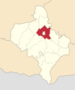
The raion is located near the eastern border of the Ivano-Frankivsk Oblast. To the north it borders Halych Raion, to the west - Kalush and Bohorodchany raions, to the south - Kolomyia and Nadvirna raions, and to the east - Tlumach Raion with small portion of an oblast demarcation line with Ternopil Oblast. The raion completely surrounds Ivano-Frankivsk Municipality with numerous villages bordering with it and are part of the city's infrastructure: Uhryniv, Yamnytsia, Drahomyrchany, Zahvizdya, and others. The administrative center of the raion, Tysmenytsia, is only 11 kilometres (6.8 mi) away from Ivano-Frankivsk.
The oldest settlements in the raion are Cherniiv (1404), Stari Kryvotuly (1436), Uhryniv (1440), others.
Government
- Executive: Head of Raion State Administration - Volodymyr Semeniv
- Legislative: Raion Council (85 seats): Chairman - Mykola Nahornyi (Rukh)
- Tysmenytsya City municipality
- Yezupil Town municipality
- Lysets Town municipality
- 41 rural municipalities (communes) encompassing 48 villages
Education
There are 43 general education schools in the raion with best ones located in Tysmenytsia, Yezupil, Lysets, Markivtsi, Radcha, Stari Kryvotuly, Chorny Lis, and Uhryniv.
Administrative division
Tysmenytsia Raion is divided into several municipalities (councils) some which are urban, others are rural. There are two types of urban municipalities: city and settlement (township). Rural municipalities (communes) may consists of a single village or combined into several villages, however most of the rural municipalities consist of a single village. Also the city of Tysmentsia carries a special status of independent administration within the raion.
- Urban (city, township)
- Rural (communes)
- Berezivka
- Bratkivtsi
- Vilshanytsia
- Cherniiv
- Chornoliztsi
- Chukalivka
- Dobrovlyany
- Dovhe
- Drahomyrchany
- Hannusivka
- Khomiakivka
- Klubivtsi
- Kluziv
- Kozyna
- Kolodiivka
- Lypivka (Nova Lypivka, Studynets)
- Maidan (Nova Huta)
- Markivtsi (Odayi)
- Myluvannia
- Novi Kryvotuly (Ternovytsia)
- Pavlivka
- Pidluzhia
- Pidlissia
- Pidpechery
- Poberezhia
- Posich
- Pshenychnyky (Pohonya)
- Radcha
- Rybne
- Roshniv
- Silets
- Slobidka
- Staryi Kryvotuly (Krasylivka)
- Staryi Lysets
- Stebnyk
- Stryhantsi
- Tiaziv
- Uhryniv
- Uzyn
- Yamnytsia
- Zahvizdia
- Ten most populous
- Tysmenytsia 9,720
- Cherniiv 3,972
- Stary Lysets 3,795
- Zahvizdya 3,684
- Yamnytsia 3,358
- Uhryniv 3,227
- Stari Kryvotuly 3,112
- Chornoliztsi 3,097
- Radcha 3,062
- Yezupil 3,026
Most of the populous municipalities are located next to the Ivano-Frankivsk city virtually serving as the extraterritorial units of it (suburbs). The smallest municipality of the raion is the Posich municipality which in 2001 accounted to only 84 residents. Note that as a settlement Posich is not the smallest.
References
- ↑ "Чисельність наявного населення України (Actual population of Ukraine)" (in Ukrainian). State Statistics Service of Ukraine. Retrieved 21 January 2015.
External links
- (Ukrainian) Verkhovna Rada website - Administrative divisions on the Tysmenytsia raion
- County of Tysmenytsia (English version)
 |
Kalush Raion | Halych Raion | (Ternopil Oblast) | |
| Kalush Raion / Bohorodchany Raion | |
Tlumach Raion | ||
| ||||
| | ||||
| Bohorodchany Raion / Nadvirna Raion | Nadvirna Raion / Kolomyia Raion | Kolomyia Raion |
| Cities | ||
|---|---|---|
| Urban-type settlements | ||
| Rural councils |
| |
| Raions | |||||||
|---|---|---|---|---|---|---|---|
| Cities |
| ||||||
| |||||||