Tyrone, Pennsylvania
| Tyrone, Pennsylvania | |
|---|---|
| Borough | |
|
Pennsylvania Avenue | |
| Motto: Where quality of life comes first | |
 Tyrone | |
| Coordinates: 40°40′29″N 78°14′29″W / 40.67472°N 78.24139°WCoordinates: 40°40′29″N 78°14′29″W / 40.67472°N 78.24139°W | |
| Country | United States |
| State | Pennsylvania |
| County | Blair |
| Settled | 1851 |
| Incorporated | 1857 |
| Government | |
| • Type | Borough Council |
| • Mayor | William Fink |
| Area | |
| • Total | 2.0 sq mi (5.2 km2) |
| Population (2010) | |
| • Total | 5,477 |
| • Density | 2,711.4/sq mi (1,046.8/km2) |
| Time zone | Eastern (EST) (UTC-5) |
| • Summer (DST) | EDT (UTC-4) |
| Zip code | 16686 |
| Area code(s) | 814 |
| Website | Tyrone Borough website |

Tyrone is a borough in Blair County, Pennsylvania, 15 miles (24 km) northeast of Altoona, on the Little Juniata River. Tyrone was of considerable commercial importance in the twentieth century. It was an outlet for the Clearfield coal fields, and it was noted for the manufacture of paper products. There were planing mills, and chemical and candy factories. In 1900, 5,847 people lived here; in 1910, 7,176; and in 1940, 8,845 people resided here. The population was 5,477 at the 2010 census. It is part of the Altoona, PA Metropolitan Statistical Area. It was named for County Tyrone in Ireland.[1]
Located along the main lines of the Norfolk Southern and Nittany and Bald Eagle railroads, and US-220, PA-453, and I-99 highways, Tyrone was at one time known as "The Hub of the Highways." In those days four railroads [Pennsylvania, Tyrone and Clearfield, Tyrone and Lock Haven, Lewisburg and Tyrone] and three main highways [US-220, PA-350, PA-453] converged there.
History
The Tyrone Borough Historic District was added to the National Register of Historic Places in 1993.[2]
Tornado
On June 2, 1998, an F1 tornado moved southeast along Pennsylvania Route 453 northwest of Tyrone. Significant tree damage was noted in several locations along a 4-mile path, beginning about 5 miles northwest of Tyrone. No significant damage was reported in Tyrone, although eyewitnesses reported seeing clouds rotating as they crossed the city. This tornado was part of the 1998 Eastern Tornado Outbreak. [3]
Geography
Tyrone is located at 40°40′29″N 78°14′29″W / 40.67472°N 78.24139°W.[4]
According to the United States Census Bureau, the borough has a total area of 2.0 square miles (5.2 km2), all of it land.
Tyrone is situated in the Bald Eagle Valley at the base of Bald Eagle Mountain along Bald Eagle Creek at the Little Juniata River water gap.
Demographics
| Historical population | |||
|---|---|---|---|
| Census | Pop. | %± | |
| 1860 | 741 | — | |
| 1870 | 1,840 | 148.3% | |
| 1880 | 2,678 | 45.5% | |
| 1890 | 4,705 | 75.7% | |
| 1900 | 5,847 | 24.3% | |
| 1910 | 7,176 | 22.7% | |
| 1920 | 9,084 | 26.6% | |
| 1930 | 9,042 | −0.5% | |
| 1940 | 8,845 | −2.2% | |
| 1950 | 8,214 | −7.1% | |
| 1960 | 7,792 | −5.1% | |
| 1970 | 7,072 | −9.2% | |
| 1980 | 6,346 | −10.3% | |
| 1990 | 5,743 | −9.5% | |
| 2000 | 5,528 | −3.7% | |
| 2010 | 5,477 | −0.9% | |
| Est. 2015 | 5,353 | [5] | −2.3% |
| Sources:[6][7][8] | |||
As of the census[7] of 2010, there were 5,477 people, 2,275 households, and 1,422 families residing in the borough. The population density was 2,711.4 people per square mile (1,046.8/km²). There were 2,472 housing units at an average density of 1,223.8 per square mile (472.5/km²). The racial makeup of the borough was 97.3% White, 0.7% Black or African American, 0.3% Native American, 0.3% Asian, 0.2% from other races, and 1.2% from two or more races. Hispanic or Latino of any race were 1.0% of the population.
There were 2,275 households, out of which 30.9% had children under the age of 18 living with them, 43.0% were married couples living together, 4.8% had a male householder with no wife present, 14.7% had a female householder with no husband present, and 37.5% were non-families. 33.0% of all households were made up of individuals, and 14.8% had someone living alone who was 65 years of age or older. The average household size was 2.34 and the average family size was 2.93.
In the borough, the population was spread out, with 22.6% under the age of 18, 8.2% from 18 to 24, 25.6% from 25 to 44, 25.3% from 45 to 64, and 18.3% who were 65 years of age or older. The median age was 40 years. For every 100 females, there were 88.8 males. For every 100 females age 18 and over, there were 85.8 males.
The median income for a household in the borough was $34,850, and the median income for a family was $43,851. The per capita income for the borough was $18,664. About 10.7% of families and 14.0% of the population were below the poverty line, including 23.0% of those under age 18 and 10.9% of those age 65 or over.
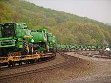
Transportation
Sports
Tyrone won the Pennsylvania AA State Football Championship in 1999. Tyrone also made the PIAA State Championship Game in 1996 and 2011, and tied for the championship in 1940.
Movie Filming
During October 2009, several scenes for the Tony Scott film Unstoppable (with Denzel Washington, Chris Pine, and Rosario Dawson) were filmed in and around Tyrone, mostly at the 14th street crossing and the north end of the rail yard. Several hundred local residents were employed as background extras. The film was released on November 12, 2010.
Notable businesses

- Gardner's Candies
- Levine Family Shoe Store since 1932
- Allegheny Mountain Radio Network, regional radio network flagshipped at Tyrone's WTRN
- The W.F. Hiller Agency, a Tyrone fixture since 1892
- Sickler, Tarpey, & Associates; a public accounting firm
Notable people
- Alan Beckwith (born 1952), film and television actor
- Lucas Giolito (born 1994), Major League Baseball pitcher with the Washington Nationals (2016-)
- Dylan Lane (born 1977), game show host (born in Tyrone, spent whole childhood in Huntingdon)
- Marcy Rylan (born 1980), film and television actress (graduated from Tyrone High School, currently stars as Lulu Spencer on the soap opera General Hospital).
- D. Brooks Smith (born 1951), federal judge - United States Third Circuit Court of Appeals (born in Altoona, grew up in Tyrone and graduated from Tyrone High School)
- Ethan Stiefel (born 1973), former principal dancer with the American Ballet Theatre
- Fred Waring (1900–1984), musician and radio-television personality
- Jeffrey Adams (born Tyrone, PA 1959), Pennsylvania historian and author as well a scholar of the development of industrial Central Pennsylvania
References
- ↑ "History". Retrieved 4 December 2016.
Irish immigrants brought the name of their home county, Tyrone, with them to America.
- ↑ National Park Service (2010-07-09). "National Register Information System". National Register of Historic Places. National Park Service.
- ↑ NCEI. "Storm Events Database - Event Details - National Centers for Environmental Information". Retrieved 4 December 2016.
- ↑ "US Gazetteer files: 2010, 2000, and 1990". United States Census Bureau. 2011-02-12. Retrieved 2011-04-23.
- ↑ "Annual Estimates of the Resident Population for Incorporated Places: April 1, 2010 to July 1, 2015". Retrieved July 2, 2016.
- ↑ "Census of Population and Housing". U.S. Census Bureau. Retrieved 11 December 2013.
- 1 2 "American FactFinder". United States Census Bureau. Retrieved 2008-01-31.
- ↑ "Incorporated Places and Minor Civil Divisions Datasets: Subcounty Resident Population Estimates: April 1, 2010 to July 1, 2012". Population Estimates. U.S. Census Bureau. Retrieved 11 December 2013.
External links
- Tyrone official website
- Tyrone community website
- Tyrone, Pennsylvania (PA) Detailed Profile
- Unstoppable movie website
- Tyrone Historical Society website(Community links)
Municipalities and communities of Blair County, Pennsylvania, United States | ||
|---|---|---|
| City | 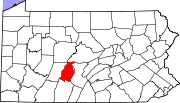 | |
| Boroughs | ||
| Townships | ||
| CDPs | ||
| Unincorporated communities | ||
| Footnotes | ‡This populated place also has portions in an adjacent county or counties | |