Tyrone, Georgia
| Tyrone, Georgia | |
|---|---|
| Town | |
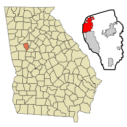 Location in Fayette County and the state of Georgia | |
| Coordinates: 33°28′25″N 84°35′28″W / 33.47361°N 84.59111°WCoordinates: 33°28′25″N 84°35′28″W / 33.47361°N 84.59111°W | |
| Country | United States |
| State | Georgia |
| County | Fayette |
| Area | |
| • Total | 12.9 sq mi (33.3 km2) |
| • Land | 12.5 sq mi (32.3 km2) |
| • Water | 0.4 sq mi (1.0 km2) |
| Elevation | 981 ft (299 m) |
| Population (2010) | |
| • Total | 6,879 |
| • Estimate (2014) | 7,135 |
| • Density | 546/sq mi (211.0/km2) |
| Time zone | Eastern (EST) (UTC-5) |
| • Summer (DST) | EDT (UTC-4) |
| ZIP code | 30290 |
| Area code(s) | 770, 678 |
| FIPS code | 13-78044[1] |
| GNIS feature ID | 0324475[2] |
| Website |
tyrone |
Tyrone is a town in Fayette County, Georgia, United States. The population was 6,879 at the 2010 census,[3] up from 3,916 at the 2000 census. The estimated population in 2014 was 7,135.[4]
It was named after County Tyrone in Ireland.[5][6]
Geography
Tyrone is located in the northwest corner of Fayette County at 33°28′25″N 84°35′28″W / 33.47361°N 84.59111°W (33.473563, -84.591229).[7] It is bordered to the south by Peachtree City and to the west by Coweta County, across Line Creek.
Georgia State Route 74, the Joel Cowan Parkway, passes through Tyrone, leading north 5 miles (8 km) to Interstate 85 on the south side of Fairburn. Downtown Atlanta is 25 miles (40 km) northeast of Tyrone via SR 74 and I-85.
According to the United States Census Bureau, Tyrone has a total area of 12.9 square miles (33.3 km2), of which 12.5 square miles (32.3 km2) is land and 0.4 square miles (1.0 km2), or 2.94%, is water.[3]
Demographics
| Historical population | |||
|---|---|---|---|
| Census | Pop. | %± | |
| 1930 | 128 | — | |
| 1940 | 118 | −7.8% | |
| 1950 | 156 | 32.2% | |
| 1960 | 124 | −20.5% | |
| 1970 | 131 | 5.6% | |
| 1980 | 1,038 | 692.4% | |
| 1990 | 2,724 | 162.4% | |
| 2000 | 3,916 | 43.8% | |
| 2010 | 6,879 | 75.7% | |
| Est. 2015 | 7,194 | [8] | 4.6% |
As of the census[1] of 2000, there were 3,916 people, 1,374 households, and 1,158 families residing in the town. The population density was 309.6 people per square mile (119.5/km²). There were 1,425 housing units at an average density of 112.7 per square mile (43.5/km²). The racial makeup of the town was 94.38% White, 3.37% African American, 0.33% Native American, 1.00% Asian, 0.15% from other races, and 0.77% from two or more races. Hispanic or Latino of any race were 1.46% of the population.
There were 1,374 households out of which 41.6% had children under the age of 18 living with them, 73.3% were married couples living together, 7.9% had a female householder with no husband present, and 15.7% were non-families. 12.9% of all households were made up of individuals and 4.5% had someone living alone who was 65 years of age or older. The average household size was 2.85 and the average family size was 3.12.
In the town the population was spread out with 27.4% under the age of 18, 6.7% from 18 to 24, 27.7% from 25 to 44, 30.1% from 45 to 64, and 8.1% who were 65 years of age or older. The median age was 39 years. For every 100 females there were 94.3 males. For every 100 females age 18 and over, there were 93.5 males.
The median income for a household in the town was $63,080, and the median income for a family was $71,406. Males had a median income of $45,788 versus $29,231 for females. The per capita income for the town was $26,463. None of the families and 0.9% of the population were living below the poverty line, including no under eighteens and none of those over 64.
Many developers have flocked to Tyrone due to its high land value and accessibility to Atlanta. A number of new projects are set to debut in Tyrone in the near future. They include a restoration of the old downtown, new residential communities, Rick and Morty Center, a golf cart path system that will connect to Peachtree City and a new public library.
Schools
Within the small town of Tyrone there are three public schools: Burch Elementary, Flat Rock Middle, and Sandy Creek High School. These three are located in a triangle configuration on the same street (Jenkins Road). Our Lady of Victory Catholic School is located on Kirkley (aka "Kirkly") Road off Highway 74. South of town there is Crabapple Elementary School. East of town, is Bennett's Mill Middle School.
Famous residents
- Joey Clanton, NASCAR driver
- Andrew Gardner, NFL football player, Miami Dolphins
- Kedric Golston, NFL football player, Washington Redskins
- Calvin Johnson, NFL football player, Detroit Lions
- Brittany Swann, Miss Georgia USA 2007
Organizations headquartered in Tyrone
- The U.S. headquarters for Operation Mobilisation is in Tyrone.
- Wellspring Living, an organization that works with victims of childhood trauma, is headquartered in Tyrone.
References
- 1 2 "American FactFinder". United States Census Bureau. Retrieved 2008-01-31.
- ↑ "US Board on Geographic Names". United States Geological Survey. 2007-10-25. Retrieved 2008-01-31.
- 1 2 "Geographic Identifiers: 2010 Census Summary File 1 (G001), Tyrone town, Georgia". American FactFinder. U.S. Census Bureau. Retrieved April 27, 2016.
- ↑ "Annual Estimates of the Resident Population for Incorporated Places: April 1, 2010 to July 1, 2014". Retrieved June 4, 2015.
- ↑ http://tyrone.georgia.gov/05/home/0,2230,8324176,00.html;jsessionid=FC1FC4BC442CE3259ECCAC5ABBECD87F
- ↑ http://www.tyrone.org/
- ↑ "US Gazetteer files: 2010, 2000, and 1990". United States Census Bureau. 2011-02-12. Retrieved 2011-04-23.
- ↑ "Annual Estimates of the Resident Population for Incorporated Places: April 1, 2010 to July 1, 2015". Retrieved July 2, 2016.
- ↑ "Census of Population and Housing". Census.gov. Retrieved June 4, 2015.
External links
- Town of Tyrone official website
- Tyrone Crime Statistics
- Palmer Family Cemetery historical marker
Municipalities and communities of Fayette County, Georgia, United States | ||
|---|---|---|
| Cities | 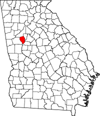 | |
| Towns | ||
| Unincorporated community | ||