Turvey Park, New South Wales
| Turvey Park Wagga Wagga, New South Wales | |||||||||||||
|---|---|---|---|---|---|---|---|---|---|---|---|---|---|
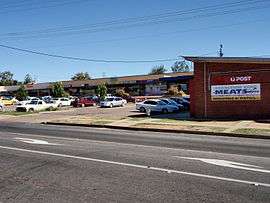 Turvey Tops Shopping Centre | |||||||||||||
| Coordinates | 35°7′34.06″S 147°21′25.48″E / 35.1261278°S 147.3570778°ECoordinates: 35°7′34.06″S 147°21′25.48″E / 35.1261278°S 147.3570778°E | ||||||||||||
| Population | 3,438 (2006)[1] | ||||||||||||
| Postcode(s) | 2650 | ||||||||||||
| LGA(s) | City of Wagga Wagga | ||||||||||||
| County | Wynyard | ||||||||||||
| Parish | South Wagga Wagga | ||||||||||||
| State electorate(s) | Wagga Wagga | ||||||||||||
| Federal Division(s) | Riverina | ||||||||||||
| |||||||||||||
Turvey Park is an inner southern suburb of Wagga Wagga in southern New South Wales, Australia. Its boundaries are defined by Fernleigh Road to the south, Glenfield Road to the west, Coleman Street to the north and to the east by Willans Hill. House prices in Turvey Park are amongst some of the highest in Wagga Wagga due to its proximity the CBD.
The suburb was added to the municipality in 1939. It was named after the property "Turvey Park" established by Thomas Turvey (died 14 January 1889), a licensee and store owner. A large family vault on the property was moved to the Church of England proportion of the Wagga Wagga Monumental Cemetery to allow for the construction of the intersection of Mitchelmore St and Hodson Ave in 1941 (Morris, p. 214). A commemorative plaque now marks the vicinity of the original site.
References and notes
- ↑ Australian Bureau of Statistics (25 October 2007). "Turvey Park (State Suburb)". 2006 Census QuickStats. Retrieved 2008-06-29.
- Morris, S (1999). Wagga Wagga, a history. Bobby Graham Publishers, Wagga Wagga. ISBN 1-875247-12-2
External links
![]() Media related to Turvey Park, New South Wales at Wikimedia Commons
Media related to Turvey Park, New South Wales at Wikimedia Commons