Turnditch
| Turnditch | |
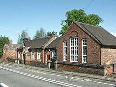 School at Turnditch. |
|
 Turnditch |
|
| Population | 301 (2011) |
|---|---|
| OS grid reference | SK293463 |
| District | Amber Valley |
| Shire county | Derbyshire |
| Region | East Midlands |
| Country | England |
| Sovereign state | United Kingdom |
| Post town | BELPER |
| Postcode district | DE56 |
| Dialling code | 01773 |
| Police | Derbyshire |
| Fire | Derbyshire |
| Ambulance | East Midlands |
| EU Parliament | East Midlands |
| UK Parliament | Amber Valley |
|
|
Coordinates: 53°00′50″N 1°33′50″W / 53.014°N 1.564°W
Turnditch is a village and civil parish in the Amber Valley district of Derbyshire, England. The popyuklation of the civil parish at the 2011 Census was 301.[1] It is located around ten miles north of Derby on the A517 road from Belper to Ashbourne.
It is built on both sides of the road halfway up the steep climb out of the Ecclesbourne Valley. Nearer to the brow of the hill is a place known as Cross o' th' Hands.
In Norman times it was within Duffield Frith and part of the manor of Duffield. The Church of All Saints was built in the 13th century as a chapel of ease to Duffield, while a Congregational chapel with a Sunday school was erected in 1818.[2][3]
References
- ↑ "Civil Parish population 2011". Office for National Statistics. Retrieved 18 March 2016.
- ↑ Daniel and Samuel Lysons (1817) Magna Britannia: volume 5 Pages 129-142 'Parishes: Doveridge - Duffield', http://www.british-history.ac.uk/report.aspx?compid=50727. Date accessed: 24 October 2007.
- ↑ http://www.andrewspages.dial.pipex.com/dby/kelly/turnditch.htm Kelly's Directory of the Counties of Derby, Notts, Leicester and Rutland pub. London (May, 1891) - p.321
External links
![]() Media related to Turnditch at Wikimedia Commons
Media related to Turnditch at Wikimedia Commons