Tumby, Lincolnshire
| Tumby | |
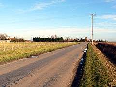 Towards Tumby Woodside |
|
 Tumby |
|
| Population | 203 (2011)[1] |
|---|---|
| OS grid reference | TF242606 |
| – London | 115 mi (185 km) S |
| Civil parish | Kirkby on Bain |
| District | East Lindsey |
| Shire county | Lincolnshire |
| Region | East Midlands |
| Country | England |
| Sovereign state | United Kingdom |
| Post town | Boston |
| Postcode district | PE22 |
| Police | Lincolnshire |
| Fire | Lincolnshire |
| Ambulance | East Midlands |
| EU Parliament | East Midlands |
| UK Parliament | Louth and Horncastle |
|
|
Coordinates: 53°07′42″N 0°08′41″W / 53.128234°N 0.144619°W
Tumby is a village and township in the East Lindsey district of Lincolnshire, England. It is situated approximately 2 miles (3.2 km) north from Coningsby and 6.5 miles (10.5 km) south from Horncastle, and in the civil parish of Kirkby on Bain.
Tumby Woodside
Tumby Woodside is a hamlet about 3 miles (4.8 km) south-east of the village of Tumby. The woods are of oak and larch.[2] In the 15th century it belonged to Ralph, Lord Cromwell, and was also known as Tumby Chase.[3]
Tumby Woodside railway station opened here in 1913 serving the Great Northern Railway, and closed in 1970.[4]
Tumby Moorside
Tumby Moorside is a hamlet about 2 miles (3.2 km) south of Tumby, and 1.5 miles (2.4 km) west of Tumby Woodside. In the 15th century it belonged to Lord Willoughby, who died leaving his estate to his wife, Maud, who then married Sir Thomas Neville, and later Sir Gervaise Clifton.[3] In 1466 Gervaise and Maud Clifton granted Sir Anthony Wydville (or Wydevile), Lord Scales, the manor of Tumby, with the exception of Tumby Woodside which belonged to Ralph, Lord Cromwell.[3]
High House Museum is at Tumby Moorside, and is a Grade II listed building dating from the 18th century.[5] A 17th-century barn located at the farmhouse is also Grade II listed.[6]
Fulsby
Fulsby is a hamlet located on the River Bain north of Tumby. It was listed in Domesday Book of 1086 as having 4 households, 8 acres (32,000 m2) of meadow and 120 acres (0.5 km2) of woodland.[7][8] Most of Fulsby Wood is classified as semi-natural woodland, with the rest as plantation.[9]
In the seventeenth century Fulsby was the home of the Cressey family.[10]
Tumby Wood is a nature reserve and Site of Special Scientific Interest.[11] The rents on a small farm at Fulsby were used by the trustees of the will of Sir John Nelthorpe to maintain Brigg Grammar School, and two poor boys from Legsby or Fulsby were educated, clothed, and looked-after by the school.[12]
References
- ↑ "Parish population 2011". Retrieved 21 August 2015.
- ↑ "Kellys Directory" (PDF). Kellys Directories Ltd. 1919. p. 581. Retrieved 27 April 2011.
- 1 2 3 Oldfield, Edmund (1829). A Topgraphical & Historical Account of Wainfleet & the Wapentake of Candleshoe, in the County of Lincolnshire. Longman, Rees, Orme, Browne and Green. p. 129. Retrieved 27 April 2011.
- ↑ "Disused Stations". Disused Stations. Retrieved 27 April 2011.
- ↑ "High House Farmhouse, Tumby". British Listed Buildings. Retrieved 27 April 2011.
- ↑ "Barn at High House Farmhouse, Tumby". British Listed Buildings. Retrieved 27 April 2011.
- ↑ "Fulsby". Domesday Map. Anna Powell-Smith/University of Hull. Retrieved 22 July 2011.
- ↑ Historic England. "Fulsby (352865)". PastScape. Retrieved 22 July 2011.
- ↑ "Fulsby Wood". Lincs to the Past. Lincolnshire Archives. Retrieved 22 July 2011.
- ↑ Notes and Queries: 168. 2 March 1912. Missing or empty
|title=(help) - ↑ "Fulsby Wood" (PDF). English Nature. English Nature. Retrieved 22 July 2011.
- ↑ Carlisle, Nicholas (1818). A concise description of the endowed grammar schools in England and Wales. Baldwin Cradock and Joy. p. 800. Retrieved 22 July 2011.
External links
 Media related to Tumby, Lincolnshire at Wikimedia Commons
England Portal | |
| Unitary authorities | |
| Boroughs or districts | |
| Major settlements |
|
| Topics | |