Troy Township, Perry County, Indiana
| Troy Township | |
|---|---|
| Township | |
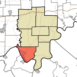 Location in Perry County | |
| Coordinates: 37°57′38″N 86°42′53″W / 37.96056°N 86.71472°WCoordinates: 37°57′38″N 86°42′53″W / 37.96056°N 86.71472°W | |
| Country |
|
| State |
|
| County | Perry |
| Government | |
| • Type | Indiana township |
| Area | |
| • Total | 44.31 sq mi (114.8 km2) |
| • Land | 43.04 sq mi (111.5 km2) |
| • Water | 1.27 sq mi (3.3 km2) 2.87% |
| Elevation | 518 ft (158 m) |
| Population (2010) | |
| • Total | 11,965 |
| • Density | 278/sq mi (107/km2) |
| ZIP codes | 47520, 47586, 47588 |
| GNIS feature ID | 0453903 |
Troy Township is one of seven townships in Perry County, Indiana, United States. As of the 2010 census, its population was 11,965 and it contained 5,746 housing units[1] (almost two thirds of the overall county population).
Geography
According to the 2010 census, the township has a total area of 44.31 square miles (114.8 km2), of which 43.04 square miles (111.5 km2) (or 97.13%) is land and 1.27 square miles (3.3 km2) (or 2.87%) is water.[1]
Cities, towns, villages
Unincorporated towns
- Fenn Haven at 37°55′53″N 86°45′24″W / 37.931445°N 86.756655°W
(This list is based on USGS data and may include former settlements.)
Cemeteries
The township contains these seven cemeteries: Bolin, Cliff, Greenwood, Log Church, Powell, Saint Michaels and Saint Pius.
Major highways
Lakes
- Echo Lake
- Fenn Haven Lake
School districts
- Cannelton City Schools
- Tell City-Troy Township School Corporation
Political districts
- State House District 74
- State Senate District 47
References
- "Troy Township, Perry County, Indiana". Geographic Names Information System. United States Geological Survey. Retrieved 2009-11-21.
- United States Census Bureau 2009 TIGER/Line Shapefiles
- IndianaMap
- 1 2 "Population, Housing Units, Area, and Density: 2010 - County -- County Subdivision and Place -- 2010 Census Summary File 1". United States Census. Retrieved 2013-05-10.
External links
- Indiana Township Association
- United Township Association of Indiana
- City-Data.com page for Troy Township
 |
Huff Township, Spencer County | Anderson Township | | |
| Lewisport Township, Hancock County, Kentucky | |
Tobin Township | ||
| ||||
| | ||||
| Hawesville Township, Hancock County, Kentucky |
Municipalities and communities of Perry County, Indiana, United States | ||
|---|---|---|
| Cities | ||
| Town | ||
| Townships | ||
| Unincorporated communities |
| |
This article is issued from Wikipedia - version of the 8/12/2015. The text is available under the Creative Commons Attribution/Share Alike but additional terms may apply for the media files.