Trombay
| Trombay Turbhe | |
|---|---|
| suburb | |
 Trombay Location in Mumbai, India | |
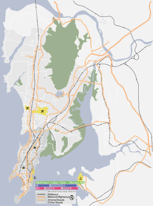
| Coordinates: 19°00′N 72°54′E / 19.0°N 72.9°ECoordinates: 19°00′N 72°54′E / 19.0°N 72.9°E | |
| Country |
|
| State | Maharashtra |
| District | Mumbai Suburban |
| Metro | Mumbai |
| Languages | |
| • Official | Marathi |
| Time zone | IST (UTC+5:30) |
Trombay is a northeastern suburb in Mumbai, India, with Mankhurd as the closest railway station on the Harbour Line of the Mumbai Suburban Railway.
History
Trombay was called Neat's Tongue because of its shape. Once, it was an island nearly 5 km East of Mumbai and was about 8 km in length and 8 km in width. The island contains several ruins of Portuguese churches from the 1620s and 1630s.[1]

In 1928, the Great Indian Peninsular Railway opened the Trombay-Andheri line called the Salsette Trombay Railway or Central Salsette Tramway.[2]
The original inhabitants of Trombay were fisherman (Kolis) - due to its proximity to the Thane creek and the Arabian Sea. It was called as "Turbhe" (not to be confused with another area called Turbhe in Navi Mumbai) in the local language. Dattanagar, It is a leprosy colony near trombay. Paylipada, near Trombay Village, is also very old, having one of the oldest masjid in Mumbai.Trombay gaothan is old village of Koli family. Paylipada has majority Muslim population. In 1976, the Janata Colony area was relocated by BARC by order of the central government and formed as Cheetah Camp.
Demographics
Starting out as an industrial area, Trombay is still known more for its industries than a residential suburb but this is fast changing. Trombay has a cosmopolitan population that is dominated by Tamilians and Maharashtrians followed by Keralites, Punjabis, Sindhis and Gujaratis.
Anushakti Nagar is the residential colony of Bhabha Atomic Research Centre.
Landmarks

- Bhabha Atomic Research Centre (BARC): India's first nuclear research facility
- Cheeta Camp
- Mandala Village
Cheeta Camp
Cheeta Camp: Relocated by BARC in 1976, thousands of middle-class family moved to a new area, which was named as Cheeta Camp. Mostly people from South India, such as Tamil Nadu and Kerala, as well as other states settled here. Even though it is a slum area, it is far better in terms of good quality lifestyle and hygienic environment. Pollution levels are minimal in this area as it is away from major roads and industrial areas, which are the main causes of pollution. Cheeta Camp faces a hill on one side and Arabian Sea on the other.
Before, the area was populated mainly by the poor and lower-middle-class people, but currently the new generation of Cheeta Camp is well educated. Moreover, a lot of them are IT Professionals. They have upgraded their lifestyle and can afford houses in developed, upmarket and posh localities. Still they love this area. In this so-called Chawl area, people enjoy their living. Social Life is very active and people from all religions stay united. Interestingly, even though most of Mumbai was afflicted by the 1992 communal riots, Cheeta Camp remained safe & secure. After this, many families moved here to settle, including those from downtown Mumbai. The majority of the population is from South India.
Paylipada
Paylipada, this name formed by Payri (coin currency) and Pada (village), which established by Portuguese Government for making coin currency factory near by Paylipada lake, Paylipada village, settled ground of Mandala Hill, which is famous for oldest Portuguese church on hill top (now its area is undertaken by BARC and Indian Navy).
See also
References
- ↑ Gazetteers of the Bombay Presidency - Thana - http://www.maharashtra.gov.in/pdf/gazeetter_reprint/Thane-III/places_Trombay.html - Retrieved on December 3, 2010.
- ↑ Times of India - Chembur-Ghatkopar Plus - http://chemburghatkoparplus.mumbaimirror.com/index.aspx?Page=article&comments=true§name=News§id=1&contentid=2010022720100225173641113f0b4d1d4 - Retrieved on December 3, 2010