Trolltunga
| Trolltunga | |
|---|---|
 The view of Trolltunga and Ringedalsvatnet with glimpses of the Folgefonna glacier in the background. | |
| Highest point | |
| Elevation | 604 m (1,982 ft) |
| Coordinates | 60°07′51″N 6°45′15″E / 60.13083°N 6.75417°ECoordinates: 60°07′51″N 6°45′15″E / 60.13083°N 6.75417°E |
| Naming | |
| Translation | Troll tongue (Norwegian) |
| Geography | |
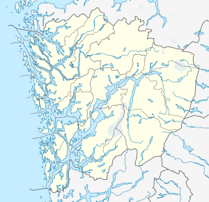 Trolltunga Location in Hordaland | |
| Topo map | Hardangervidda Vest (2010) |
| Geology | |
| Mountain type | Granite penetrated by glacial erosion |
Trolltunga (Troll tongue) is a piece of rock jutting horizontally out of a mountain about 700 metres (2,300 ft) above the north side of the lake Ringedalsvatnet[1] in the municipality of Odda in Hordaland county, Norway. The cliff is located east of the Skjeggedal area, about 10 kilometres (6.2 mi) east of the village of Tyssedal and the Sørfjorden (a branch off of the main Hardanger Fjord.
Formation
The cliff is part of the precambrian bedrock and was formed during the ice age, approximately 10,000 years ago, when the edges of the glacier reached the cliff. The water from the glacier froze in the crevices of the mountain and eventually broke off large, angular blocks, which were later carried away with the glacier. Along the cliff itself, a gneiss, there continues to be deep cracks. The trail to Trolltunga also passes through the bedrock and washed slippery hillsides in the background also containing gneiss.
Access
Trolltunga is available for hikers from approximately mid-June to mid-September. According to the Norwegian Trekking Association, a fit adult can do the hike in 8 to 10 hours in total, while the local tourist office rates it as a 10 to 12 hour hike and that the hike should start before 10:00 am.[2] The hike is about 22 kilometers, with a height difference of about 900 meters. The Norwegian Trekking Association rates the hike as "challenging", requiring good endurance as well as proper hiking boots and equipment.[3]
Trolltunga is located 17 kilometres from city centre in Odda, Hordaland, a county in Western Norway. The city of Bergen, the second largest in Norway, is located about 190 kilometres from the site via main roads. To reach the trail from national road 13, turn eastward in Tyssedalen away from the fjord up towards Hardangervidda, and drive the narrow but good road about 7 km up Skjeggedal. The road to the site ends at a parking facility near the dam at the end of Ringedalsvatnet 443 meters above sea level. There is a car park where Mågelibanen (a trolley car) started, though it is no longer in operation. The path up to Måglitoppen begin on the right of the cart path on the stairwell. There is a steep trail that rises about 410 meters up the first 1.5 kilometers up to the Måglitopp. Here the track surfaces slightly out before raising up Gryteskaret, another 330 meters to the highest point on the first part of the route 4 kilometers from the startingpoint, at Trombåskaret (1183 meters above sealevel).[3]
The next section slopes down towards Store Floren, getting sight of the drop towards the valley floor containing Ringedalsvatnet and an increasing number of glimpses by the Folgefonna glacier in the west. The area has typical mountain vegetation of small plants and flowers. Here there are masonry remains after a stable for horses used by plant construction operations for power development in the early 1900s. Further along the track continues over Hesteflåene and the dried out river Endåno. In this area there are traces of prior construction activities. The path continues steeply up to Endanuten, the highest part (being 1214 meters above sea level) and crosses the dried river to Tyssestrengene. This was a twin waterfall of 300 meters free fall, which would have been Norway's highest. These two waterfalls were built over and placed in tubes in 1967. It is possible to take a detour to the edge and look down towards Ringedalsvatnet. The path goes on past glacial potholes, then continues past Tysshøl, and finally approaches Trolltunga.
There are other significant geological features and settlements around Ringedalsvatnet.
Popularity of the trail and rock formations has increased in recent years, with up to 500 visitors a day.[1][3][4][5]
A U.S. internet magazine listed this place as number one in the world where an impressive selfie can be taken.[6][7]
Safety
Thousands of tourists visit Trolltunga during the four summer months, a number which has greatly increased from 500 per year to 40,000 between 2009 and 2014.[8] No safety railing has been constructed on the edge of the cliff so as not to harm the natural beauty of the cliff, although a few small metal hooks have been installed as footholds to climb down to the actual rock. On 5 September 2015, a 24-year-old Australian woman fell to her death off Trolltunga. It is believed to be the first recorded death from a fall there.[8][9][10]
Climate
Along the fjord there is a mild and humid coastal climate. There could be snow at the Trolltunga during summertime if there has been a hard winter.
Surrounding landscape
The cliff overlooks the valleys of the Hardanger region. The mountains surrounding the cliff reach heights of up to 1500 meters. Some of the hilltops have plains which are interspersed with lakes. Patches of snow are present in some areas, even in the summer months. Due to heavy use by tourists, the trail to Trolltunga quickly turns to mud after a rain in the summer.
Gallery
 'Trolltunga' in Odda
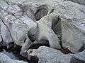 Lunar landscape of 'Jettegryter', Glacial potholes, nearby 'Trolltunga'
See also
- Kjerag
- Kjeragbolten
- Preikestolen
- Trollgaren
- De syv søstre
- Trollveggen
- Trollstigen
- Besseggen
- List of waterfalls
- National parks of Norway
References
- 1 2 Faltin, Tine (14 September 2013). "Jeg har møtt turister som reiser hit på helgetur fra New York og Korea. Stor kåring: To av verdens ti beste fotturer ligger i Norge" (in Norwegian). Dagbladet. Retrieved 12 October 2013.
- ↑ "Hiking to Trolltunga". Odda Tourist Offce. Retrieved 10 September 2016.
- 1 2 3 "Til Trolltunga" (in Norwegian). UT.no. Retrieved 12 October 2013.
- ↑ Giæver, Ole Peder (31 July 2013). "Hopper og spretter på Trolltunga: Våghalser utfører stunt på spissen av Trolltunga i Odda. Se de flotte bildene" (in Norwegian). ABCnyheter.no. Retrieved 12 October 2013.
- ↑ Hjelle, Jo (4 October 2011). "Trolltunga trekkjer til seg tusener: For to år siden var det knapt en kjeft her på Trolltunga i Hardanger. Fiffig markedsføring har gitt turiststraum" (in Norwegian). Bergens Tidende. Retrieved 12 October 2013.
- ↑ The 17 Most Stunning Places In The World To Take A Selfie (BuzzFeed, 17 March 2014)
- ↑ Trolltunga, Norway Is The Scariest Instagram Spot On Earth (Huffington Post, 16 November 2013)
- 1 2 "Trolltunga photos removed after fatal fall". Stuff.co.nz. 2015-09-14. Retrieved 2015-09-27.
- ↑ "Kvinne i 20-årene døde etter fall fra Trolltunga - Aftenposten". Aftenposten.no. 2014-01-31. Retrieved 2015-09-27.
- ↑ "Mother of Kristi Kafcaloudis mourns loss of 'beautiful soul' who died in 300-metre cliff fall in Norway". ABC News. Australian Broadcasting Corporation. 8 September 2015. Retrieved 8 September 2015.
External links
| Wikimedia Commons has media related to Trolltunga. |
- Hiking Trolltunga from Odda Tourist Office
- About Trolltunga from Fjord Norway, the official tourist board of Western Norway
- Til Trolltunga Tour suggestions on UT.no (in Norwegian)