Tripoli, Greece
| Tripoli Τρίπολη | |
|---|---|
|
Central square with the Court House, designed by Ernst Ziller | |
 Tripoli | |
|
Location within the region 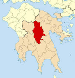 | |
| Coordinates: 37°31′N 22°23′E / 37.517°N 22.383°ECoordinates: 37°31′N 22°23′E / 37.517°N 22.383°E | |
| Country | Greece |
| Administrative region | Peloponnese |
| Regional unit | Arcadia |
| Government | |
| • Mayor | John Smirniotis |
| Area | |
| • Municipality | 1,475.8 km2 (569.8 sq mi) |
| • Municipal unit | 119.3 km2 (46.1 sq mi) |
| Elevation | 655 m (2,149 ft) |
| Population (2011)[1] | |
| • Municipality | 47,254 |
| • Municipality density | 32/km2 (83/sq mi) |
| • Municipal unit | 33,785 |
| • Municipal unit density | 280/km2 (730/sq mi) |
| Community[1] | |
| • Population | 30,912 (2011) |
| Time zone | EET (UTC+2) |
| • Summer (DST) | EEST (UTC+3) |
| Postal code | 221 00 |
| Area code(s) | 2710 |
| Vehicle registration | ΤΡ |
| Website | www.tripolis.gr |

Tripoli (Greek: Τρίπολη, Trípoli, formerly Τρίπολις, Trípolis; earlier Τριπολιτσά Tripolitsa) is a city in the central part of the Peloponnese, in Greece. It is the capital of the Peloponnese region as well as of the regional unit of Arcadia. The homonym municipality has around 47,000 inhabitants.
Etymology
In the Middle Ages the place was known as Drobolitsa, Droboltsá, or Dorboglitza, either from the Greek Hydropolitsa, 'Water City' or perhaps from the South Slavic for 'Plain of Oaks'.[2][3] The association made by 18th- and 19th-century scholars with the idea of the "three cities" (Τρίπολις, τρεις πόλεις "three cities": variously Callia, Dipoena and Nonacris, mentioned by Pausanias without geographical context,[4] or Tegea, Mantineia and Pallantium, or Mouchli, Tegea and Mantineia[5] or Nestani, Mouchli and Thana), were considered paretymologies by G.C. Miles.[6] An Italian geographical atlas of 1687[7] notes the fort of Goriza e Mandi et Dorbogliza; a subsequent Italian geographical dictionary of 1827 attributes the name Dorbogliza to the ruins of Mantineia (Mandi) and states that it is located north of Tripolizza.[8]
The Ottoman Turks referred to the town and the district as Tripoliçe.
History

In spring 1770 during a Greek uprising known as Orlov Revolt, the revolutionary armies were halted out of Tripolitsa. As a retaliation of the Greek uprising Albanian mercenaries of the Ottomans slaughtered 3,000 Greeks in a few hours upon entering the city. Total massacre and destruction of the city was avoided after intervention of Osman bey, leader of the Albanian mercenaries.[9]
Before the Greek War of Independence, under the Ottoman name of "Tripoliçe", it was one of the Ottoman administrative centers in the Peloponnese (the Morea Eyalet, often called "pashalik of Tripolitsa") and had large Muslim and Jewish populations. Tripolis was one of the main targets of the Greek insurgents in the Greek War of Independence, who stormed it on 17 October 1821, following the bloody Siege of Tripolitsa, and exterminated the Muslim and Jewish populations in revenge.[10][11]
Ibrahim Pasha retook the city on June 22, 1825, after it had been abandoned by the Greeks. Before he evacuated the Peloponnese in early 1828, he destroyed the city and tore down its walls.[12]
After the independent Greek state was established in 1830, Tripoli was rebuilt and was developed as one of the main cities of the Kingdom of Greece, serving as the capital of the Arcadia district. During the 19th and the 20th centuries the city emerged to be the administrative, economic, commercial and transportation center of central and south Peloponnese.[13]
Geography and climate
The city of Tripolis has a mediterranean climate (Köppen: Csa). Tripoli is in the center of the Peloponnese, in a broad montane basin at about 650 m in altitude. Tripolis is surrounded by thickly wooded mountains on all sides, the tallest and closest of which is Mount Mainalon to the northwest. The southwest of the Tripolis basin formerly consisted of wetlands which have now been drained and converted to farmland. Because of its inland location and high altitude, Tripolis has a transitional mediterranean/continental climate with hot dry summers and cold winters. Summer temperatures can exceed 38 °C (100 °F) and in winter temperatures below −10 °C (14 °F) have been observed. Snow or sleet can occur several times between late October and early April.
Its main plazas are aligned with the main street and with a highway linking to Pyrgos and Patras. One of them is named Kennedy, the other is named Georgiou B' (George II). The southern part has its main street named Washington. The main section of the city is enclosed around the castle walls that were built during the Ottoman occupation of Greece. An industrial park has been built in the southwest.
| Climate data for Tripolis | |||||||||||||
|---|---|---|---|---|---|---|---|---|---|---|---|---|---|
| Month | Jan | Feb | Mar | Apr | May | Jun | Jul | Aug | Sep | Oct | Nov | Dec | Year |
| Record high °C (°F) | 20.4 (68.7) |
24.2 (75.6) |
25.4 (77.7) |
29.8 (85.6) |
36.6 (97.9) |
39.8 (103.6) |
42.2 (108) |
39.8 (103.6) |
35.4 (95.7) |
33.8 (92.8) |
26.8 (80.2) |
22.6 (72.7) |
42.2 (108) |
| Average high °C (°F) | 9.4 (48.9) |
10.3 (50.5) |
13.0 (55.4) |
17.3 (63.1) |
22.7 (72.9) |
27.6 (81.7) |
30.1 (86.2) |
29.9 (85.8) |
26.5 (79.7) |
20.3 (68.5) |
15.5 (59.9) |
11.1 (52) |
19.48 (67.05) |
| Daily mean °C (°F) | 5.1 (41.2) |
5.7 (42.3) |
8.0 (46.4) |
11.9 (53.4) |
17.0 (62.6) |
21.9 (71.4) |
24.5 (76.1) |
23.9 (75) |
20.1 (68.2) |
14.4 (57.9) |
10.0 (50) |
6.7 (44.1) |
14.1 (57.38) |
| Average low °C (°F) | 0.9 (33.6) |
1.4 (34.5) |
2.6 (36.7) |
5.1 (41.2) |
8.2 (46.8) |
11.9 (53.4) |
14.3 (57.7) |
14.4 (57.9) |
11.7 (53.1) |
8.2 (46.8) |
5.0 (41) |
2.7 (36.9) |
7.2 (44.97) |
| Record low °C (°F) | −17.0 (1.4) |
−15.8 (3.6) |
−16.0 (3.2) |
−4.0 (24.8) |
−0.2 (31.6) |
4.0 (39.2) |
7.6 (45.7) |
7.8 (46) |
0.4 (32.7) |
−2.6 (27.3) |
−5.8 (21.6) |
−11.0 (12.2) |
−17.0 (1.4) |
| Average precipitation mm (inches) | 119.2 (4.693) |
100.4 (3.953) |
72.3 (2.846) |
59.2 (2.331) |
35.4 (1.394) |
24.8 (0.976) |
18.9 (0.744) |
15.6 (0.614) |
24.7 (0.972) |
78.6 (3.094) |
114.0 (4.488) |
147.7 (5.815) |
810.8 (31.92) |
| Average precipitation days | 13.7 | 12.8 | 12.5 | 11.5 | 9.2 | 6.1 | 4.0 | 3.3 | 4.8 | 9.8 | 11.9 | 15.6 | 115.2 |
| Average relative humidity (%) | 76.1 | 74.4 | 69.3 | 62.5 | 57.0 | 47.4 | 44.1 | 45.9 | 54.5 | 75.4 | 77.4 | 77.5 | 63.46 |
| Source: Hellenic National Meteorological Service [14] | |||||||||||||
Municipality

The municipality of Tripoli was formed at the 2011 local government reform by merging these 8 former municipalities, that became municipal units:[15]
The municipality has an area of 1,475.805 km2, the municipal unit 119.287 km2.[16]
Subdivisions
The municipal unit of Tripoli is subdivided into these communities:
- Agios Vasileios
- Agios Konstantinos
- Evandro
- Makri
- Merkovouni
- Pallantio
- Pelagos
- Perthori
- Skopi
- Thanas
- Tripoli
Education
Tripoli is the seat of the recently founded University of the Peloponnese with two departments of the Sciences and Technology School and one department of the Economics and Administration School.
Transportation
Because it is at the centre of the Peloponnese, Tripolis is a transportation hub. Corinth is 75 kilometres (47 miles) NE, Pyrgos 145 kilometres (90 mi) E, Patras 144 km (89 mi) NW, Kalamata 65 km (40 mi) SW, and Sparti 60 km (37 mi) S.
Tripoli is mainly accessed from Athens and the rest of Greece through the Corinth-Tripoli-Kalamata motorway, known as the Moreas Motorway (A7). An alternative route is the GR-7 which used to be the main highway to Tripoli before the construction of the motorway. The city is also accessed by GR-74 and GR-76 from Pyrgos and by GR-39 from Sparta.
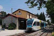
Tripoli is served by the metre gauge railway line from Corinth to Kalamata of the Hellenic Railways Organisation (OSE). The line was renovated and passenger services to Árgos and Corinth, which had been suspended for a few years, were reinstated in 2009. However, in December 2010 services ceased again due to the general suspension of railway services in the Peloponnese.
Military
Tripoli is home to the two largest Armed Forces bootcamp centers of Greece, one for the Hellenic Army and one for the Hellenic Air Force
- 251 Army Training Battalion (Greek)
- 124 Basic Training Wing (Greek)
Sports
Tripoli hosts three sport clubs with presence in the higher national divisions in Greek football and basketball. These clubs are shown below.
| Sport clubs based in Tripoli | |||
|---|---|---|---|
| Club | Founded | Sports | Achievements |
| Panarkadikos F.C. | 1927 | Football | Earlier presence in Beta Ethniki |
| Asteras Tripolis | 1931 | Football | Presence in A Ethniki |
| Arkadikos B.C. | 1976 | Basketball | Presence in A2 Ethniki |
In popular culture
The Siege of Tripolitsa was made famous in the folk (Δημοτικό) song "40 παλικάρια από την Λιβαδειά" (Forty lads from Livadhia)[17]
Historical population
| Year | Community | Municipal unit | Municipality |
|---|---|---|---|
| 1981 | 21,337 | – | – |
| 1991 | 22,429 | 26,432 | – |
| 2001 | 25,520 | 28,976 | – |
| 2011 | 30,912 | 33,785 | 47,254 |
Famous people

- Konstantinos Georgakopoulos (1890–1978), lawyer and politician, Prime Minister of Greece
- Moralı Enişte Hasan Pasha (1658–1713), Ottoman vizier and general
- Kostas Karyotakis (1896–1928), poet
- Theodoros Kolokotronis (3 April 1770 – 4 February 1843), general and pre-eminent leader of the Greek War of Independence
- Ioannis Kossos, sculptor
- Yiannis Kouros (1956), ultramarathon runner
- Konstantinos Manetas (1879–1960), general and politician
- Theodoros Manetas (1881–1947), general and politician
- Alexandros Papanastasiou (1876–1936), politician and sociologist, Prime Minister of Greece
- George Peponis, medical practitioner, sports administrator and former captain of the Australian Rugby League team was born in the town in 1953
- Stavros Tsiolis (1937), film director
- Petros Tatoulis (1953), politician
- Electros Vekris (1950), artist
International relations
Twin towns — sister cities
Tripoli, Greece is twinned with:
Gallery
 Statue of General Theodoros Kolokotronis.
 Agios Vasilios, Tripoli's cathedral.
- Train station
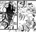 Tripolizza by François Pouqueville
References
- 1 2 "Απογραφή Πληθυσμού - Κατοικιών 2011. ΜΟΝΙΜΟΣ Πληθυσμός" (in Greek). Hellenic Statistical Authority.
- ↑ R. M. Dawkins, The Place-names of Later Greece, in Transactions of the Philological Society, November 1933, p. 19–20
- ↑ George C. Miles, The Athenian Agora, vol. 9, 1962, p 12 (Miles considers "Hydropolitsa" a popularization)
- ↑ Description of Greece, Arcadia, 8.27.4
- ↑ Leake, Travels in the Morea, Volume 2
- ↑ George C. Miles, The Athenian Agora vol.9, 1962, p 12
- ↑ La Morea, 1687, Marescotti
- ↑ Nuovo Dizionario Geografico Universale, Cavagna Sanguliani, 1827, page 827
- ↑ Nikolaou, Georgios (1997). "Islamisations et Christianisations dans le Peloponnese (1715- 1832)". didaktorika.gr. Universite des Sciences Humaines - Strasbourg II: 181. doi:10.12681/eadd/8139. Retrieved 12 December 2015.
Les Albanais, qui avaient pris l'initiative des opérations, sont entrés à Tripolitsa, ont massacre les habitants et se sont adonnés au pillage. On évalue qu'en l'espace de quelques heures seulement 3.000 Grecs furent tués. Grâce à l'intervention du chef des Albanais Osman bey, l'extermination et la dévastation ne furent pas totales.
- ↑ Nevill Forbes, et al., The Balkans (full text)
- ↑ Theodoros Kolokotronis, Apomnimoneumata
- ↑ John Hartley, Researches in Greece and the Levant, p 341
- ↑ http://www.visitgreece.gr/en/main_cities/tripoli
- ↑ "Mean Tripolis Climatic Averages". Hellenic National Meteorological Service. Retrieved 31 August 2014.
- ↑ Kallikratis law Greece Ministry of Interior (Greek)
- ↑ "Population & housing census 2001 (incl. area and average elevation)" (PDF) (in Greek). National Statistical Service of Greece.
- ↑
External links
- http://www.cs.bham.ac.uk/~gkt/www/tripoli.html
- http://arcadia.ceid.upatras.gr/arkadia/places/trip/tripoli.htm (in Greek)
- Weather in Tripoli (in Greek)
- Mapquest – Tripoli
- GTP – Tripoli
- GTP – Municipality of Tripoli
 |
Mantineia | | ||
| Falanthos | |
Korythio | ||
| ||||
| | ||||
| Valtetsi | Tegea |
| Regional unit of Arcadia | 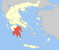 | |
|---|---|---|
| Regional unit of Argolis | ||
| Regional unit of Corinthia | ||
| Regional unit of Laconia | ||
| Regional unit of Messenia | ||
| ||