Trehafod
| Trehafod | |
 |
|
 Trehafod |
|
| Population | 498 (2011)[1] |
|---|---|
| OS grid reference | ST044909 |
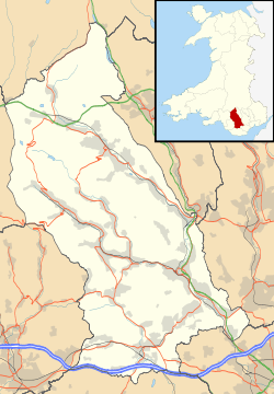
| Principal area | Rhondda Cynon Taf |
| Ceremonial county | Mid Glamorgan |
| Country | Wales |
| Sovereign state | United Kingdom |
| Post town | PONTYPRIDD |
| Postcode district | CF37 |
| Dialling code | 01443 |
| Police | South Wales |
| Fire | South Wales |
| Ambulance | Welsh |
| EU Parliament | Wales |
| UK Parliament | Rhondda and Pontypridd |
| Welsh Assembly | Rhondda and Pontypridd |
|
|
Coordinates: 51°36′35″N 3°22′52″W / 51.6096°N 3.3811°W
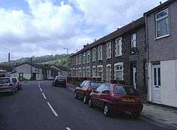
Trehafod is a village and community in the Rhondda Valley between Porth and Pontypridd in the county borough of Rhondda Cynon Taf, Wales, although in administrative terms is split between the electoral division of Cymmer (Rhondda) to the West and Rhondda (Pontypridd) to the East. A former coal mining area, the village is now best known as the site of the Rhondda Heritage Park, a tourist attraction reflecting industrial life of coal mining Rhondda.
History
The 1847 tithe map of the area shows a number of farms on the area that was to become Trehafod, these were named, Hafod Uchaf, Hafod Ganol and Hafod Fawr. It was from these farms that Trehafod was to take its name. Hafod is a Welsh word that can mean "summer dwelling" or "upland farm".
Trehafod railway station lies on the Rhondda Line which follows the River Rhondda; the railway line and river border the village on either side.
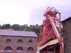
Trehafod is now most famous for the Rhondda Heritage Park which was once the Lewis Merthyr colliery, at the peak time for coal mining production, one of the most productive collieries in the South Wales Coalfield.
Due to the river flowing very close to a lot of houses within the village there have been a number of floodings. The biggest floods were in 1960, which claimed the life of one man who lived in Afon street. Afon is a Welsh word that means river. In most streets, the whole lower level of buildings was submerged by water. Other years that floodings have occurred were 1921, 1929, 1979 and most recently in the mid 1990s. In the late 1990s the Trehafod stretch of the Rhondda river bank was reinforced, in an effort to prevent future floodings.
External links
- Pictures of events in Trehafod
- Trehafod
- Welsh Coal Mines website - research the local pit history
- www.geograph.co.uk : photos of Trehafod and surrounding area
References
- ↑ "Community population 2011". Retrieved 15 November 2015.
 |
| |||
| Cymmer, Porth | |
Hopkinstown, Pontypridd | ||
| ||||
| | ||||
Villages and towns of the Rhondda Valley | ||
|---|---|---|
| Rhondda Fawr | 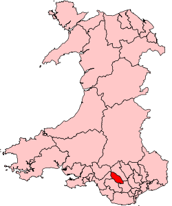 | |
| Rhondda Fach | ||