Trams in Essen
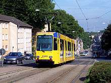 An M8C tram at Hobeisenbrücke. | |||
| Operation | |||
|---|---|---|---|
| Locale | Essen, North Rhine-Westphalia, Germany | ||
| Open | 23 August 1893 | ||
| Status | Operational | ||
| Lines | 7[1] | ||
| Operator(s) | Essener Verkehrs-AG (EVAG) | ||
| Infrastructure | |||
| Track gauge | 1,000 mm (3 ft 3 3⁄8 in)[1] | ||
| Propulsion system(s) | Electricity | ||
| Electrification | 750 V DC | ||
| Statistics | |||
| Route length | 52.4 km (32.6 mi)[1] | ||
| |||
| Website | Essener Verkehrs-AG (EVAG) (German) | ||

The Essen tramway network (German: Straßenbahnnetz Essen) is a 52.4-kilometer (32.6 mi)[1] network of tramways forming part of the public transport system in Essen, a city in the federal state of North Rhine-Westphalia, Germany.
Opened in 1893, the network has been operated since 1954 by Essener Verkehrs-AG (EVAG), and also serves the neighbouring city of Gelsenkirchen.
The network is complemented by the three light rail lines of the Essen Stadtbahn.
Lines
As of November 2010, the 52.4-kilometer (32.6 mi) tram network consisted of the following seven lines:[1]
Line | Route | Headway Mon.-Fri. | Headway Sat. | Headway Sun. |
| 101 | (Bredeney – Rüttenscheid –) Essen Hbf – Bergeborbeck Bf – Borbeck Germaniaplatz | 10 | 15 | 30/15 |
| 103 | Dellwig Wertstr. – Borbeck – Altendorf – Rathaus Essen – Essen Hbf/Hollestraße (– Huttrop – Steele (S))1 | 10 | 15 | 30/15 |
| 104 | MH-Flughafen – Stadtmitte – MH-Grenze Borbeck – E-Schönebeck Abzw. Aktienstr.2 | 10/20 | 15/30 | 30 |
| 105 | Frintrop Unterstr. – Altendorf – Essen Hbf – Bergerhausen – Rellinghausen Finefraustr. | 10 | 15 | 30/15 |
| 106 | Altenessen Bf – Rathaus Essen – Essen Hbf – Rüttenscheid – Essen West (S) – Helenenstr. (– Bergeborbeck Bf) | 10 | 15 | 15 |
| 107 | Gelsenkirchen Hbf – Feldmark – E-Katernberg – Abzweig Katernberg – Zollverein – Stoppenberg – Rathaus Essen – Hollestr./Essen Hbf – Rüttenscheid – Bredeney (KulturLinie 107)3/4 | 20/10/5 | 30/15 | 30/15 |
| 109 | Frohnhausen Breilsort – Alfred Krupp Schule – Berliner Platz – Rathaus Essen – Huttrop – Steele (S) | 10 | 15 | 15 |
Sections with shorter headways in Bold, sections with longer headways in italics.
1 During rush hour via Hollestraße to Steele, at shoulder times only to Hollestraße. and in off peak times Rathaus Essen to Essen Hbf.
2 Line is operated jointly by EVAG/MVG.
3 Line is operated jointly by EVAG/BOGESTRA (almost exclusively with EVAG rolling stock).
4 Extra services during rush hour from Rathaus Essen to Hollestraße, other services from Rathaus via Hbf. to Bredeney.
See also
References
Inline references
Bibliography
- Höltge, Dieter (1994). Straßen- und Stadtbahnen in Deutschland [Tramways and Stadtbahnen in Germany] (in German). Band 4: Ruhrgebiet - Von Dortmund bis Duisburg [Volume 4: Ruhr - from Dortmund to Duisburg]. Freiburg i. B., Germany: EK-Verlag. ISBN 9783882553345.
- Schwandl, Robert (2012). Schwandl's Tram Atlas Deutschland (in German and English) (3rd ed.). Berlin: Robert Schwandl Verlag. pp. 52–54. ISBN 9783936573336.
External links
![]() Media related to Trams in Essen at Wikimedia Commons
Media related to Trams in Essen at Wikimedia Commons
- Essen database / photo gallery and Essen tram list at Urban Electric Transit – in various languages, including English.
- Essen database / photo gallery at Phototrans – in various languages, including English.
| Baden-Württemberg |  | |
|---|---|---|
| Bavaria | ||
| Berlin | ||
| Brandenburg |
| |
| Bremen | ||
| Hesse | ||
| Lower Saxony | ||
| Mecklenburg-Vorpommern | ||
| North Rhine-Westphalia | ||
| Rhineland-Palatinate | ||
| Saarland | ||
| Saxony | ||
| Saxony-Anhalt | ||
| Thuringia | ||
| ||
Urban public transport networks and systems in Germany | ||
|---|---|---|
| S-Bahn |    | |
| U-Bahn | ||
| Stadtbahn | ||
| Trams |
| |
| Trolleybuses | ||
| Suspension monorails | ||
| Other | ||
| ||
Coordinates: 51°26′14″N 07°00′04″E / 51.43722°N 7.00111°E