Tourlaville
| Tourlaville | |
|---|---|
|
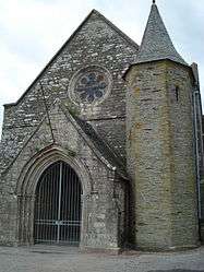
The church of Notre-Dame | |
 Tourlaville | |
|
Location within Normandy region  Tourlaville | |
| Coordinates: 49°38′30″N 1°34′39″W / 49.6417°N 1.5775°WCoordinates: 49°38′30″N 1°34′39″W / 49.6417°N 1.5775°W | |
| Country | France |
| Region | Normandy |
| Department | Manche |
| Arrondissement | Cherbourg |
| Canton | Tourlaville |
| Government | |
| • Mayor (2008–2014) | André Rouxel |
| Area1 | 17.19 km2 (6.64 sq mi) |
| Population (2006)2 | 16,649 |
| • Density | 970/km2 (2,500/sq mi) |
| Time zone | CET (UTC+1) |
| • Summer (DST) | CEST (UTC+2) |
| INSEE/Postal code | 50602 / 50110 |
| Elevation |
0–132 m (0–433 ft) (avg. 127 m or 417 ft) |
|
1 French Land Register data, which excludes lakes, ponds, glaciers > 1 km² (0.386 sq mi or 247 acres) and river estuaries. 2 Population without double counting: residents of multiple communes (e.g., students and military personnel) only counted once. | |
Tourlaville is a former commune in the Manche department in Normandy in north-western France. On 1 January 2016, it was merged into the new commune of Cherbourg-en-Cotentin.[1]
Heraldry
 |
The arms of Tourlaville are blazoned : Azure, a tower argent, overall a chevron or. |
See also
References
- ↑ Arrêté préfectoral 1 December 2015 (French)
| Wikimedia Commons has media related to Tourlaville. |
This article is issued from Wikipedia - version of the 3/14/2016. The text is available under the Creative Commons Attribution/Share Alike but additional terms may apply for the media files.