Totonicapán
| Totonicapán | |
|---|---|
| Municipality | |
| Nickname(s): Toto | |
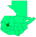
 Municipality of Totonicapán within the Department of Totonicapán | |
 Totonicapán within Guatemala | |
| Coordinates: 14°54′39″N 91°21′38″W / 14.91083°N 91.36056°WCoordinates: 14°54′39″N 91°21′38″W / 14.91083°N 91.36056°W | |
| Country |
|
| Department |
|
| Government | |
| • Type | Municipal |
| Area[1] | |
| • Total | 328 km2 (127 sq mi) |
| Elevation | 2,495 m (8,186 ft) |
| Population (2012)[2] | |
| • Total | 134,373 |
| • Density | 410/km2 (1,100/sq mi) |
| • Ethnicities | K'iche' people, Ladino |
| • Religions | Roman Catholicism, Evangelicalism, Maya |
| Climate | Cwb |
Totonicapán is a city in Guatemala. It serves as the capital of the department of Totonicapán and as the administrative seat for the surrounding municipality of Totonicapán.
Historically, Totonicapán was known for its hot springs.[3]

Municipal Theater of Totonicapán

Central plaza in Totonicapán

Municipal building of Totonicapán
References
- ↑ "Totonicapán - Estrategia para la reducción de la pobreza municipal" (PDF). SEGEPLAN. 2003. Retrieved 2008. Check date values in:
|access-date=(help) - ↑ "Caracterización departamental: Totonicapán 2013" (PDF). Caracterización departamental: Totonicapán 2013. Instituto Nacional de Estadística (INE). 2014. Retrieved 1 August 2015.
- ↑ Baily, John (1850). Central America; Describing Each of the States of Guatemala, Honduras, Salvador, Nicaragua, and Costa Rica. London: Trelawney Saunders. p. 85.
External links
Capital: Totonicapán | ||
| Municipalities | | |
This article is issued from Wikipedia - version of the 8/18/2016. The text is available under the Creative Commons Attribution/Share Alike but additional terms may apply for the media files.