Totenkopf (hill)
| Totenkopf | |
|---|---|
|
Totenkopf with communications tower visible | |
| Highest point | |
| Elevation | 557 m (1,827 ft) |
| Prominence | 364 metres (1,194 ft) |
| Coordinates | 48°04′51″N 7°40′14″E / 48.08083°N 7.67056°ECoordinates: 48°04′51″N 7°40′14″E / 48.08083°N 7.67056°E |
| Naming | |
| Translation | Skull (German) |
| Geography | |
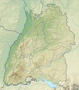 Totenkopf The location within Baden-Württemberg | |
| Location | Baden-Württemberg, Germany |
| Parent range | Kaiserstuhl |

The Totenkopf is a hill in Baden-Württemberg, Germany, forming the highest point in the Kaiserstuhl region. The hill is topped by an observation tower and a 120-m (394-ft) Deutsche Telekom communications tower. Wine and fruit are cultivated on its slopes.
Etymology
The name of the hill Totenkopf, meaning Skull, dates back to the Middle Ages - when skulls were said to be abound on it—the German King Otto, who would be later become the Holy Roman Emperor Otto III chose this hill to be the place of execution after the day of hearing close to Sasbach am Kaiserstuhl and had his judgements carried out here, so convicts were beheaded on the soon to be called Totenkopf (i.e. Skull).[1]
References
- ↑ Hans Jürgen Kugler: Südwest: Die Totenköpfe auf dem Kaiserstuhl(i.e. The Skulls on the Kaiserstuhl), Badische Zeitung, 6. September 2011
This article is issued from Wikipedia - version of the 6/17/2015. The text is available under the Creative Commons Attribution/Share Alike but additional terms may apply for the media files.