Tong District
| Tong Тоң району | |
|---|---|
| Raion | |
 | |
| Country | Kyrgyzstan |
| Region | Issyk-Kul Region |
| Area | |
| • Total | 2,790 sq mi (7,230 km2) |
| Population (2012) | |
| • Total | 49,130 |
| Time zone | GMT +5 (UTC+5) |
Tong is a raion (district) of Issyk-Kul Region in north-eastern Kyrgyzstan. The capital lies at Bokonbayevo.[1] Tong District borders Issyk Kul District to the north-west, Jeti-Oguz District to the south and south-east, Kochkor District to the south-west, Naryn District to the south, Kemin District to the north-west, and Issyk Kul - to the north.
Urban-type settlements, rural communities and villages
For 2009, Tong District include 1 urban-type settlement and 29 villages located in 8 rural communities (aiyl okmotus). Each rural community can consist of one or several villages. The rural communities and settlements in the Tong District are:[2]
- urban-type settlement Kadji Say
- Ak-Terek aiyl okmotu (center - village Kara-Koo, and also villages Ala-Bash, Barbulak, Den-Talaa, Komsomol, Kyzyl-Tuu)
- Kel-Ter aiyl okmotu (center - village Toguz-Bulak, and also villages Kel-Ter, Konur-Olen)
- Kek-Moynok aiyl okmotu (center - village Akulen, and also villages Kek-Moynok-1 and Kek-Moynok-2 )
- Eshperovo aiyl okmotu (center - village Eshperovo, and also villages Ak-Say, Jer-Uy, Kok-Say )
- Kyun-Chygysh aiyl okmotu (center - village Bokonbayevo, and also village Archaly)
- Tong aiyl okmotu (center - village Ton, and also villages Kadji-Saz, Ak-Say)
- Tortkël' aiyl okmotu (center - village Tortkël', Issyk Kul, and also villages Temir-Kanat, Tuura-Suu)
- Ulakol aiyl okmotu (center - village Ottuk and also villages Kara-Talaa, Kara-Shaar, Tuura-Suu, Shor-Bulak)
References
Capital: Bishkek (also four raions: Lenin, Oktyabr, Pervomay, Sverdlov) | ||
| Batken Region | 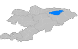 | |
| Chuy Region | ||
| Issyk Kul Region | ||
| Jalal-Abad Region | ||
| Naryn Region | ||
| Osh Region | ||
| Talas Region | ||
Coordinates: 42°06′52″N 76°59′36″E / 42.114391°N 76.993289°E
This article is issued from Wikipedia - version of the 5/31/2016. The text is available under the Creative Commons Attribution/Share Alike but additional terms may apply for the media files.