Todd County, South Dakota
| Todd County, South Dakota | |
|---|---|
 Location in the U.S. state of South Dakota | |
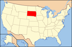 South Dakota's location in the U.S. | |
| Founded | 1909[1] |
| Named for | John Blair Smith Todd |
| Seat | None |
| Largest city | Mission |
| Area | |
| • Total | 1,391 sq mi (3,603 km2) |
| • Land | 1,389 sq mi (3,597 km2) |
| • Water | 2.3 sq mi (6 km2), 0.2% |
| Population (est.) | |
| • (2015) | 9,959 |
| • Density | 6.9/sq mi (3/km²) |
| Congressional district | At-large |
| Time zone | Central: UTC-6/-5 |
| Footnotes: Winner in neighboring Tripp County serves as it administrative center. | |
Todd County is a county located in the U.S. state of South Dakota. As of the 2010 census, the population was 9,612.[2] Todd County does not have its own county seat. Instead, Winner in neighboring Tripp County serves as its administrative center.[3] Its largest city is Mission. The county was created in 1909, although it remains unorganized.[1][4] The county was named by European-American settlers after John Blair Smith Todd, who was a delegate from Dakota Territory to the United States House of Representatives[1] and a general in the Union Army during the American Civil War.
The county lies entirely within the Rosebud Indian Reservation and is coterminous with the main reservation (exclusive of off-reservation trust lands, which lie in four nearby counties). Its southern border is with the state of Nebraska. It is one of five South Dakota counties entirely within an Indian reservation. (The others are Corson, Dewey, Oglala Lakota, and Ziebach.) The county's per-capita income makes it the third poorest county in the United States.[5] Unlike many rural counties in South Dakota, since 1960, its population has increased.
History
Until 1981 Todd, Oglala Lakota (formerly Shannon) and Washabaugh County, South Dakota, were the last unorganized counties in the United States. Although then organized, Todd did not receive a home rule charter until 1983. As noted above, it contracts with Tripp County for its Auditor, Treasurer, and Registrar of Deeds.[6]
Geography
According to the U.S. Census Bureau, the county has a total area of 1,391 square miles (3,600 km2), of which 1,389 square miles (3,600 km2) is land and 2.3 square miles (6.0 km2) (0.2%) is water.[7]
Major highways
 U.S. Highway 18
 U.S. Highway 83
 South Dakota Highway 63
Adjacent counties
- Mellette County, South Dakota - north
- Tripp County, South Dakota - east
- Cherry County, Nebraska - south
- Bennett County, South Dakota - west
Demographics
| Historical population | |||
|---|---|---|---|
| Census | Pop. | %± | |
| 1910 | 2,164 | — | |
| 1920 | 2,784 | 28.7% | |
| 1930 | 5,898 | 111.9% | |
| 1940 | 5,714 | −3.1% | |
| 1950 | 4,758 | −16.7% | |
| 1960 | 4,661 | −2.0% | |
| 1970 | 6,606 | 41.7% | |
| 1980 | 7,328 | 10.9% | |
| 1990 | 8,352 | 14.0% | |
| 2000 | 9,050 | 8.4% | |
| 2010 | 9,612 | 6.2% | |
| Est. 2015 | 9,959 | [8] | 3.6% |
| U.S. Decennial Census[9] 1790-1960[10] 1900-1990[11] 1990-2000[12] 2010-2015[2] | |||
2000 census
As of the census[13] of 2000, there were 9,050 people, 2,462 households, and 1,917 families residing in the county. The population density was 6 people per square mile (3/km²). There were 2,766 housing units at an average density of 2 per square mile (1/km²). The racial makeup of the county was 85.60% Native American, 12.57% White, 0.09% Black or African American, 0.14% Asian, 0.21% from other races, and 1.38% from two or more races. 1.52% of the population were Hispanic or Latino of any race.
There were 2,462 households out of which 48.90% had children under the age of 18 living with them, 35.20% were married couples living together, 31.80% had a female householder with no husband present, and 22.10% were non-families. 18.90% of all households were made up of individuals and 5.20% had someone living alone who was 65 years of age or older. The average household size was 3.62 and the average family size was 4.09.
In the county, the population was spread out with 44.00% under the age of 18, 10.40% from 18 to 24, 25.10% from 25 to 44, 14.80% from 45 to 64, and 5.80% who were 65 years of age or older. The median age was 22 years. For every 100 females there were 97.90 males. For every 100 females age 18 and over, there were 92.30 males.
The median income for a household in the county was $20,035, and the median income for a family was $19,533. Males had a median income of $20,993 as opposed to $21,449 for females. The per capita income for the county was $7,714. About 44.00% of families and 48.30% of the population were below the poverty line, including 57.60% of those under age 18 and 33.50% of those age 65 or over. The county's per-capita income makes it one of the poorest counties in the United States.[14]
2010 census
As of the 2010 United States Census, there were 9,612 people, 2,780 households, and 2,091 families residing in the county.[15] The population density was 6.9 inhabitants per square mile (2.7/km2). There were 3,142 housing units at an average density of 2.3 per square mile (0.89/km2).[16] The racial makeup of the county was 88.1% American Indian, 9.6% white, 0.2% black or African American, 0.2% Asian, 0.2% from other races, and 1.8% from two or more races. Those of Hispanic or Latino origin made up 2.4% of the population.[15] In terms of ancestry, 5.1% were German, and 1.1% were American.[17]
Of the 2,780 households, 55.9% had children under the age of 18 living with them, 28.5% were married couples living together, 34.7% had a female householder with no husband present, 24.8% were non-families, and 21.1% of all households were made up of individuals. The average household size was 3.45 and the average family size was 3.95. The median age was 24.0 years.[15]
The median income for a household in the county was $25,196 and the median income for a family was $29,010. Males had a median income of $26,971 versus $30,211 for females. The per capita income for the county was $11,010. About 44.2% of families and 48.8% of the population were below the poverty line, including 59.0% of those under age 18 and 45.7% of those age 65 or over.[18]
Communities
City
Town
Census-designated places
Unincorporated communities
- HeDog
- Grass Mountain
Unorganized territories
The county is divided into two areas of unorganized territory: East Todd and West Todd.
See also
References
- 1 2 3 Legislative Manual, South Dakota, 2005, p. 597
- 1 2 "State & County QuickFacts". United States Census Bureau. Retrieved November 28, 2013.
- ↑ "Find a County". National Association of Counties. Retrieved 2011-06-07.
- ↑ "Dakota Territory, South Dakota, and North Dakota: Individual County Chronologies". Dakota Territory Atlas of Historical County Boundaries. The Newberry Library. 2006. Retrieved March 31, 2015.
- ↑ United States counties by per capita income
- ↑ , accessed April 19, 2009.
- ↑ "2010 Census Gazetteer Files". United States Census Bureau. August 22, 2012. Retrieved March 28, 2015.
- ↑ "County Totals Dataset: Population, Population Change and Estimated Components of Population Change: April 1, 2010 to July 1, 2015". Retrieved July 2, 2016.
- ↑ "U.S. Decennial Census". United States Census Bureau. Retrieved March 28, 2015.
- ↑ "Historical Census Browser". University of Virginia Library. Retrieved March 28, 2015.
- ↑ Forstall, Richard L., ed. (March 27, 1995). "Population of Counties by Decennial Census: 1900 to 1990". United States Census Bureau. Retrieved March 28, 2015.
- ↑ "Census 2000 PHC-T-4. Ranking Tables for Counties: 1990 and 2000" (PDF). United States Census Bureau. April 2, 2001. Retrieved March 28, 2015.
- ↑ "American FactFinder". United States Census Bureau. Retrieved 2011-05-14.
- ↑ Lottery Winner from Winner, SD Yahoo! News Published 6 June 2009. Retrieved 6 June 2009.
- 1 2 3 "DP-1 Profile of General Population and Housing Characteristics: 2010 Demographic Profile Data". United States Census Bureau. Retrieved 2016-03-12.
- ↑ "Population, Housing Units, Area, and Density: 2010 - County". United States Census Bureau. Retrieved 2016-03-12.
- ↑ "DP02 SELECTED SOCIAL CHARACTERISTICS IN THE UNITED STATES – 2006-2010 American Community Survey 5-Year Estimates". United States Census Bureau. Retrieved 2016-03-12.
- ↑ "DP03 SELECTED ECONOMIC CHARACTERISTICS – 2006-2010 American Community Survey 5-Year Estimates". United States Census Bureau. Retrieved 2016-03-12.
 |
Mellette County | | ||
| Bennett County | |
Tripp County | ||
| ||||
| | ||||
| Cherry County, Nebraska |
Municipalities and communities of Todd County, South Dakota, United States | ||
|---|---|---|
| City | | |
| Town | ||
| CDPs |
| |
| Unincorporated communities | ||
| Indian reservation | ||
| Footnotes | ‡This populated place also has portions in an adjacent county or counties | |
Coordinates: 43°11′N 100°44′W / 43.18°N 100.73°W