Tizapan El Alto
| Tizapan El Alto | ||
|---|---|---|
| Municipality and city | ||
 | ||
| ||
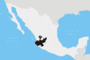
 Location of the municipality in Jalisco | ||
|
Tizapan El Alto Location in Mexico | ||
| Coordinates: 20°02′N 102°36′W / 20.033°N 102.600°WCoordinates: 20°02′N 102°36′W / 20.033°N 102.600°W | ||
| Country |
| |
| State | Jalisco | |
| Area | ||
| • Total | 273.32 km2 (105.53 sq mi) | |
| Population (2010) | ||
| • Total | 20,857 | |
| Time zone | Central Standard Time (UTC-6) | |
| • Summer (DST) | Central Daylight Time (UTC-5) | |
| Area code(s) | 376 | |
| Website | http://www.jalisco.gob.mx/es/jalisco/municipios/tizapan-el-alto | |

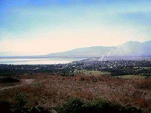
Tizapan El Alto is a town and municipality, in Jalisco in central-western Mexico. The municipality covers an area of 273.32 km².
As of 2010, the municipality had a total population of 20857.[1]
References
- ↑ "Tizapan El Alto". Enciclopedia de los Municipios de México. Instituto Nacional para el Federalismo y el Desarrollo Municipal. Retrieved April 16, 2009.
This article is issued from Wikipedia - version of the 2/19/2016. The text is available under the Creative Commons Attribution/Share Alike but additional terms may apply for the media files.