Tinsukia
| Tinsukia তিনিচুকীয়া City of Ponds | |
|---|---|
| City | |
|
| |
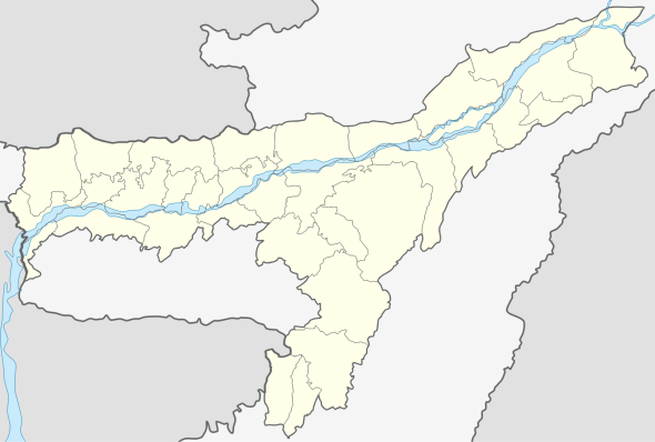 Tinsukia  Tinsukia Location in Assam, India | |
| Coordinates: 27°30′00″N 95°22′01″E / 27.500°N 95.367°ECoordinates: 27°30′00″N 95°22′01″E / 27.500°N 95.367°E | |
| Country |
|
| State | Assam |
| District | Tinsukia |
| Government | |
| • Body | Tinsukia Municipality Board |
| Elevation | 116 m (381 ft) |
| Population (2011)[1] | |
| • Total | 99,448 |
| Languages | |
| • Official | Assamese |
| Time zone | IST (UTC+5:30) |
| PIN | 786125 |
| Telephone code | 91-374 |
| ISO 3166 code | IN-AS |
| Vehicle registration | AS -23 |
| Website |
www |

Tinsukia (Pron: ˌtɪnˈsʊkiə) (Assamese: তিনিচুকীয়া) is a city and municipal board in Tinsukia district, Assam, India. It is situated 480 kilometres (298 mi) north east of Guwahati and 84 kilometres (52 mi) kilometres away from the border with Arunachal Pradesh.
It is the administrative headquarters of Tinsukia District of Assam, India. It contains a mixture of Assamese, and Hindi- speaking people. New malls and buildings are being constructed.
Tinsukia deals in agricultural products such as tea, oranges, ginger, citrus fruits and paddy. It also contains the state's largest railway junction.
History
Tinsukia is the site of Bengmara, which was originally known as Changmai Pathar. It was the capital city of the Muttack Kingdom which was founded by Swargadeo Sarbananda Singha.[2]

Swargadeo Sarbananda Singha, known as Mezara, rose to become an able administrator. Mezara adopted the name Sarbananda Singha after he became the King. Swargadeo Sarbananda Singha introduced coins after his name and in Saka 1716 and 1717, he inscribed the title Swargadeo in the coins.
As instructed by Swargadeo Sarbananda Singha, his Minister Gopinath Barbaruah alies Godha dug a triangular pond which is known as Tinikunia Pukhuri. In 1884 a station was constructed near this pond, when the Dibru-Sadiya Rail line was laid, which was named as Tinsukia. Since then it has been known as Tinsukia.
Geography
Tinsukia is located at 27°30′N 95°22′E / 27.5°N 95.37°E.[3] It has an average elevation of 116 metres (380 feet).
National protected area
Climate
Tinsukia has a humid subtropical climate with summer, winter and monsoon forming the seasonal cycle. Summer in Tinsukia are typically during the months of March–May, and these months experience a maximum temperature of around 31 °C and a minimum of 24 °C. Rain showers are common during the summer months, and humidity is normally at its highest during this season. the monsoon months in Tinsukia are the months of June–September bringing heavy rainfall. The temperature in the region during winter, which occurs from October to February, ranges from a maximum of 24 °C to a minimum of 11 °C(min).
Trade and commerce

The district is known for its tea production, and wood related products like Kitply, Merino Ply, and National Ply. Chamber Road, situated at the centre of the town, is the traditional business hub. Besides the wood industry, businesses dealing in garments, electronics, hardware for tea industry form the commercial base of the city.
Plastic park in Tinsukia district: the state government has commissioned a 1,500-bigha plastic park in Tinsukia district to accommodate 400 downstream plastic processing units.The plant will produce various ranges of polymers for different applications in sectors such as packaging film, injection, raffia and blow-moulding which will be marketed with assistance from GAIL.
Demographics
According to the India census, Tinsukia had a population of 1,25,216.[4] Males constituted 55% of the population and females 45%. Tinsukia had an average literacy rate of 70.15%, higher than the national average of 64.84%: male literacy was 77.89%, and female literacy 63.54%. 13.29% of the population was under 6 years of age.[5]
Transportation


- Road
Tinsukia is connected by air, national highway and railway. It is 492 km by road from Guwahati. Buses from ASTC and other private operators conneceted the town with Guwahati and other places. Local transportation is facilitated by auto-rickshaws and mini vans, with rickshaws being the primary mode of transportation.
- Air
The nearest airport is Dibrugarh Airport at Mohanbari, Dibrugarh which is about 40 km from Tinsukia with daily flights to Delhi, Guwahati and Kolkata.
- Rail
Tinsukia falls under Northeast Frontier Railway of Indian Railways. It is also one of the divisional headquarters of NF Railway. The New Tinsukia railway station connects the city with rest of the country through notable trains like Dibrugarh Rajdhani Express, Brahmaputra Mail, Kamrup Express, New Tinsukia - Bengaluru Weekly Express, Avadh Assam Express etc. It is an A category railway station of Northeast Frontier railway under Tinsukia railway division. The town has another station called Tinsukia Junction which is the old one.
Notable places
The Dibru Saikhowa National Park, adjacent to the city is a national park of India and is considered an important Biodiversity Hotspot in India. The Brahmaputra is at the northern border and the Dibru river at the southern, and the park is an island with feral horses, endangered White-winged Wood ducks and Hoolock Gibbons. Bherjan-Borajan-Padumoni Wildlife Sanctuary is about 6 km from Tinsukia. It is famous for different species of primates including the endangered Hoolock Gibbon. Maguri Beel is used for birdwatching.
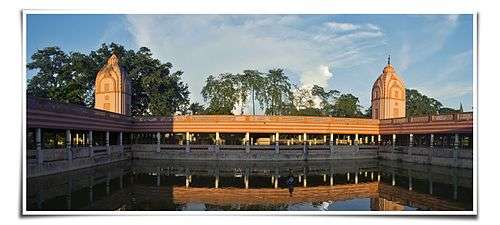
The Shiv Dham is a temple of Lord Shiva with a pond in the middle. The pond constitutes of over 1000 fishes and few turtles. Devotees are often seen praying to the Gods and feeding these fishes. The Tilinga Mandir (bell temple), located at Bordubi, about 9 kilometer from Tinsukia, is another famous Shiva temple. This temple is known for its numerous bells (tilinga) tied on the branches of a giant peepal tree by devotees whose wishes made at this temple are believed to have been fulfilled. The area also has Tea Estates. Marut Nandan Kanan Park is also a tourist attraction.

Some attractions of Tinsukia and its surrounding places are:
- The Railway Heritage Museum of North East India is at Tinsukia.
- The Dibru Saikhowa National Park is a biological hotspot of India.
- The largest Railway Junction in Assam is at Tinsukia
- Asia's oldest oil-refinery, The Digboi Refinery is located a few kilometers from the city of Tinsukia at Digboi.
- The incredible Hindu Temple, The Bell Temple or Tilinga Mandir is at Tinsukia
- The Bherjan-Borajan-Padumoni Wildlife Sanctuary, which is about a distance of 6 km.
- The start point of the historical Stilwell Road, also known as Ledo Road, is connected.
Politics
Tinsukia is part of Dibrugarh (Lok Sabha constituency).[6]
Media
Assamese daily Dainik Janambhumi published from Tinsukia along with Guwahati and Jorhat.
Communication
Tinsukia has landline, mobile and internet connectivity. Internet connectivity through wireless datacards and Broadband is available. The major cellular service providers are Airtel, IDEA, BSNL, Aircel, Vodafone, Reliance, S Tel.
3G services are a recent addition to the city.
| Sl No. | Mobile Operator |
|---|---|
| 1 | BSNL[7] |
| 2 | Aircel[8] |
| 3 | Reliance[9] |
| 4 | Airtel[10] |
| 5 | Idea Cellular[11] |
| 6 | Vodafone[12] |
Education
List of schools
- Our ABC Play House (Estd.1995)
- Kendra Vidyalaya Tinsukia
- St. Stephen's High School, Bordoloi Nagar
- Vivekananda Kendra Vidyalaya, Tinsukia
- Senairam High Secondary School (Estd. 1937)
- A New High School
- Guru Teg Bahadur Academy
- Our ABC Academy Borguri Court Tinali
- Bhagwat Vidyamandir High School, Sripuria
- Don Bosco High School, Tinsukia

Don Bosco High School - Hindi English High School
- Holy Child Girl's/Boy's High School
- Babies Nursery School
- Buds Nursery School

Church at Don Bosco High School - Budding Buds Sr. Sec. School
- Hindustan Kendra Vidyalaya
- Pinewood School
- Bimala Prasad Chaliha Nagar School
- Aadarsha Parthomik School
- Sarbajanik Balika Vidyalaya
- Sarbajanik Hindi Balika Vidyalaya

A view of Tinsukia Law College - Saumarjyoti Vidyalaya
- Bengali Girls High School
- Shiksha-The Gurukul
- Railway High School
- Delhi Public School, Digboi
- Tinsukia Bangia Vidyalaya (H.S.)
- Borguri High School
- Tinsukia English Academy
- Jatiya Vidyalaya, Tinsukia
- Don Bosco Bible School
- Bhawti Bhagwan High Secondary School (Udyog Nagar)
- Omega English Academy (Udyog Nagar)
- Apple Bee Fun School (preschool)[13]
- Los Angeles English Academy, Bordubi
- Kendriya Vidyalaya, Tinsukia
- Tinsukia Railway High School
- Intel Kids Pre School Near Chaliha Bordoloi Nagar Namghar, Tinsukia
- Bachpan Play School[14]
- Kids Campus International Preschool
List of colleges
- Tinsukia College
- Women's College
- ACE College of Commerce
- G.S. Lohia Girl's College
- Pinewood Residential Jr. Sc. College
- B.B. Memorial Jr. College
- C.T. College
- Tinsukia Law College
- D.H. Memorial College (Sripuria)
- Tinsukia Commerce College (Sripuria)
List of Hospitals
- City Hospital & Research Center
- Life Line Hospital
- Jeevan Jyoti Hospital
- ESI Hospital
- Civil Hospital
- Dey's Nursing Home
- The Apollo Clinic
- Aditya Diagnostics and Hospital
- R.C. Agarwal Memorial Hospital & Research Centre, Makum Road, Near Thermal Gate
- Borthakur nursing home
- Pinewood Hospital, Subochoni Road, Tinsukia
- St.Luke's Hospital, Duliajan Road, Tinsukia
Urban Localities
- D.D. Market
- Chaliha Nagar
- Bordoloi Nagar
- Gelapukhuri
- Chamber Road
- GNB Road
- DM Lohia Road
- Parbotia
- Tamulbari
- Dhekia Juri
- Daily Bazaar
- Hijuguri
- Sripuria
- Borguri
- Khageswar Road
- New Colony
- Sripuria
- Subachani
- Development Area
- Makum Road
- Rangagora Road
- Durgabari
- Borpathar
- Professor Colony
- AT Road
- Chirwapatty
- Milan Pally
- Mission Para
- Shyama Pally
- Babupatty
- Tulsiram Road
- Nau-Pukhri
- Balugada
- Chinapatty
- Lal Bunglow Road
- Ananda nagar
- Panitola
- Jugipathar
- Govindapur
Gallery

A view of Tilinga Mandir 
A View of the Dibru River 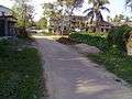
A locality in Tinsukia
References
- ↑ http://www.censusindia.gov.in/pca/SearchDetails.aspx?Id=298235
- ↑ "Tinsukia". Retrieved 2 May 2012.
- ↑ Falling Rain Genomics, Inc - Tinsukia
- ↑ "Census of India / Assam / Tinsukia". Census of India. Retrieved 2 May 2012.
- ↑ "Census Of India". Retrieved 2 May 2012.
- ↑ "List of Parliamentary & Assembly Constituencies" (PDF). Assam. Election Commission of India. Retrieved 2008-10-06.
- ↑ http://www.assam.bsnl.co.in
- ↑ http://www.aircel.com
- ↑ http://www.rcom.co.in
- ↑ http://www.airtel.in
- ↑ http://www.ideacellular.com
- ↑ https://www.vodafone.in/pages/index.aspx
- ↑ http://www.applebeefunschool.webs.com
- ↑ "Bachpan Play School". Bachpanglobal.com. Retrieved 2015-08-22.
External links
| Wikimedia Commons has media related to Tinsukia. |
- Tinsukia district official website
- Birding in Maguri-Motapung Beel
-
 Tinsukia travel guide from Wikivoyage
  Assam topics
Topics History Districts & Divisions - North Assam Division
- Lower Assam Division
- Central Assam Division
- Upper Assam Division
- Barak Valley Division
Geography Culture Arts, Literature,
Music Cinema- Assamese literature
- Assamese poetry
- List of Assamese Poets
- List of Assamese writers Pen Names
- List of Assamese Periodicals
- The Arunodoi (Orunodoi - 1846)
- The Hemkosh
- The Assam Tribune
- Assam Rhetorical Congress
- Buranji
- Kirtan Ghosa
- Dasham
- Namghosa
- Kotha Ramayana
- Jonaki
- Music of Assam
- Goalpariya Lokageet
- Tokari Geet
- Dihanaam
- Hiranaam
- Dhol
- Gogona
- Pepa
- Cinema of Assam
- Joymati, first Assamese motion picture
People Notable surnames - Barua (and its variations)
- Borah
- Bharali
- Borbarua
- Borgohain
- Borpatrogohain
- Borphukan
- Burhagohain
- Chakraborty
- Choudhury (and its variations)
- Das
- Deka
- Dutta
- Gayen
- Gogoi
- Gohain
- Goswami
- Hazarika
- Kalita
- Saikia
- Sarma
- Sutiya
- Sutradhar
Urban centres - Fairs and Festivals
- Hindu Temples
- History