Tinchebray
| Tinchebray | |
|---|---|
 | |
 Tinchebray | |
|
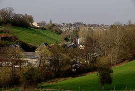
Location within Normandy region  Tinchebray | |
| Coordinates: 48°45′49″N 0°43′59″W / 48.7636°N 0.7331°WCoordinates: 48°45′49″N 0°43′59″W / 48.7636°N 0.7331°W | |
| Country | France |
| Region | Normandy |
| Department | Orne |
| Arrondissement | Argentan |
| Canton | Domfront |
| Intercommunality | Communauté de communes du Pays de Tinchebray |
| Government | |
| • Mayor (2008–2014) | Jérôme Nury |
| Area1 | 26.52 km2 (10.24 sq mi) |
| Population (2006)2 | 2,681 |
| • Density | 100/km2 (260/sq mi) |
| Time zone | CET (UTC+1) |
| • Summer (DST) | CEST (UTC+2) |
| INSEE/Postal code | 610486 / 61800 |
| Elevation | 152–311 m (499–1,020 ft) |
| Website | www.tinchebray.fr |
|
1 French Land Register data, which excludes lakes, ponds, glaciers > 1 km² (0.386 sq mi or 247 acres) and river estuaries. 2 Population without double counting: residents of multiple communes (e.g., students and military personnel) only counted once. | |
Tinchebray is a former commune in the Orne department in the Lower Normandy region in north-western France. On 1 January 2015, Tinchebray and six other communes merged becoming one commune called Tinchebray-Bocage.
It was the scene of the Battle of Tinchebray fought on 28 September 1106.
Heraldry
.svg.png) |
The arms of Tinchebray are blazoned : Azure, a key between 2 pairs of shuttles each pair in saltire argent, on a chief gules a lion passant between 2 fleurs de lys Or. |
See also
References
| Wikimedia Commons has media related to Tinchebray. |
This article is issued from Wikipedia - version of the 4/25/2016. The text is available under the Creative Commons Attribution/Share Alike but additional terms may apply for the media files.