Ticino (river)
| Ticino | |
|---|---|
 The river Ticino and the Covered Bridge of Pavia (originally medieval in date, rebuilt in 1950 after the destruction due to war bombing) | |
 | |
| Country | Switzerland, Italy |
| Basin | |
| Main source |
Val Bedretto, Ticino, Switzerland about 2,478 m (8,100 ft) |
| River mouth | River Po, south-east of Pavia, Italy |
| Basin size | 7,228 km2 (2,791 sq mi) |
| Physical characteristics | |
| Length | 248 km (154 mi) |
| Discharge |
|
The river Ticino (/tᵻˈtʃiːnoʊ/; Italian pronunciation: [tiˈtʃiːno]; Lombard: Tisín; French and German: Tessin; Latin: Ticīnus) is the most important perennial left-bank tributary of the Po River. It has given its name to the Swiss canton through which its upper portion flows.
Course
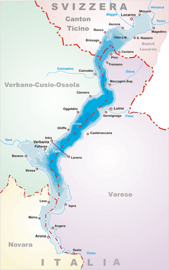
The river rises in the Val Bedretto in Switzerland at the frontier between the cantons of Valais and Ticino, is fed by the glaciers of the Alps and later flows through Lake Maggiore, before entering Italy. The Ticino joins the Po a few kilometres downstream (along the Ticino) from Pavia. It is about 248 kilometres (154 mi) long. The highest point of the drainage basin is the summit of Grenzgipfel (a subpeak of Monte Rosa), at 4,618 metres (15,151 ft). Beneath it flows the Anza River, a right-bank tributary of the Ticino.
The river is dammed in Switzerland in order to create hydroelectricity, while in Italy it is primarily used for irrigation.
History
The legendary Gallic leader Bellovesus was said to have defeated the Etruscans here in circa 600 BC. Ticino was the location of the Battle of Ticinus, the first battle of the Second Punic War fought between the Carthaginian forces of Hannibal and the Romans under Publius Cornelius Scipio in November 218 BC. The Ticino was in the territory of the Duchy of Milan during much of the later medieval and early modern period, although its upper portion as far as Bellinzona in 1500 and as far as the shores of Lago Maggiore in 1513, fell to the Swiss as a result of their campaigns in the Italian Wars.
Towns and tributaries
.jpg)
Val Bedretto

Val Bedretto, a narrow alpine valley named after the village of Bedretto, culminates in Nufenen Pass, Italian Passo della Novena, at 2,478 m (8,130 ft) located between Pizzo Gallina and Nufenstock. Through it runs the border between the cantons of Valais and Ticino. A road constructed in 1964 goes over the pass ultimately leading to the Rhone river valley on the other side. French is mainly spoken in Valais but near the pass German is spoken. The population of Ticino speaks Italian.
The road up the val is fairly straight until it approaches the pass, where it becomes hairpin. On the slope below the first hairpin at about 2,478 m (8,130 ft) is an area of springs from which the Ticino river originates. Subsequently it becomes a mountain brook flowing straight down the val to the village of All'Acqua or All'Acqua Ospizio at 1,614 m (5,295 ft), named for the hospice for travellers located there at the previous end of the road in former centuries. Currently it is a base for skiing and hiking. Below it is Ronco at 1,487 m (4,879 ft) and Bedretto at 1,402 m (4,600 ft).[1] The val is subject to avalanches and snow can remain on the ground as late as September.
Below Bedretto the Ri di Cristallina, "Cristallina stream", comes in from the right at Ossasco, and further down Fontana, still in Bedretto. The entire area is laced with hiking trails and mountain huts.
Valle Leventina
Other
- in Switzerland: Bellinzona, Locarno (on Lake Maggiore).
- in Italy: Stresa (on Lake Maggiore), Vigevano, Pavia.
External links
References
| Wikimedia Commons has media related to Ticino (river). |
- ↑ Reynolds, Kev (1992). "Val Bedretto". Walking in Ticino, Switzerland: A Walking Guide (illustrated ed.). Milnthorpe: Cicerone Press Limited. pp. 32–43. ISBN 1852840986, ISBN 978-1-85284-098-3.
Coordinates: 45°08′38″N 9°14′12″E / 45.14389°N 9.23667°E