Thuru
For the mountain in Chile, see Cerro Toro.
| Thuru | |
|---|---|
 Thuru Location in Bolivia | |
| Highest point | |
| Elevation | 5,179 m (16,991 ft) [1] |
| Coordinates | 18°57′46″S 66°26′11″W / 18.96278°S 66.43639°WCoordinates: 18°57′46″S 66°26′11″W / 18.96278°S 66.43639°W |
| Geography | |
| Location | Bolivia, Oruro Department, Challapata Province |
| Parent range | Andes |
Thuru (Aymara for rough,[2] also spelled Toro) is a 5,179 metres (16,991 ft) high mountain in the Andes in Bolivia. It is located in the Oruro Department, Challapata Province, Challapata Municipality. It lies south-west of the mountain Wawachani and north-west of the mountains Wichhu Qullu and Wila Qullu.
The river Jach'a Jawira (Aymara for "big river", Jachcha Jahuira) which later is called Kuntur Nasa ("condor nose", Condor Nasa) after it reaches the mountain of the same name originates south-east Thuru. It flows to the south-west.[1][3]
References
- 1 2 Bolivian IGM map 1:50,000 Estancia Calacota 6336-IV
- ↑ Radio San Gabriel, "Instituto Radiofonico de Promoción Aymara" (IRPA) 1993, Republicado por Instituto de las Lenguas y Literaturas Andinas-Amazónicas (ILLLA-A) 2011, Transcripción del Vocabulario de la Lengua Aymara, P. Ludovico Bertonio 1612 (Spanish-Aymara-Aymara-Spanish dictionary)
- ↑ "Challapata". INE, Bolivia. Retrieved October 13, 2014.
Capital: Oruro | ||
| Provinces | 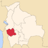 | |
| Municipalities (and seats) |
| |
This article is issued from Wikipedia - version of the 1/20/2016. The text is available under the Creative Commons Attribution/Share Alike but additional terms may apply for the media files.