Thurgoland
| Thurgoland | |
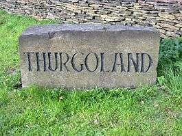 Boundary stone on the A629 |
|
 Thurgoland |
|
| Population | 1,801 (2001 Census)[1] |
|---|---|
| OS grid reference | SE290010 |
| Civil parish | Thurgoland |
| Metropolitan borough | Barnsley |
| Metropolitan county | South Yorkshire |
| Region | Yorkshire and the Humber |
| Country | England |
| Sovereign state | United Kingdom |
| Post town | SHEFFIELD |
| Police | South Yorkshire |
| Fire | South Yorkshire |
| Ambulance | Yorkshire |
| EU Parliament | Yorkshire and the Humber |
| UK Parliament | Penistone and Stocksbridge |
| Website | http://www.thurgoland.org.uk// |
Coordinates: 53°30′19″N 1°33′49″W / 53.5054°N 1.5635°W
Thurgoland is a village and civil parish in the Metropolitan Borough of Barnsley in South Yorkshire, England, on the A629 road. According to the 2001 census the parish had a population of 1,801,[1] increasing to 1,969 at the 2011 Census.[2] The civil parish includes the adjacent Crane Moor, a former mining village, now largely residential.
Buildings

The village has one primary school, the Holy Trinity (Church of England) and a Methodist Chapel. There are four public houses: The Monkey, The Horse & Jockey, The Green Dragon and The Bridge Inn. There are several listed buildings on Huthwaite Lane, including Huthwaite Hall (1748) designed by John Carr. There is a recreational ground at the centre of the village, by the village hall and the youth centre. Thurgoland Junior School is ranked second in the local league table.
History
The earliest known written record of Thurgoland is Domesday book of 1086, in which it is referred to as Turgesland. The name is of Old Norse origin and may mean 'Cultivated land of a man called Thorgeirr'.[3][4] Other sources claim derivation from the Saxon ‘The fee farm in the Ga of Thor’ – meaning the rented farm on the land named in honour of the god Thor.
In the 1840s the Sheffield, Ashton-under-Lyne and Manchester Railway was built running past the village. A station was opened at Thurgoland in December 1845, but closed 11 months later. The two mile long Thurgoland Coal Branch opened on 24 November 1847 to serve the nearby Stanhope Silkstone Main Colliery.[5]
Thurgoland was a centre for wire drawing mills. There were three wire mills in the parish; Old Wire Mill is thought to date from 1624, New Wire Mill was built around 1717, and Thurgoland Tilt Mill was operating in the 19th century.[6]
Governance
Thurgoland is a civil parish and local issues are governed by a parish council, one of 17 such councils in the Metropolitan Borough of Barnsley.[7] It is in the Penistone East Ward of the Borough, which is represented on the Borough Council by John Wilson, Robert Barnard, and Paul Hand-Davis, all members of the Conservative Party.[8] This ward became part of the new Penistone and Stocksbridge parliamentary constituency in 2010, and is represented in the House of Commons by MP Angela Smith of the Labour Party.
Geography
Thurgoland is located on the north side of the River Don, about 4.7 miles (7.5 km) south west of the town of Barnsley and 9.3 miles (15 km) north west of Sheffield City Centre. The village sits on a hill overlooking a bend in the river at about 250 metres (820 ft) above mean sea level.[9]
Demography
At the time of the United Kingdom 2001 Census the population of Thurgoland civil parish was 1,801 people.[1] The ethnic mix was 99.2% white (White British, White Irish, or White Other), 0.2% Asian, 0.2% Chinese and 0.4% mixed race.[10]
Below is a table outlining population change of the parish since 1911.
| Year | 1911 | 1921 | 1931 | 1951 | 1961 | 1971 | 2001 | ||||||
|---|---|---|---|---|---|---|---|---|---|---|---|---|---|
| Population | 1,571 | 1,623 | 1,516 | 1,437 | 1,551 | 1,421 | 1,801 | ||||||
| Source: A Vision of Britain through Time[11] | |||||||||||||
Transport
The main road transport route through Thurgoland is the A629.[9] The closest motorway route is the M1 motorway, which passes to the east of the village. Stagecoach Yorkshire operates bus routes through the village, linking it to Barnsley, Penistone, and Sheffield, as well as the surrounding villages.[12] The closest mainline railway stations are at Penistone and Silkstone Common.
References and notes
- 1 2 3 "Silkstone CP: Parish Headcounts". Neighbourhood Statistics. Office for National Statistics. Retrieved 8 April 2007.
- ↑ "Civil Parish population 2011". Neighbourhood Statistics. Office for National Statistics. Retrieved 6 March 2016.
- ↑ Goodall, Armitage (1914). "Thurgoland, Thurlstone, Thurstonland". Place-Names of South-West Yorkshire. Cambridge: Cambridge University Press. p. 282. OCLC 5809268.
- ↑ Mills, A.D. (2003). "Thurgoland". A Dictionary of English Place-Names. Oxford: Oxford University Press.
- ↑ Slaughter, Mihill (1849). Railway intelligence. London: W. H. Smith & Son. p. 31.
- ↑ "Historical Industries in the River Don Valley Surrounding Wortley Top Forge". Wortley Top Forge & Industrial Museum website. South Yorkshire Industrial History Society and South Yorkshire Trades Historical Trust. Retrieved 17 January 2009.
- ↑ "Parish and Town Councils in the Barnsley Borough". Barnsley Metropolitan Borough Council. Retrieved 17 January 2009.
- ↑ "Members of the Council". Barnsley Metropolitan Borough Council website. Barnsley Metropolitan Borough Council. Retrieved 17 January 2009.
- 1 2 "Grid reference SE 290 010". Get A Map. Ordnance Survey. Retrieved 17 January 2009.
- ↑ Data taken from Lower Layer Super Output Area areas Barnsley 027C, which does not include the entire civil parish, giving a total population of 1,489 people. See: "Area: Thurgoland CP (Parish)". Neighbourhood Statistics. Office for National Statistics. Retrieved 16 January 2009.
- ↑ "Thurgoland Tg/CP: Total Population". A Vision of Britain Through Time. Great Britain Historical GIS Project. Retrieved 17 January 2008.
- ↑ "Bus timetables for Thurgoland". Travel South Yorkshire. South Yorkshire Passenger Transport Executive. Retrieved 17 January 2009.
External links
![]() Media related to Thurgoland at Wikimedia Commons
Media related to Thurgoland at Wikimedia Commons