Throop, Dorset

Coordinates: 50°45′47″N 1°50′49″W / 50.763°N 1.847°W
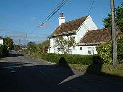
Throop is a village in Dorset situated on the outskirts of Bournemouth. It is renowned for its expansive fishing industry.
Geography and Administration
Although within the historic county boundaries of Hampshire, at the time of the 1974 local government re-organization it was considered desirable that the whole of what is now called the South East Dorset conurbation, which includes Bournemouth and Poole, should be part of the same county. Throop is currently part of the Throop and Muscliffe Ward within the Bournemouth borough council[1] and is close to the River Stour featuring countryside views over the Stour Valley. The population of this ward at the 2011 census was 8,882.[2]
History
Throop village has existed for many years and is described in various historical texts relating to the Bournemouth area – in 1842 it is referred to as a "Pleasant and secluded village".[3]
Throop Mill
One of the main characteristics of modern-day Throop is the watermill referred to as “Throop Mill”. The watermill in Throop village has been present in some regard from the 12th century passing through various ownership's including monks from Quarr Abbey and was mentioned in the Domesday Book because of the tales that surround it.
It has often been suggested that the old building and the surrounding area has been haunted by pacing black figures and sometimes the sound of voices, the voices are said to be those of some children who went missing in the area in the 1800s. Their laughter and cries are said to fill the cold night air with loneliness. There are mysteries and many a dark folk tale that surround the mill and the local area and not surprisingly despite many attempts to re-open, the mill remains closed to the public. It has been suggested by the local council to turn the site into tea rooms. The mill has four floors, most of which are in a state of disrepair; although some have speculated that there is something more sinister to hide.
The mill is in a lovely location in the small village of Throop. A popular location for tourists and dog walkers with the river stour located a just a short walk away it is a perfect place to get in some fishing or have a picnic.
Throop House
Throop House is the finest house in the village, and with its unrivalled river frontage and 3 acres (12,000 m2) of gardens, is one of the most delightful and distinctive homes in Bournemouth. The house was built in 1804 of the distinctively cream Bournemouth brick. It was built by Lord Malmesbury as the dower house for Hurn Court a mile away across the River Stour. Several magnificent cedar trees are the highlight of the gardens. In 1959 Dr James Fisher (after whom the James Fisher Medical Centre in Shillingstone Drive is named) and his wife Rosemary and family came to Throop House where they lived until 1978. In 1975 their eldest son Adrian, the internationally renowned maze designer, created his first maze in the garden of Throop House; this maze planted in holly unfortunately no longer exists.
Throop Ford and the Pig Shoot
There has been a ford across the River Stour for many centuries, some 400 metres downstream of Throop Mill. Tradition holds that it was the place where Sir Walter Tyrrell crossed the River Stour in August 1100 on his way to Poole and exile, having killed King William Rufus in the New Forest a few hours earlier. Over the centuries, a substantial structure of posts was created, holding back a broad strip of gravel some 50 metres long. In Victorian times, crossing the ford was a popular highlight for horse-and-carriage trips by visitors to Bournemouth. In the Second World War, to deny advantage to a possible German invasion, the retaining posts were removed, and the ford was washed away. At this point, the river is now deep and makes a sharp turn, and all that remains of the ford is the sloping track down to the river known as the Pig Shoot, and the gravel track to which it is aligned on the opposite bank.
The track on the opposite bank leads on to a second Ford, still intact, across the Leaden Stour. This is known locally as Pansy's Bathing Place, named after the golden retriever of Dr and Mrs James Fisher, who have lived in Throop (in Throop House and latterly in Throop Mill Cottage) since 1959. Pansy loved swimming in this ford.
References
- ↑ Bournemouth.gov.uk – Bournemouth Council Online
- ↑ "Throop and Muscliff ward 2011". Retrieved 7 April 2015.
- ↑ The visitor's guide to Bournemouth and its neighbourhood By Thomas Johnstone Aitkin
- ↑ The Stour Valley Way
External links
| Wikimedia Commons has media related to Throop, Dorset. |