Thrandeston
| Thrandeston | |
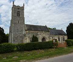 Church of St Margaret |
|
 Thrandeston |
|
| Population | 146 (2011 Census)[1] |
|---|---|
| OS grid reference | TM115765 |
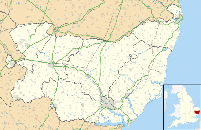
| District | Mid Suffolk |
| Shire county | Suffolk |
| Region | East |
| Country | England |
| Sovereign state | United Kingdom |
| Post town | DISS |
| Postcode district | IP21 |
| Dialling code | 01379 |
| Police | Suffolk |
| Fire | Suffolk |
| Ambulance | East of England |
| EU Parliament | East of England |
| UK Parliament | Central Suffolk and North Ipswich |
Coordinates: 52°20′46″N 1°06′14″E / 52.346°N 1.104°E
Thrandeston is a small village (population 130[2]) on the Norfolk/Suffolk border in England. The population was measured at 146 in the 2011 Census.
Overview
The village is split into two areas, Thrandeston Little Green and Thrandeston Great Green. Most of the housing, the church and rectory are situated in the former and grouped around the triangular green or the three roads leading off it. These lead to Eye, Mellis and Palgrave.
Thrandeston sits on slightly higher ground away from the southern point of the river Waveney that forms the county boundary. The village is situated on the 'High Suffolk' claylands,[3] making it suitable for arable farming.
The village is about a mile away from both the A143 road from Bury St Edmunds to Great Yarmouth and the A140 from Norwich to Ipswich. These were formally Turnpike trusts of 1762 and 1711, respectively.
History
Thrandeston had at least 6 holdings listed in the Domesday Book of 1066, the main manor was held by Anselm from the Abbot of St Edmunds and included a church with 8 acres (32,000 m2) of land and woodland for four pigs.[4] There are three moated sites at Malting Farm, Church Farm and Goswold Hall. Goswold Hall has links with the Grey family,[5] the most famous member of which was Lady Jane Grey
Thrandeston has its origins in the arable community mainly in the growing of hemp, as the nearby town of Diss was a large linen market. Three linen weavers, a tailor and a collar maker were all listed in the village in the late 17th century. A cattle fair was held annually on 31 July and in 1848 there were 347 inhabitants.[6]
Church
St Margaret, Thrandeston contains the armorial bearings of the Rix and Blakeby families.[7] The 15th century tower has a dedicatory inscription. It remembers that the Sulyards and the Cornwallises had it built. Inside are medieval carvings and wooden figures and animals, thought to be witches.[8]
References
- ↑ "Civil Parish population 2011". Neighbourhood Statistics. Office for National Statistics. Retrieved 29 August 2016.
- ↑ Office for National Statistics & Suffolk County Council, 2005. Estimates of total population of areas in Suffolk.
- ↑ Thrandeston conservation area appraisal, 2006. Appraisal for Thrandeston as a conservation area by local authority.
- ↑ Domesday Book 1986 Suffolk Phillimore.
- ↑ Grey of Northumberland. Family tree of the Grey Family.
- ↑ Topographical Dictionary of England, 1848. A small description from 1848
- ↑ National Gazetteer of Great Britain and Ireland, 1868.
- ↑ St Margarets Thrandeston a journey through the churches of suffolk. St Margarets Thrandeston
- Domesday Book 1986 Suffolk Phillimore
External links
| Wikimedia Commons has media related to Thrandeston. |
- - Appraisal for Thrandeston as a conservation area by local authority
- - Thrandeston Village Web Site
- - Family tree of the Grey Family
- - Impressions of St Margaret Thrandeston