Thornton River

The Thornton River, near Sperryville
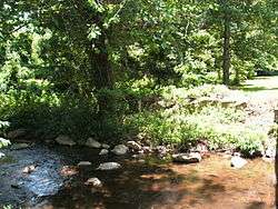
Bank of the river, near Sperryville
The Thornton River is a 27.9-mile-long (44.9 km)[1] river in the U.S. state of Virginia. It rises at Thornton Gap in Shenandoah National Park and flows east through Rappahannock County, running parallel to U.S. Route 211 until it reaches the town of Sperryville. Continuing east into Culpeper County, the Thornton River joins the Hazel River, a tributary of the Rappahannock River, and thus part of the Chesapeake Bay watershed.
See also
References
- ↑ U.S. Geological Survey. National Hydrography Dataset high-resolution flowline data. The National Map, accessed April 1, 2011
Coordinates: 38°36′09″N 78°00′10″W / 38.6026°N 78.0028°W
This article is issued from Wikipedia - version of the 9/11/2016. The text is available under the Creative Commons Attribution/Share Alike but additional terms may apply for the media files.