Thorndike, Maine
| Thorndike, Maine | |
|---|---|
| Town | |
|
Thorndike, ME as seen looking north on ME 220 towards ME 139. | |
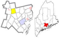 Location of Thorndike (in yellow) in Waldo County and the state of Maine | |
| Coordinates: 44°34′40″N 69°14′36″W / 44.57778°N 69.24333°W | |
| Country | United States |
| State | Maine |
| County | Waldo |
| Area[1] | |
| • Total | 25.26 sq mi (65.42 km2) |
| • Land | 25.26 sq mi (65.42 km2) |
| • Water | 0 sq mi (0 km2) |
| Elevation | 591 ft (180 m) |
| Population (2010)[2] | |
| • Total | 890 |
| • Estimate (2012[3]) | 889 |
| • Density | 35.2/sq mi (13.6/km2) |
| Time zone | Eastern (EST) (UTC-5) |
| • Summer (DST) | EDT (UTC-4) |
| ZIP code | 04986 |
| Area code(s) | 207 |
| FIPS code | 23-76610 |
| GNIS feature ID | 0582764 |

Thorndike is a town in Waldo County, Maine, United States. The town was named after Israel Thorndike, a landowner.[4] The population was 890 at the 2010 census.
Geography
According to the United States Census Bureau, the town has a total area of 25.26 square miles (65.42 km2), all of it land.[1]
Demographics
| Historical population | |||
|---|---|---|---|
| Census | Pop. | %± | |
| 1820 | 543 | — | |
| 1830 | 652 | 20.1% | |
| 1840 | 897 | 37.6% | |
| 1850 | 1,029 | 14.7% | |
| 1860 | 958 | −6.9% | |
| 1870 | 730 | −23.8% | |
| 1880 | 713 | −2.3% | |
| 1890 | 589 | −17.4% | |
| 1900 | 497 | −15.6% | |
| 1910 | 525 | 5.6% | |
| 1920 | 429 | −18.3% | |
| 1930 | 454 | 5.8% | |
| 1940 | 478 | 5.3% | |
| 1950 | 534 | 11.7% | |
| 1960 | 457 | −14.4% | |
| 1970 | 439 | −3.9% | |
| 1980 | 603 | 37.4% | |
| 1990 | 702 | 16.4% | |
| 2000 | 712 | 1.4% | |
| 2010 | 890 | 25.0% | |
| Est. 2014 | 890 | [5] | 0.0% |
2010 census
As of the census[2] of 2010, there were 890 people, 330 households, and 232 families residing in the town. The population density was 35.2 inhabitants per square mile (13.6/km2). There were 396 housing units at an average density of 15.7 per square mile (6.1/km2). The racial makeup of the town was 97.5% White, 0.2% African American, 0.1% Native American, 0.2% Asian, 0.3% from other races, and 1.6% from two or more races. Hispanic or Latino of any race were 0.8% of the population.
There were 330 households of which 36.1% had children under the age of 18 living with them, 57.0% were married couples living together, 8.5% had a female householder with no husband present, 4.8% had a male householder with no wife present, and 29.7% were non-families. 20.6% of all households were made up of individuals and 8.8% had someone living alone who was 65 years of age or older. The average household size was 2.70 and the average family size was 3.16.
The median age in the town was 38 years. 27.2% of residents were under the age of 18; 8.4% were between the ages of 18 and 24; 26% were from 25 to 44; 25.9% were from 45 to 64; and 12.6% were 65 years of age or older. The gender makeup of the town was 51.6% male and 48.4% female.
2000 census
As of the census[7] of 2000, there were 712 people, 279 households, and 201 families residing in the town. The population density was 28.2 people per square mile (10.9/km²). There were 337 housing units at an average density of 13.3 per square mile (5.1/km²). The racial makeup of the town was 99.02% White, 0.14% African American, 0.28% Native American, 0.28% Asian, and 0.28% from two or more races. Hispanic or Latino of any race were 0.28% of the population.
There were 279 households out of which 33.0% had children under the age of 18 living with them, 59.5% were married couples living together, 8.6% had a female householder with no husband present, and 27.6% were non-families. 19.7% of all households were made up of individuals and 6.8% had someone living alone who was 65 years of age or older. The average household size was 2.54 and the average family size was 2.89.
In the town the population was spread out with 24.7% under the age of 18, 8.1% from 18 to 24, 29.2% from 25 to 44, 26.7% from 45 to 64, and 11.2% who were 65 years of age or older. The median age was 37 years. For every 100 females there were 102.3 males. For every 100 females age 18 and over, there were 95.6 males.
The median income for a household in the town was $26,786, and the median income for a family was $29,479. Males had a median income of $24,375 versus $24,018 for females. The per capita income for the town was $13,090. About 14.9% of families and 17.4% of the population were below the poverty line, including 22.6% of those under age 18 and 26.3% of those age 65 or over.
History
In 1873 John True Gordon, after a family dispute, killed his brother, sister-in-law and their daughter while they slept, with an ax. He then set the farmhouse on fire and began saving the furniture. A farm worker also living in the home, woke to the smell of smoke, raising an alarm. 2 young family members escaped to the neighbors, as the surrounding farms turned out to help put out the fire.
John True Gordon was quickly arrested and held for trial. One of the biggest that Waldo County had ever seen. After offering little defense he was convicted and sentenced to be hanged with the Smuttynose Island Murderer Louis H.F. Wagner on the gallows of the Maine State Prison at Thomaston.
On the day of his execution, June 25, 1875, John True attempted suicide and had to be carried to the gallows and held in place while the trap dropped.
Months after the execution, police received a mailed letter of confession from an anonymous source claiming responsibility for the murders. The truth about the case is still unknown.
Gordon's victims were buried in Thorndike and it was said the funeral was attended by 5,000 people and over 500 wagons. The Thorndike Slayer was recently included in a book entitled Return to Smuttynose Island and other Maine Axe Murders by Emeric Spooner.
References
- 1 2 "US Gazetteer files 2010". United States Census Bureau. Retrieved 2012-12-16.
- 1 2 "American FactFinder". United States Census Bureau. Retrieved 2012-12-16.
- ↑ "Population Estimates". United States Census Bureau. Retrieved 2013-07-06.
- ↑ "Profile for Thorndike, Maine". ePodunk. Retrieved 2010-05-08.
- ↑ "Annual Estimates of the Resident Population for Incorporated Places: April 1, 2010 to July 1, 2014". Retrieved June 4, 2015.
- ↑ "Census of Population and Housing". Census.gov. Retrieved June 4, 2015.
- ↑ "American FactFinder". United States Census Bureau. Retrieved 2008-01-31.
External links
Municipalities and communities of Waldo County, Maine, United States | ||
|---|---|---|
| City | 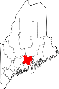 | |
| Towns | ||
| CDPs | ||
| Other villages | ||
Coordinates: 44°34′41″N 69°16′33″W / 44.57806°N 69.27583°W