Thiruppanandal
| Thiruppanandal | |
|---|---|
| city | |
| Country |
|
| State | Tamil Nadu |
| District | Thanjavur |
| Population (2001) | |
| • Total | 10,376 |
| Languages | |
| • Official | Tamil |
| Time zone | IST (UTC+5:30) |
Thiruppanandal is a panchayat town in Thanjavur district in the Indian state of Tamil Nadu.
Demographics
As of 2001 India census,[1] Thiruppanandal had a population of 10,376. Males constitute 49% of the population and females 51%. Thiruppanandal has an average literacy rate of 69%, higher than the national average of 59.5%: male literacy is 75%, and female literacy is 63%. In Thiruppanandal, 12% of the population is under 6 years of age.
Small Town with big things
Thirupanandal - even though a small town to find in the map, is having its own features. Kissed by mother nature, nourished by Hindu Mutt (called Kasi Mutt), and grown by farmers and small business community, having its own water source, food source and other essentials. Power electricity - of course imported from nearby Neyveli - Thermal power plants.
The prominent monument of the town is the massive Hindu Temple of lord Shiva, Arulmigu Thaalapureeswarar Temple, constructed during Chola dynasty, and currently maintained by State Hindu Religious Board and Kasi Mutt.
Kasi Mutt is another landmark in the town, The Chief Sage is the head of the mutt.
The town location is a way location for some important southern cities like Kumbakonam, Tanjavur (tanjore) and more.
The major population consists of farmers and agriculture related business men and merchants.
This town has a college (run by Kasi Mutt), called SKSS College of Arts and Science.
There is fast bank called City Union Bank Limited,and next one State Bank Of India.
Muslims in Thiruppanandal
There are approximately 500 Muslim families who reside in the western part of the village. For centuries, they have co-existed peacefully with their Hindu counterparts. The lives of the Muslims revolve around the Muhyuddin Andavar Mosque. There is also a prayer hall in the market area to cater to the needs of the traders there.
References
- ↑ "Census of India 2001: Data from the 2001 Census, including cities, villages and towns (Provisional)". Census Commission of India. Archived from the original on 2004-06-16. Retrieved 2008-11-01.
External links
Coordinates: 11°05′46″N 79°28′10″E / 11.09611°N 79.46944°E
| District headquarters | 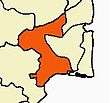 | |
|---|---|---|
| Country | ||
| State | ||
| Region | ||
| Divisions | ||
| Taluks | ||
| Revenue blocks | ||
| Municipal Corporations | ||
| Municipalities | ||
| Rivers | ||
| History | ||
| Places of interest |
| |
| Religious and monastic institutions | ||
| Universities | ||
| ||