East Cobb, Georgia
| East Cobb, Georgia | |
|---|---|
| Unincorporated community | |
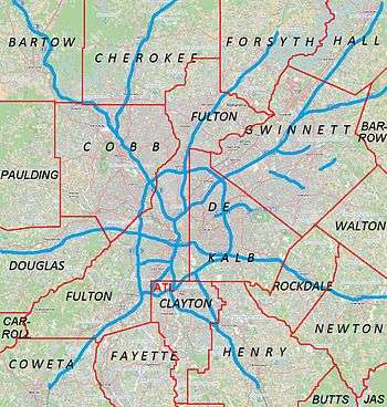 East Cobb Location within Metro Atlanta | |
| Coordinates: 33°57′58″N 84°24′41″W / 33.96611°N 84.41139°WCoordinates: 33°57′58″N 84°24′41″W / 33.96611°N 84.41139°W | |
| Country | United States |
| State | Georgia |
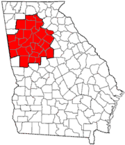
| County | Cobb |
| Population (2007)[1] | |
| • Total | 169,756 (Northeast Cobb CCD) |
| Time zone | Eastern (EST) (UTC-5) |
| • Summer (DST) | EDT (UTC-4) |
| ZIP codes | 30062, 30066, 30068, 30067, 30075 |
| Area code(s) | 770/678/470/404 |
Home to about 175,890, East Cobb is an unincorporated community in Cobb County, Georgia, United States. It is an affluent northern suburb of Atlanta.[2]
Geography
East Cobb is roughly bounded by:
- Cherokee County to the north
- Willeo Creek and Roswell in Fulton County to the northeast
- the Chattahoochee River and Sandy Springs in Fulton County to the southeast
- Bell's Ferry Road, I-575, and the Marietta city limits to the west, and
- Interstate 285 and the Cumberland/Galleria edge city at the southern tip.
No part of East Cobb technically falls within incorporated city limits. East Cobb consists primarily of unincorporated areas near Marietta, and a significant portion of unincorporated area near Roswell, as defined by United States Postal Service ZIP codes (though Roswell itself was in Cobb until 1932). A small sliver of an unincorporated area near Atlanta is in the extreme southern tip near Vinings, and a portion of the northwest is in an unincorporated area near Kennesaw (30144). ZIP codes that are associated with this area are (30144), (30188), (30062), (30066), (30067), (30068), and some of (30075).
East Cobb does not fall within any census-designated place, but within the Northeast Cobb census county division.[3]
History
Small communities, many established early in the area's post-Cherokee history, include Mount Bethel (located in present day central East Cobb), Shallowford Falls, Sandy Plains, Noonday, Blackwells, and Westoak. The area was developed as a suburb of Atlanta beginning in the 1960s. The "city" of Chattahoochee Plantation, which never had a city government, was established along the river by the Georgia General Assembly entirely to prevent Atlanta from annexation in 1961, and was officially abolished in 1995 along with dozens of other Georgia towns with defunct governments.
Incorporation as a city
In contrast to other northern suburbs of Atlanta, East Cobb has remained unincorporated. The idea of incorporating East Cobb as a city was most recently suggested in 2009 by the organization "Citizens for the City of East Cobb".[4] Yet the first serious discussion of incorporating East Cobb was initiated in 1998 by then Cobb County chairman Bill Byrne.[5] Under Byrne's proposal, the city's boundary lines would be drawn by the Cobb Legislative Delegation, the county government would continue to provide water, sewer, police and fire services to the city for a nominal fee of one dollar per year, and the city would be governed by an elected mayor and five City Council members, with wards drawn by the Cobb Delegation.[6] However, Byrne was defeated by Cobb County Chairman Incumbent Tim Lee, who dismissed the idea of incorporating East Cobb as "solution looking for a problem."[7] If East Cobb were to incorporate as a city, it would be the largest in the county and the second largest in metro Atlanta (behind Atlanta), with around 150,000 residents.[8]
Economy
Shopping
Merchant's Walk is a 367,600-square-foot (34,150 m2) open-air shopping center with retailers, restaurants, and a movie theater originally built in 1976 and since expanded and twice renovated, once in the early 1990s and again in 2008-2011. The East Cobber newspaper called the center the "heart" of the East Cobb community.[9] Tenants include Cook's Warehouse, Kohl's, Stein Mart, PetsMart, ULTA Beauty, Old Navy, Georgia Theatre, Whole Foods Market, Marlow's Tavern, and SEED Kitchen & Bar, as well as a movie theater.[10] The center is located at the intersection of Johnson Ferry and Roswell Roads.
East Cobb Library was once located in Merchant's Walk, but it has since been moved to Parkaire, a nearby strip of stores.[11]
The Avenue East Cobb is a 236,189-square-foot (21,943 m2) open-air shopping center at 4475 Roswell Road anchored by a Bed Bath & Beyond and Michaels arts and crafts store. It has a horseshoe-shaped form and a "period-style Main Street design"[12] and "town square" concepts,[13] according to its designers.[14][15]
Paper Mill Village is a collection of 33 buildings linked by over a mile of pedestrian walkways. The Village includes: retail tenants, restaurant tenants as well as service provider tenants. The village also hosts a monthly food truck night from April-October each year on the last Monday of each month.
Culture
A popular community event is the Taste of East Cobb, held annually. The YMCA operates the McKlesky Family-East Cobb YMCA at 1055 East Piedmont Road. East Cobb park is a popular recreational area for the community. The community is also home to a civic association, a Kiwanis Club, and a Rotary Club.[16][17][18][19][20] The paper-only weekly East Cobb Neighbor has a circulation of around 44,000.[21][22]
East Cobb is home to some of metro Atlanta's largest churches. Johnson Ferry Baptist Church, located between Johnson Ferry Road and Woodlawn Drive, has roughly 7,500 members. Mt. Bethel United Methodist Church, located off of Lower Roswell Road by the Cobb County Government Center, has over 9,000 members. The Catholic Church of St. Ann is located at the corner of Bishop Lake Road and Roswell Road as well.
Government
Various neighborhood and subdivision community associations are represented within the overall East Cobb Civic Association,[23] which promotes dialog between government and community organizations and seeks to shape county government policy and improve the community's quality of life. The United States Postal Service operates the East Cobb Post Office branch.[24]
Cobb County operates the East Cobb Government Service Center. The center contains a county Police precinct, a Cobb Fire and Emergency Services station, and a Tag (license plate) Office. East Cobb comprises districts 2 and 3 of the Cobb County Commission.[25]
Cobb County Public Library operates the East Cobb Library (formerly the Merchant's Walk Library).
Education
The area known as East Cobb comprises several high school attendance districts: Pope, Sprayberry, Wheeler, Kell, Walton, and Lassiter. The western half of the Kell district lies outside of East Cobb. The extreme western portion of the Sprayberry district (the Town Center Mall area) also lies outside of East Cobb. The extreme southwestern and southern portions of the Wheeler district lie west of I-75 and south of I-285 respectively, thus excluding these small areas from being considered a part of East Cobb.
The area known as East Cobb comprises the following middle school districts: Daniell, McCleskey, Simpson, Hightower Trail, Mabry, East Cobb, Dodgen, and Dickerson (small portions of the Daniell and East Cobb Middle School districts lie outside of East Cobb; a sliver of the eastern portion of the Palmer Middle School district can be considered a part of East Cobb). [26]
Notable residents
- Chris Robinson and Rich Robinson of The Black Crowes
- Blaine Boyer, professional baseball player
- Newt Gingrich, Former Speaker of the House of Representatives, 2012 Republican Presidential candidate.
- Travis Tritt, country music star
- Cody Rhodes, professional wrestler
- T.J. Yates, NFL quarterback
- Lawson Vaughn, professional soccer player
- Ty Pennington, Sprayberry High graduate, Extreme Home Makeover and Trading Spaces
- Brett Butler (comedian)
- Bobby Cox, former manager of the Atlanta Braves
- Alton Brown, Food and Media Personality
- Robin Meade; news anchor
- Johnny Isakson; United States Senator (R-GA)
- Tony Schiavone; former announcer for WCW, currently radio sports announcer, producer, engineer
- Missy Elliott;musician
References
- ↑ http://www.city-data.com/city/Northeast-Cobb-Georgia.html
- ↑ http://realtytimes.com/rtpages/20050729_atlantasuburb.htm
- ↑ "Census 2000 Block Map, Cobb County", US Census Bureau
- ↑ http://www.cityofeastcobb.org/about/
- ↑ [The Marietta Daily Journal, East Cobbers voice mixed reactions to city idea, http://mdjonline.com/view/full_story/19755515/article-East-Cobbers-voice-mixed-reactions-to-idea-about-forming-city]
- ↑ [The Marietta Daily Journal, Byrne floats idea for an East Cobb city, http://mdjonline.com/view/full_story/19737517/article-Byrne-floats-idea-for-an-East-Cobb-city]
- ↑ [11Alive, Could East Cobb be Georgia's newest city?, http://www.11alive.com/news/article/252130/3/Could-East-Cobb-be-Georgias-newest-city-]
- ↑ https://books.google.com/books?id=yLN0dsWN57EC&pg=PA110&dq=east+cobb+georgia&hl=en&ei=_I-lTPufK4nCsAPz5fj9Dg&sa=X&oi=book_result&ct=result&resnum=3&ved=0CDMQ6AEwAg#v=onepage&q=east%20cobb%20georgia&f=false
- ↑ "Merchant's Walk makes changes", East Cobber, 2012-01-19
- ↑ Page on Edens website
- ↑ http://eastcobb.patch.com/listings/merchants-walk
- ↑ Page at CMH Architects
- ↑ Page at Dougherty Architectural consulting
- ↑ [http://www.city-data.com/articles/Avenue-East-Cobb-Marietta-Atlanta.html
- ↑ "Stores", The Avenue East Cobb website
- ↑
- ↑
- ↑
- ↑
- ↑
- ↑ http://www.echo-media.com/mediaDetail.php?ID=4305
- ↑ http://www.mondotimes.com/1/world/us/10/606/21364
- ↑ East Cobb Civic Association
- ↑ http://usps.whitepages.com/service/post_office/east-cobb-station-1395-e-cobb-dr-marietta-ga-1361686
- ↑ East Cobb Civic Association
- ↑ http://www.cobbk12.org/centraloffice/planning/zonemaps.aspx
http://www.cobbk12.org/centraloffice/planning/zonemaps.aspx
External links
Municipalities and communities of Cobb County, Georgia, United States | ||
|---|---|---|
| Cities | 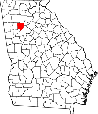 | |
| CDPs | ||
| Unincorporated communities | ||
| Footnotes | ‡This populated place also has portions in an adjacent county or counties | |
|  | |||||||
|
| ||||||||
| ||||||||