Tewksbury, Massachusetts
| Tewksbury, Massachusetts | ||
|---|---|---|
| Town | ||
|
Tewksbury Hospital, Old Administration Building | ||
| ||
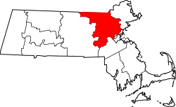
 Location in Middlesex County in Massachusetts | ||
| Coordinates: 42°36′38″N 71°14′05″W / 42.61056°N 71.23472°WCoordinates: 42°36′38″N 71°14′05″W / 42.61056°N 71.23472°W | ||
| Country | United States | |
| State | Massachusetts | |
| County | Middlesex | |
| Settled | 1637 | |
| Incorporated | 1734 | |
| Government | ||
| • Type | Open town meeting | |
| Area | ||
| • Total | 21.1 sq mi (54.5 km2) | |
| • Land | 20.7 sq mi (53.7 km2) | |
| • Water | 0.3 sq mi (0.9 km2) | |
| Elevation | 126 ft (38 m) | |
| Population (2010) | ||
| • Total | 28,961 | |
| • Density | 1,400/sq mi (530/km2) | |
| Time zone | Eastern (UTC-5) | |
| • Summer (DST) | Eastern (UTC-4) | |
| ZIP code | 01876 | |
| Area code(s) | 978 / 351 | |
| FIPS code | 25-69415 | |
| GNIS feature ID | 0618238 | |
| Website | http://www.tewksbury-ma.gov/ | |


Tewksbury is a town in Middlesex County, Massachusetts, United States. The population was 28,961.
History
Tewksbury was first settled in 1637 and was officially incorporated in 1734 from Billerica. Like Tewksbury Township, New Jersey, it is named after the town of Tewkesbury, England. Tewksbury, Massachusetts and Tewkesbury, England kept connected through a local committee called the twinning committee.[1] One of the oldest sections of town is the area around the Shawsheen River. This is where the Shawshin tribe settled, allowing them access to a great food source. Tewksbury was also known for a historic visit by President Andrew Jackson, stopping off at local watering hole, Brown's Tavern.[2]
On July 24, 1857, a powerful tornado swept through Tewksbury. The tempest began at Round Pond as a small water spout, and traveled west and then southeast to the Shawsheen River. It dissipated at North Wilmington. Several corn fields and orchards were severely damaged, with one residence having its roof blown off. The tornado was powerful enough to flatten barns and sheds, pull up large trees by their roots, and sweep away and kill a team of oxen. Due to the sparse population, and homes located above the valley floor, no one was killed, and only a few people were injured.[3]
Geography
According to the United States Census Bureau, the town has a total area of 21.1 square miles (55 km2), of which 20.7 square miles (54 km2) is land and 0.3 square miles (0.78 km2), or 1.61%, is water.
The Merrimack River forms part of the northern boundary of Tewksbury, and the Shawsheen River runs through the southern end of town as well.
Tewksbury is in Greater Lowell. The town is located about 19 miles (31 km) north-northwest of Boston along I-93 and I-495 (Boston's outer beltway). Tewksbury is bordered by the city of Lowell to the northwest, Dracut to the north (unreachable across the Merrimack), Andover to the northeast, Wilmington to the southeast, and Billerica to the southwest. Tewksbury also meets the town of Chelmsford at a point in the middle of the Concord River along with Lowell and Billerica.
Transportation
The LRTA 12 bus connects Tewksbury to Lowell and Wilmington on the MBTA Commuter Rail Lowell Line.
Demographics
| Historical population | ||
|---|---|---|
| Year | Pop. | ±% |
| 1850 | 1,044 | — |
| 1860 | 1,744 | +67.0% |
| 1870 | 1,944 | +11.5% |
| 1880 | 2,179 | +12.1% |
| 1890 | 2,515 | +15.4% |
| 1900 | 3,683 | +46.4% |
| 1910 | 3,750 | +1.8% |
| 1920 | 4,450 | +18.7% |
| 1930 | 5,585 | +25.5% |
| 1940 | 6,261 | +12.1% |
| 1950 | 7,505 | +19.9% |
| 1960 | 15,902 | +111.9% |
| 1970 | 22,755 | +43.1% |
| 1980 | 24,635 | +8.3% |
| 1990 | 27,266 | +10.7% |
| 2000 | 28,851 | +5.8% |
| 2010 | 28,961 | +0.4% |
| * = population estimate. Source: United States Census records and Population Estimates Program data.[4][5][6][7][8][9][10][11][12][13] | ||
As of the census[14] of 2000, there were 28,851 people, 9,964 households, and 7,692 families residing in the town. The population density was 1,392.3 people per square mile (537.6/km²). There were 10,158 housing units at an average density of 490.2 per square mile (189.3/km²). The racial makeup of the town was 96.44% White, 0.67% African American, 0.12% Native American, 1.59% Asian, 0.01% Pacific Islander, 0.41% from other races, and 0.75% from two or more races. Hispanic or Latino of any race were 1.22% of the population.
There were 9,964 households out of which 35.9% had children under the age of 18 living with them, 65.1% were married couples living together, 9.1% had a female householder with no husband present, and 22.8% were non-families. 18.9% of all households were made up of individuals and 7.2% had someone living alone who was 65 years of age or older. The average household size was 2.81 and the average family size was 3.24.
The town's population was spread out, with 25.0% under the age of 18, 6.2% from 18 to 24, 32.8% from 25 to 44, 24.6% from 45 to 64, and 11.5% who were 65 years of age or older. The median age was 38 years. For every 100 females there were 96.1 males. For every 100 females age 18 and over, there were 93.7 males.
The median income for a household in the town was $68,800, and the median income for a family was $76,443. Males had a median income of $50,296 versus $33,918 for females. The per capita income for the town was $27,031. About 1.9% of families and 3.8% of the population were below the poverty line, including 2.4% of those under age 18 and 5.3% of those age 65 or over.
Government
Tewksbury, like most towns in Massachusetts, operates under a New England town form of government. Day-to-day management is led by a Town Manager, who reports to the town's five member Board of Selectmen. Every spring the town holds an Open Town Meeting where the budget is submitted for approval by the town's citizens.
Tewksbury is located in the 6th Congressional District and thus represented in the House of Representatives by Seth Moulton of Salem. In the Senate by Senators Ed Markey of Malden and Elizabeth Warren of Cambridge.
Tewksbury is one of the more Republican-leaning towns in the Commonwealth. It was one of the few communities who supported John McCain over Barack Obama in the 2008 Presidential Election.[15] In the special election to replace the late Ted Kennedy, Tewksbury supported Scott Brown over Martha Coakley by a 2-to-1 margin.[16]
The former Tew-Mac Airport was located in the town [17] before it was closed in 1997 and replaced with condos and a country club.[18]
Hospital
Tewksbury Hospital, a state-owned facility, is located here. Originally built as an almshouse in the mid-19th century, it includes over 900 acres (3.6 km2) of open space. Tewksbury Hospital is home to both the Department of Mental Health and the Department of Public Health, and has many different programs for addictive behavior and other health concerns. Anne Sullivan (Helen Keller's teacher) spent time at Tewksbury Hospital.
Notable residents
- Miko Kaufman Famous sculptor and Olympic Medal designer [19]
- Adelbert Ames (d. 1933), Medal of Honor recipient; last surviving Civil War general[20]
- George D. Behrakis, philanthropist and retired businessman.
- John James Nazarian, celebrity private investigator
- Scott Oberg, Professional baseball player for the Colorado Rockies
- Anne Sullivan, tutor and companion of Helen Keller
- Paul Sullivan (d. 2007) former selectman, talk show host on WBZ radio, Boston
- John Trull, captain of the Tewksbury minutemen in the Revolutionary War
- David Wade, television news anchor, WBZ Boston
- Dale Dorman, retired radio personality, WRKO, Kiss 108, Oldies 103
- Michael Rock, morning personality on Fun 107 radio, New Bedford/Providence
- Bill Catherwood, fly fishing legend[21]
Education
The Tewksbury public schools district serves students in pre-kindergarten through twelfth grade by a high school, two junior high schools and four elementary schools, specifically:
- Tewksbury Memorial High School (TMHS) Grades 9-12
- John W. Wynn Middle School - Grades 7-8
- John F. Ryan Elementary School - Grades 5-6
The 4 elementary schools in Tewksbury were redistricted in 2010. Before the switch, each school had its own district and served Grades K-4. Now, The 2 schools on each side of town were grouped together and each was given specific grades for that school.
North Tewksbury:
- Loella F. Dewing Elementary School - Grades PreK-2
- North Street Elementary School - Grades 3-4
South Tewksbury:
- Heath Brook Elementary School - Grades K-2
- Louise Davy Trahan Elementary School - Grades 3-4
High school students have the option to attend Shawsheen Valley Technical High School, which serves five area communities.
The nearest community college, Middlesex Community College, has two campuses in nearby Lowell and Bedford. The nearest state university is the University of Massachusetts Lowell, with several state colleges in Salem and Framingham. The nearest private college is Merrimack College in North Andover, with several others within an hour drive in Boston.
Media
Tewksbury is served by the Boston television stations, and by newspapers such as the Lowell Sun and the Town Crier (weekly).
Tewksbury was once mentioned by John Cena on an episode of WWE Raw that was filmed in Boston
References
- ↑ Richard Howe: Tewksbury and Tewkesbury (accessed 16 Oct 2016)
- ↑ Archived August 15, 2014, at the Wayback Machine.
- ↑ Tewksbury Tornado of 1857 at CelebrateBoston.com
- ↑ "TOTAL POPULATION (P1), 2010 Census Summary File 1". American FactFinder, All County Subdivisions within Massachusetts. United States Census Bureau. 2010.
- ↑ "Massachusetts by Place and County Subdivision - GCT-T1. Population Estimates". United States Census Bureau. Retrieved July 12, 2011.
- ↑ "1990 Census of Population, General Population Characteristics: Massachusetts" (PDF). US Census Bureau. December 1990. Table 76: General Characteristics of Persons, Households, and Families: 1990. 1990 CP-1-23. Retrieved July 12, 2011.
- ↑ "1980 Census of the Population, Number of Inhabitants: Massachusetts" (PDF). US Census Bureau. December 1981. Table 4. Populations of County Subdivisions: 1960 to 1980. PC80-1-A23. Retrieved July 12, 2011.
- ↑ "1950 Census of Population" (PDF). Bureau of the Census. 1952. Section 6, Pages 21-10 and 21-11, Massachusetts Table 6. Population of Counties by Minor Civil Divisions: 1930 to 1950. Retrieved July 12, 2011.
- ↑ "1920 Census of Population" (PDF). Bureau of the Census. Number of Inhabitants, by Counties and Minor Civil Divisions. Pages 21-5 through 21-7. Massachusetts Table 2. Population of Counties by Minor Civil Divisions: 1920, 1910, and 1920. Retrieved July 12, 2011.
- ↑ "1890 Census of the Population" (PDF). Department of the Interior, Census Office. Pages 179 through 182. Massachusetts Table 5. Population of States and Territories by Minor Civil Divisions: 1880 and 1890. Retrieved July 12, 2011.
- ↑ "1870 Census of the Population" (PDF). Department of the Interior, Census Office. 1872. Pages 217 through 220. Table IX. Population of Minor Civil Divisions, &c. Massachusetts. Retrieved July 12, 2011.
- ↑ "1860 Census" (PDF). Department of the Interior, Census Office. 1864. Pages 220 through 226. State of Massachusetts Table No. 3. Populations of Cities, Towns, &c. Retrieved July 12, 2011.
- ↑ "1850 Census" (PDF). Department of the Interior, Census Office. 1854. Pages 338 through 393. Populations of Cities, Towns, &c. Retrieved July 12, 2011.
- ↑ "American FactFinder". United States Census Bureau. Retrieved 2008-01-31.
- ↑ "Massachusetts results". The Boston Globe. November 5, 2008. Archived from the original on February 1, 2014.
- ↑ "Check out this Page on Boston.com". The Boston Globe. December 8, 2009.
- ↑ Archived August 15, 2014, at the Wayback Machine.
- ↑ Abandoned & Little-Known Airfields: Central Massachusetts
- ↑ http://medallicartcollector.com/miko-kaufman_biography.html
- ↑ Warner, Ezra J. (1964). Generals in Blue: Lives of the Union Commanders. Baton Rouge: Louisiana State University Press. p. 6. ISBN 0-8071-0822-7.
- ↑ Tewksbury Town Crier - Back in Time, by Bill Catherwood, Saltwater Fly Museum, "Bill Catherwood is one of the "originals" of saltwater fly tying in New England... articles were being written as early as the 1950's about Bill's series of big flies called 'Giant Killers'."Lowell Sun Obituaries
External links
| Wikimedia Commons has media related to Tewksbury, Massachusetts. |
- Town of Tewksbury official website
- Tewksbury Historical Society
- Tewksbury Citizens Online Open Forum
- Tewksbury community website
 "Tewksbury". Collier's New Encyclopedia. 1921.